mumbai_oli_2017030_tn.jpg
0 x 0
JPEG
0 x 0
JPEG
720 x 540
JPEG
2000 x 3000
3 MB - JPEG
720 x 540
JPEG
2000 x 3000
3 MB - JPEG

720 x 480
JPEG
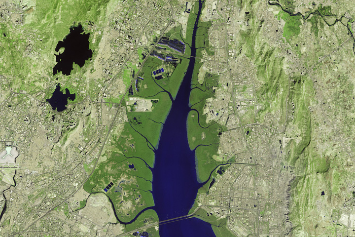
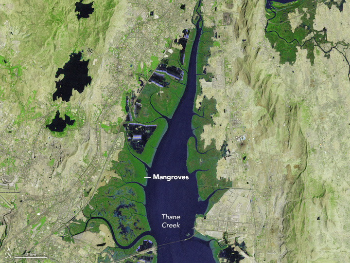
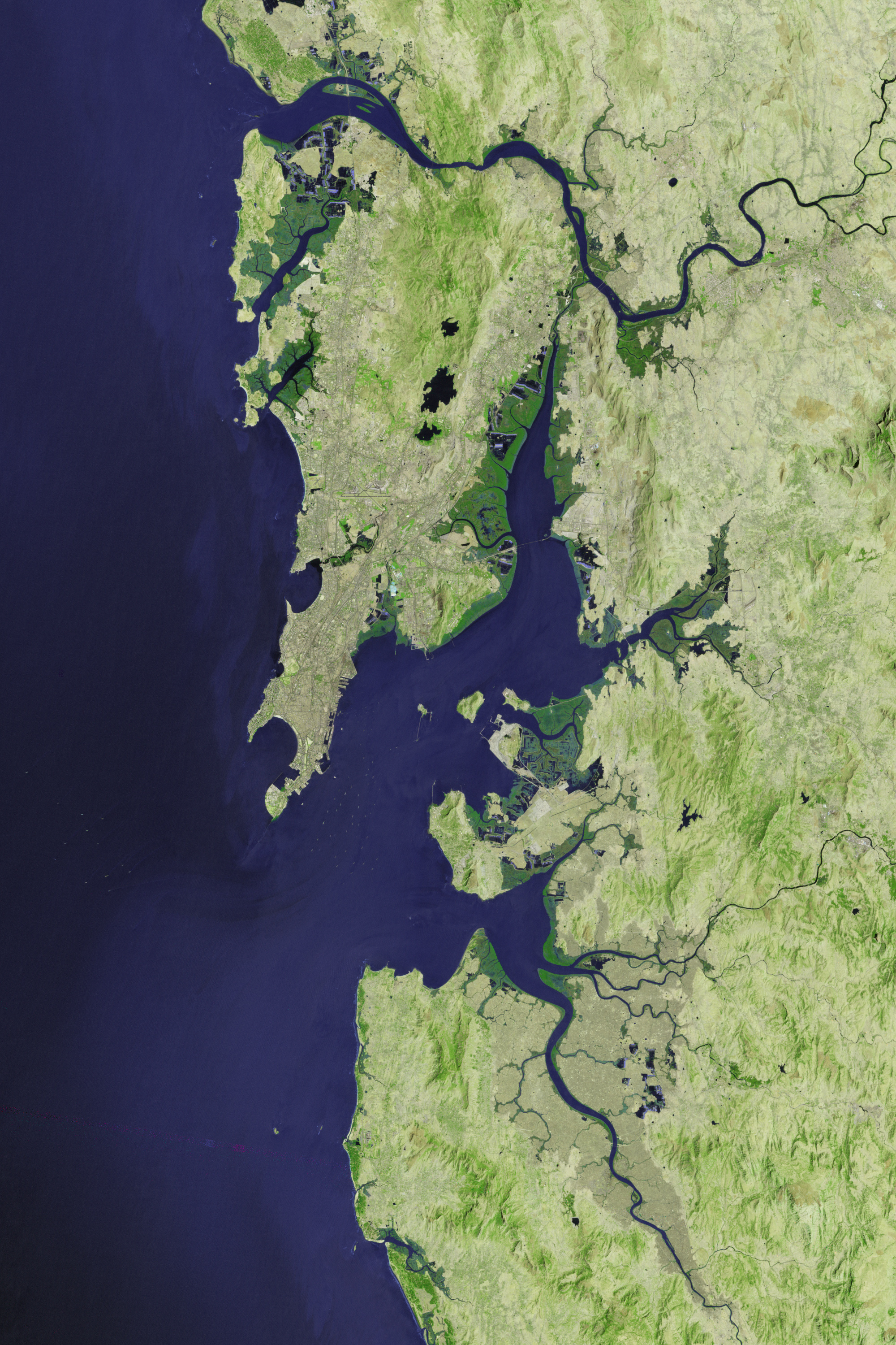
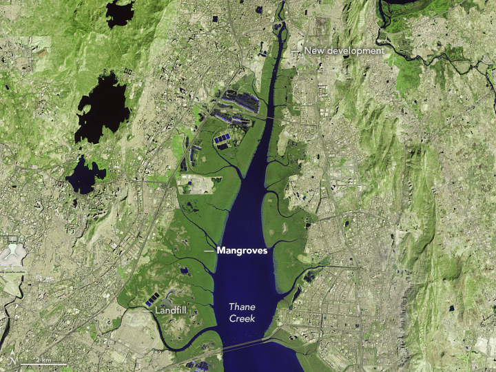
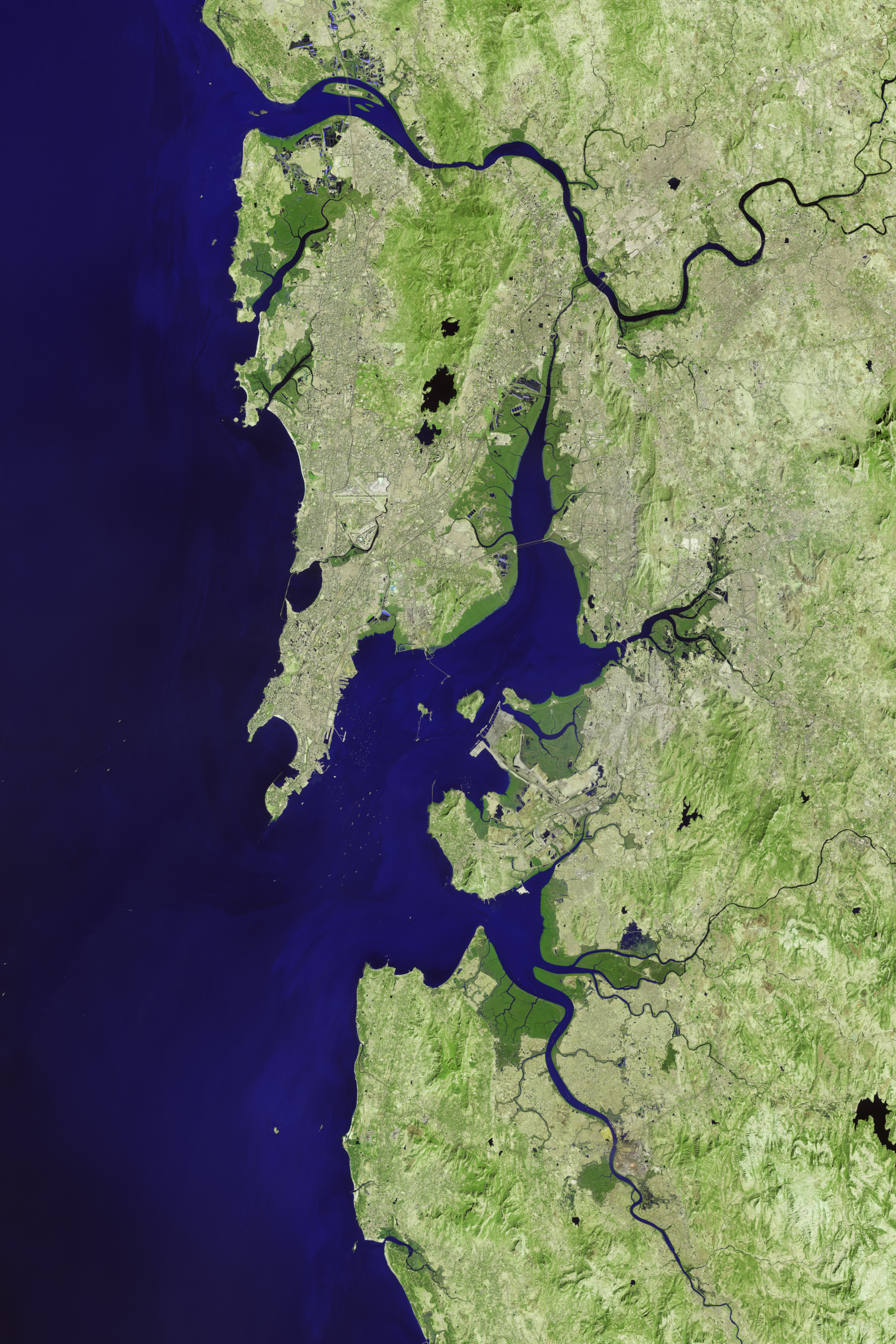
Monitoring Mumbai’s Mangroves
Satellites offer some needed perspective on the status of vulnerable mangrove forests along the Indian city’s many waterways.
This image originally appeared in the NASA Earth Observatory story Monitoring Mumbai’s Mangroves.
NASA Earth Observatory images by Jesse Allen, using Landsat data from the U.S. Geological Survey. Story by Adam Voiland.
Published November 30, 2017
Data acquired 1988 - 2017
- Sources:
- Landsat 5 > TM
- Landsat 8 > OLI