larsenc_tir_2017170_tn.jpg
0 x 0
JPEG
0 x 0
JPEG
720 x 857
JPEG
4800 x 6400
4 MB - JPEG
720 x 597
JPEG
720 x 480
JPEG
5934 x 3956
11 MB - JPEG
720 x 480
PNG
720 x 480
JPEG
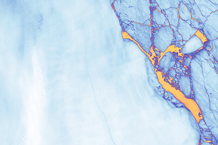
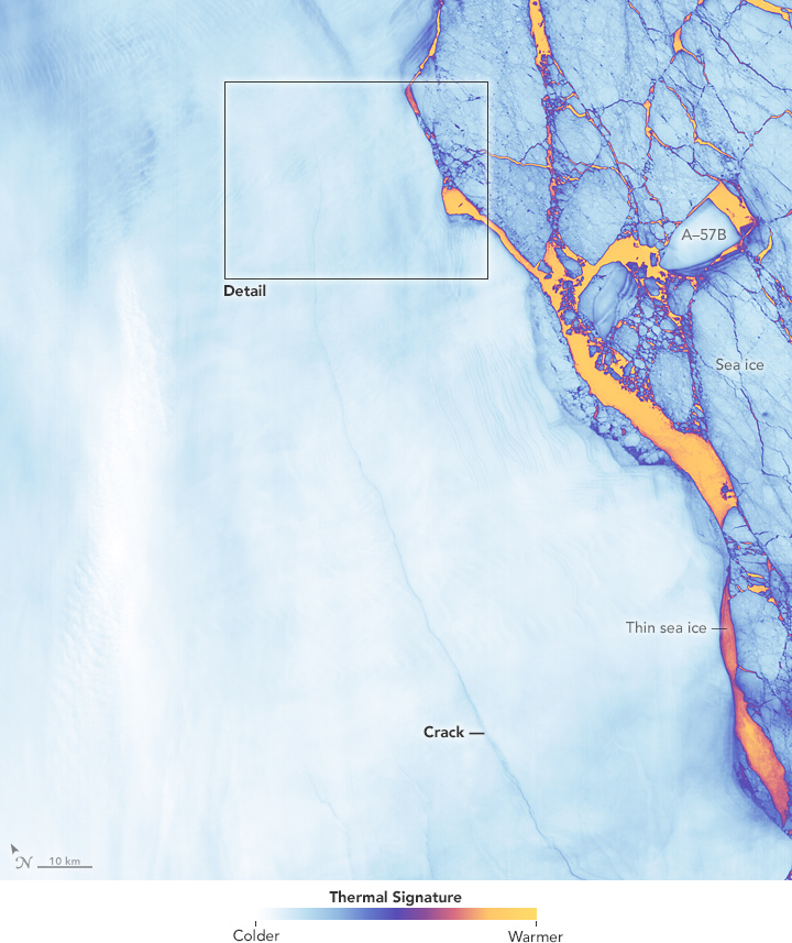
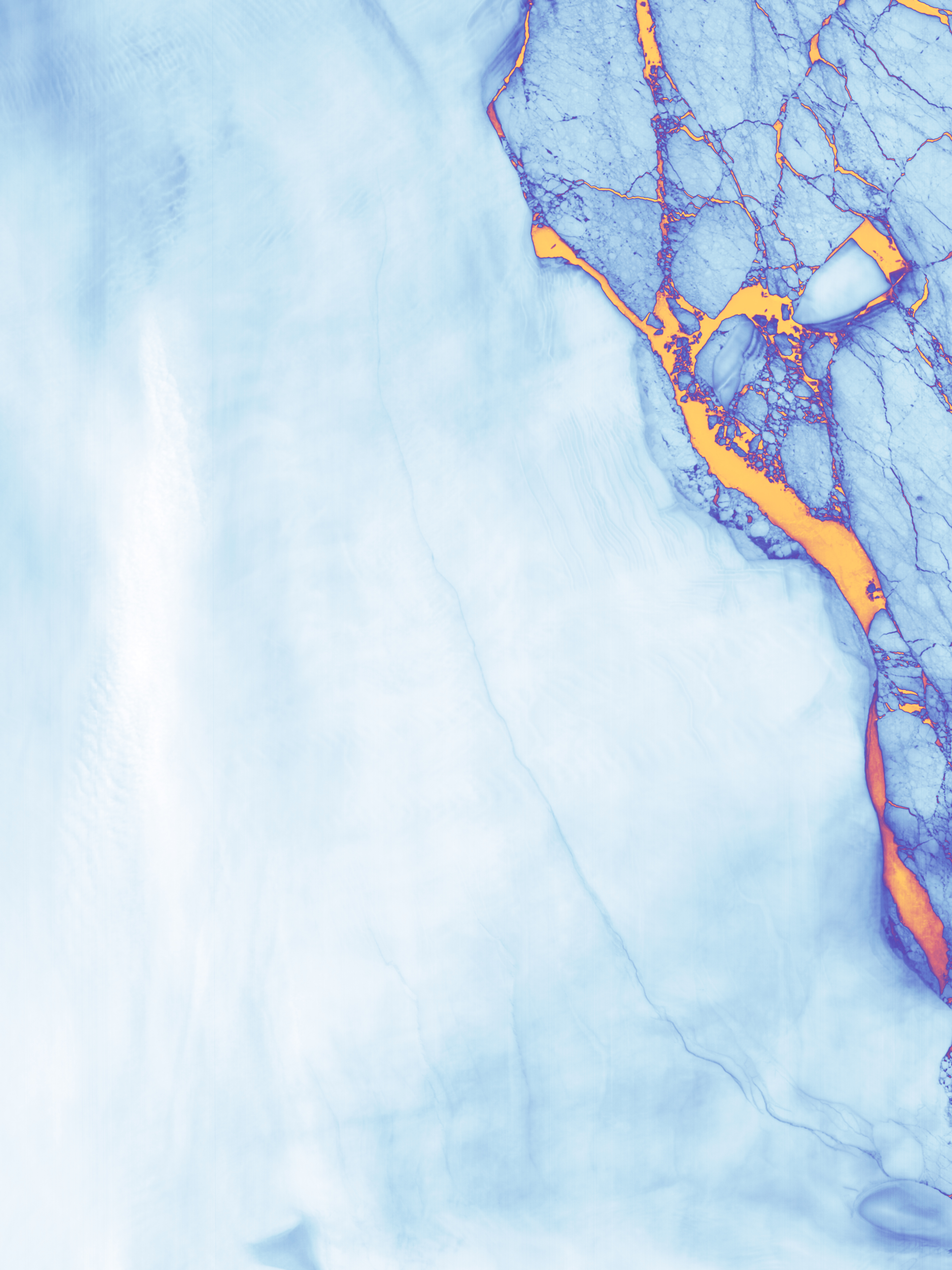
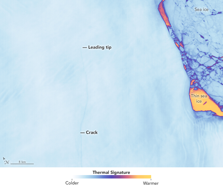
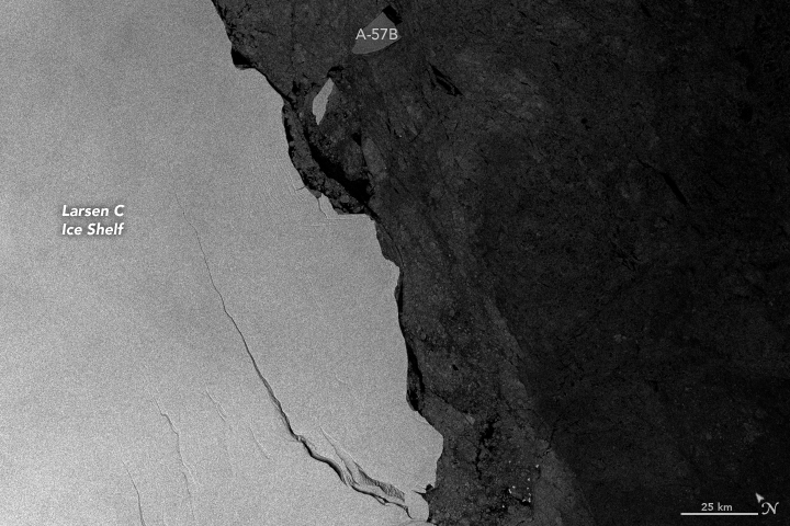
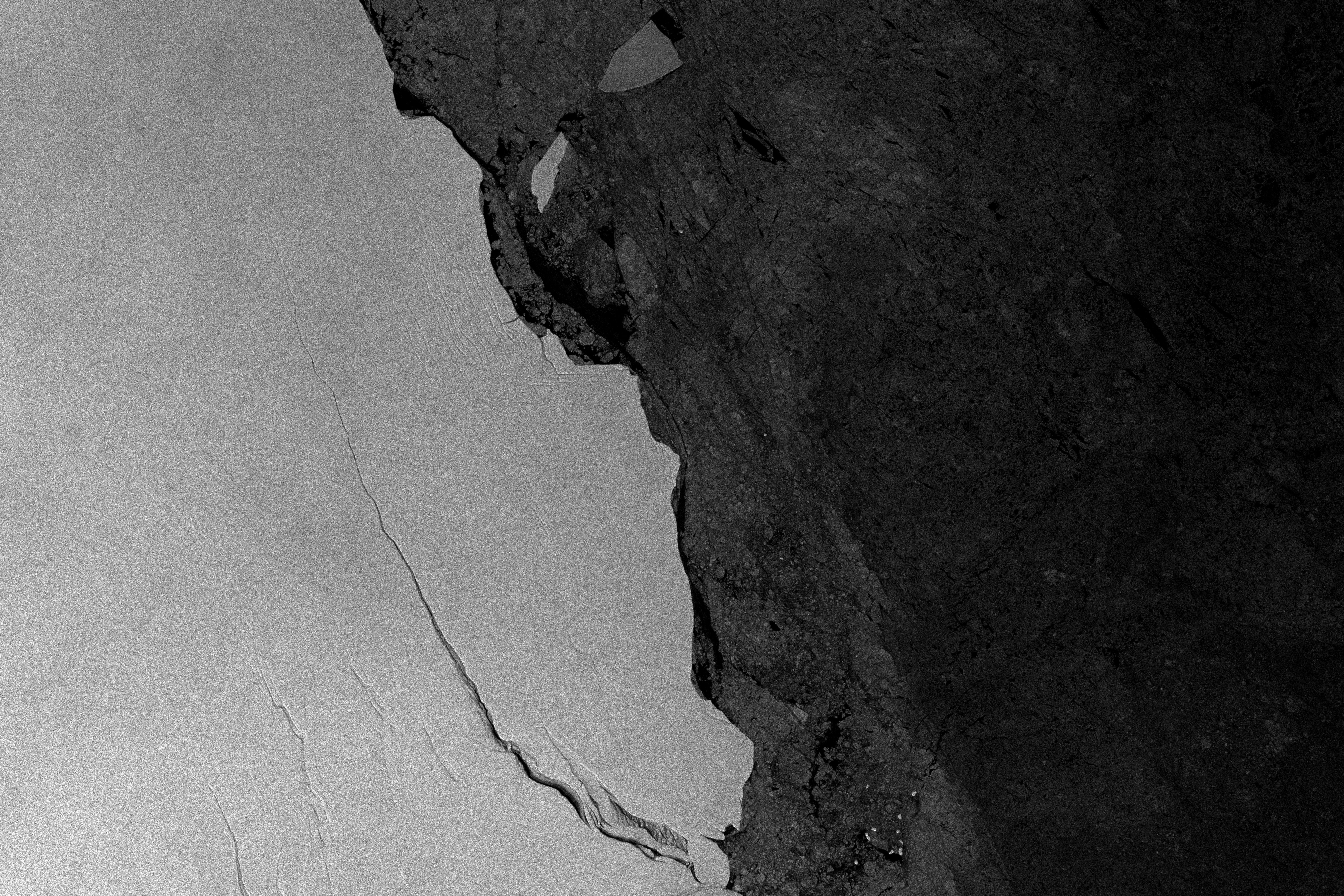
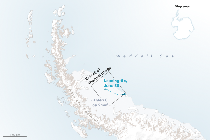
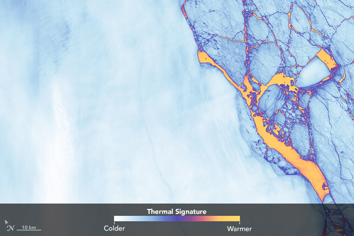
A Crack of Light in the Polar Dark
Even in the dark, there are satellite instruments that allow scientists to “see” the rift growing across Antarctica’s Larsen C ice shelf.
This image originally appeared in the NASA Earth Observatory story A Crack of Light in the Polar Dark.
NASA Earth Observatory images by Joshua Stevens and Jesse Allen, using Landsat data from the U.S. Geological Survey and modified Copernicus Sentinel data (2017) processed by the European Space Agency. Story by Kathryn Hansen with image interpretation by Christopher Shuman/UMBC JCET/NASA’s Goddard Space Flight Center.
Published June 29, 2017
Data acquired June 17, 2017
- Sources:
- Landsat 8 > TIRS
- Sentinel-1A