tohoku_earthquake_intensity_tn.jpg
0 x 0
JPEG

0 x 0
JPEG
720 x 764
JPEG
1652 x 1651
743 KB - JPEG
342 x 228
JPEG
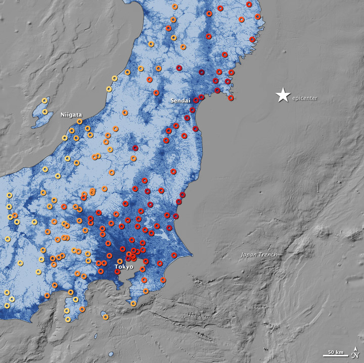
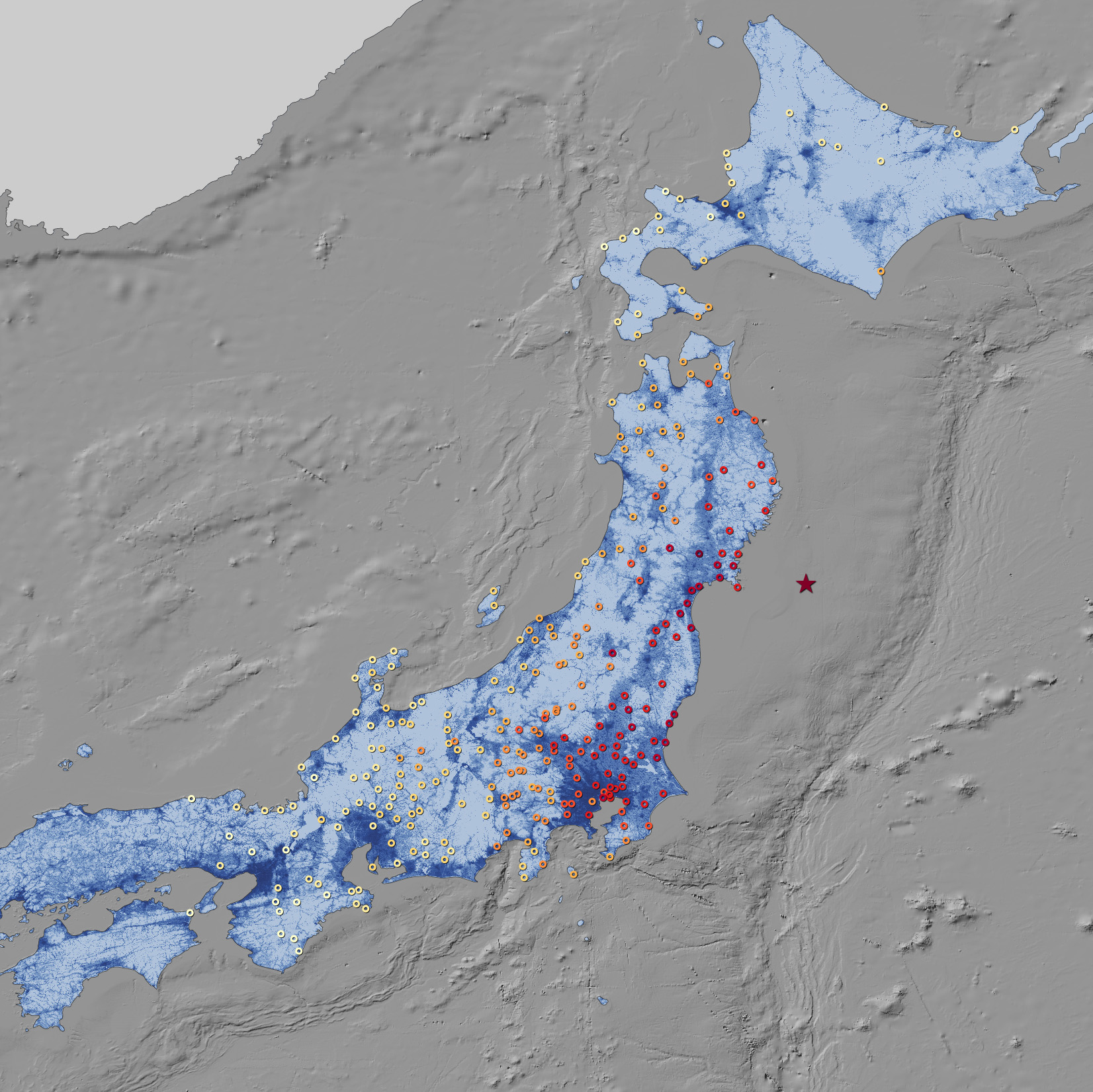
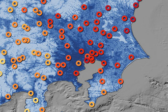
Tohoku Earthquake Shaking Intensity
This map shows the ground motion and shaking intensity from the March 11, 2011, earthquake at dozens of locations across Japan.
This image originally appeared in the NASA Earth Observatory story Tohoku Earthquake Shaking Intensity.
NASA Earth Observatory Image by Jesse Allen and Robert Simmon, using data from the USGS Earthquakes Hazard Program and Oak Ridge National Laboratory Geographic Information Science and Technology. Caption by MIke Carlowicz.
Published March 19, 2011
Data acquired March 11, 2011
- Source:
- In situ Measurement