boliviaradial_oli_2022234_th.jpg
0 x 0
JPEG
0 x 0
JPEG
720 x 670
JPEG
3964 x 3636
3 MB - JPEG
720 x 670
JPEG
3964 x 3636
3 MB - JPEG
720 x 480
JPEG
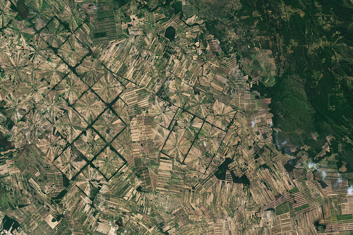
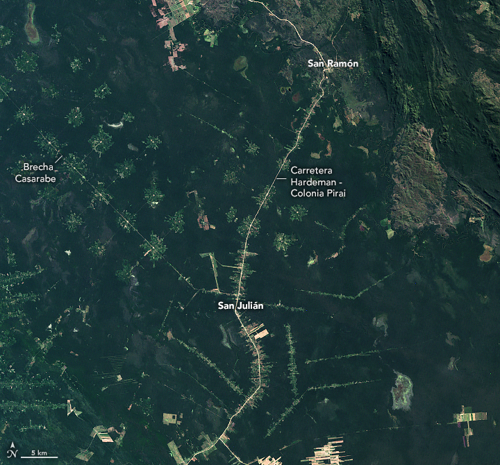
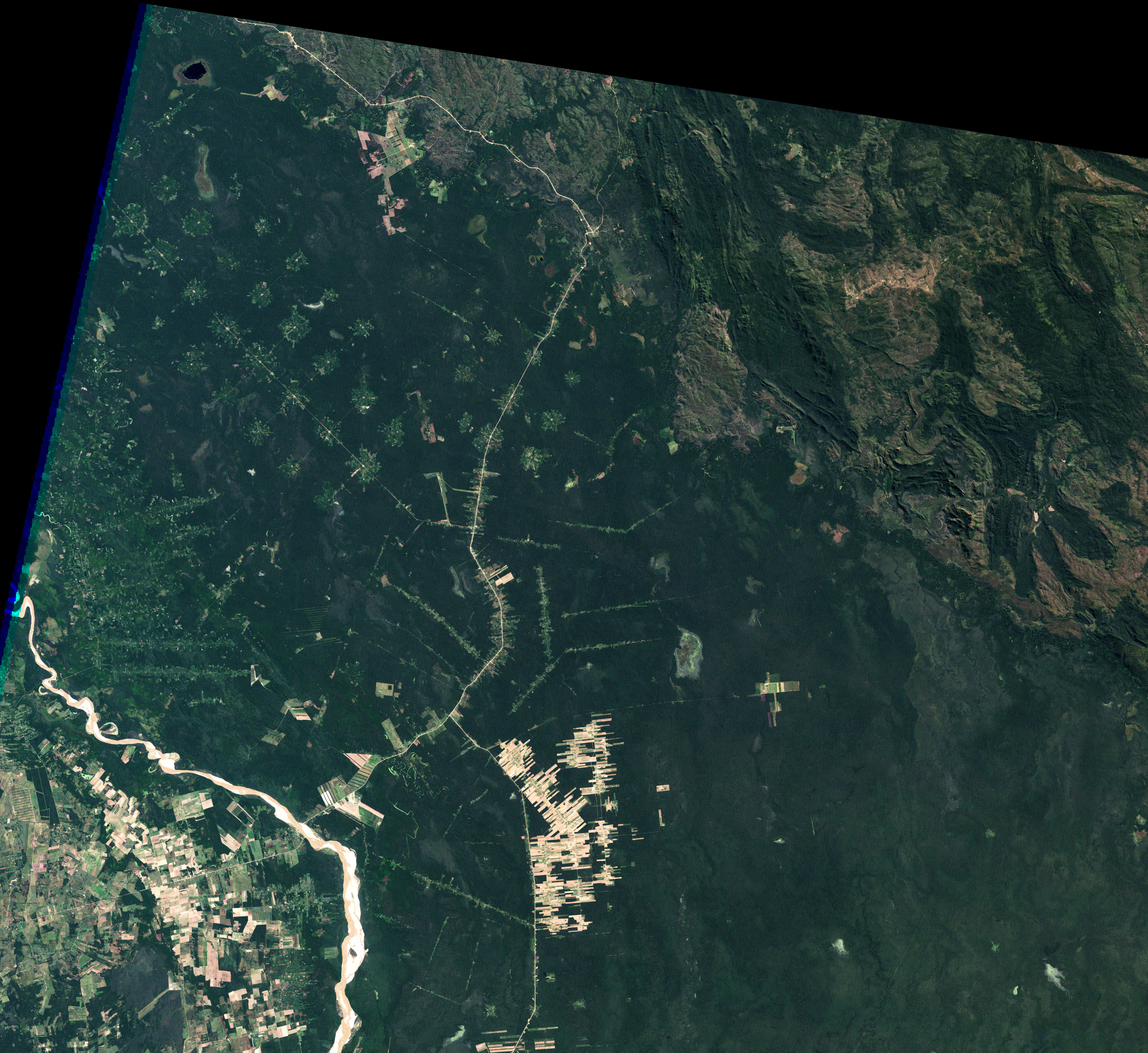
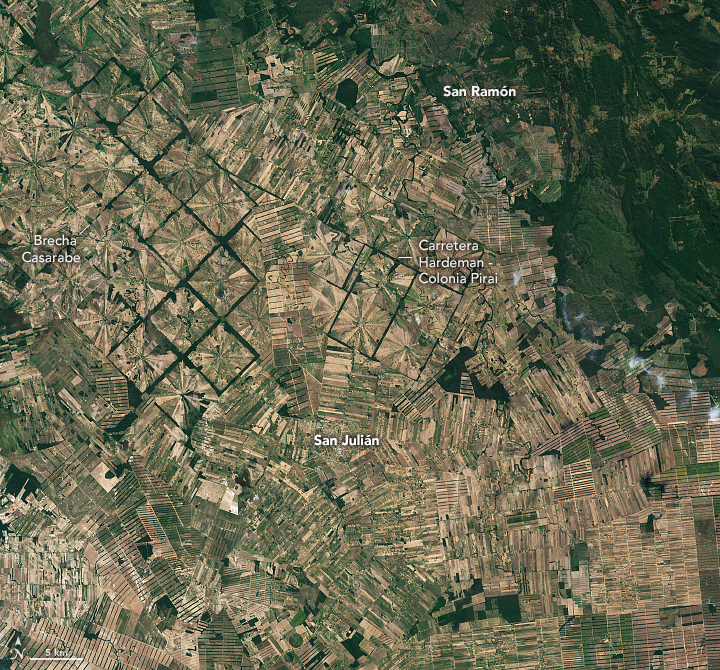
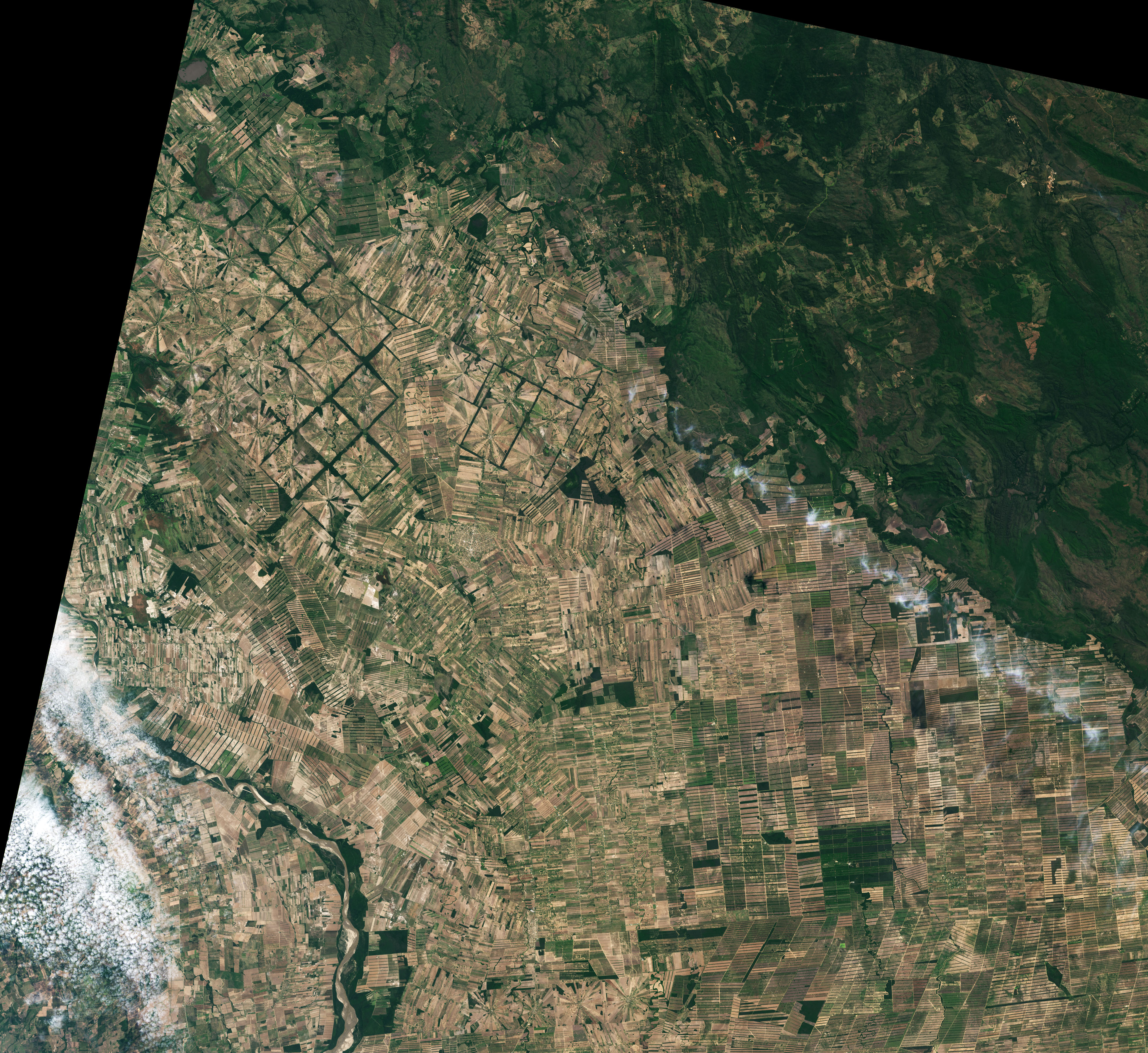
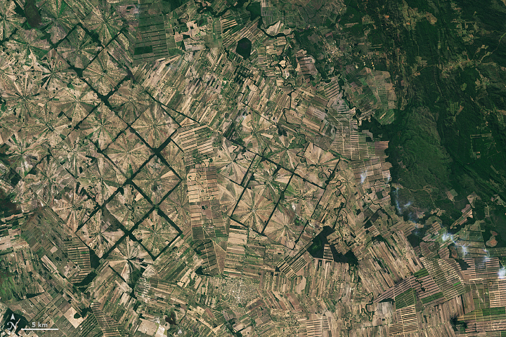
Patterns of Forest Change in Bolivia
Deforestation patterns near Santa Cruz de la Sierra reflect different waves of settlers and economic activities.
This image originally appeared in the NASA Earth Observatory story Patterns of Forest Change in Bolivia.
NASA Earth Observatory images by Lauren Dauphin, using Landsat data from the U.S. Geological Survey. Story by Adam Voiland.
Published August 25, 2022
Data acquired July 2, 1986 - August 22, 2022
- Sources:
- Landsat 5 > TM
- Landsat 8 > OLI