tidalwetlandloss_oli_2019_th.jpg
0 x 0
JPEG

0 x 0
JPEG
720 x 480
JPEG
3507 x 2480
874 KB - JPEG
720 x 480
JPEG
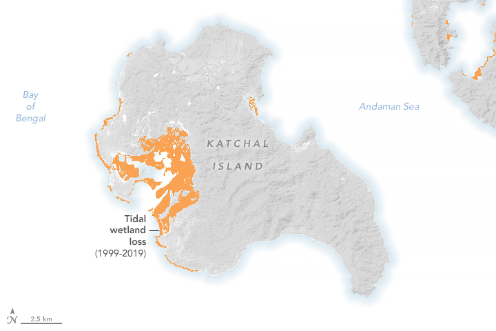
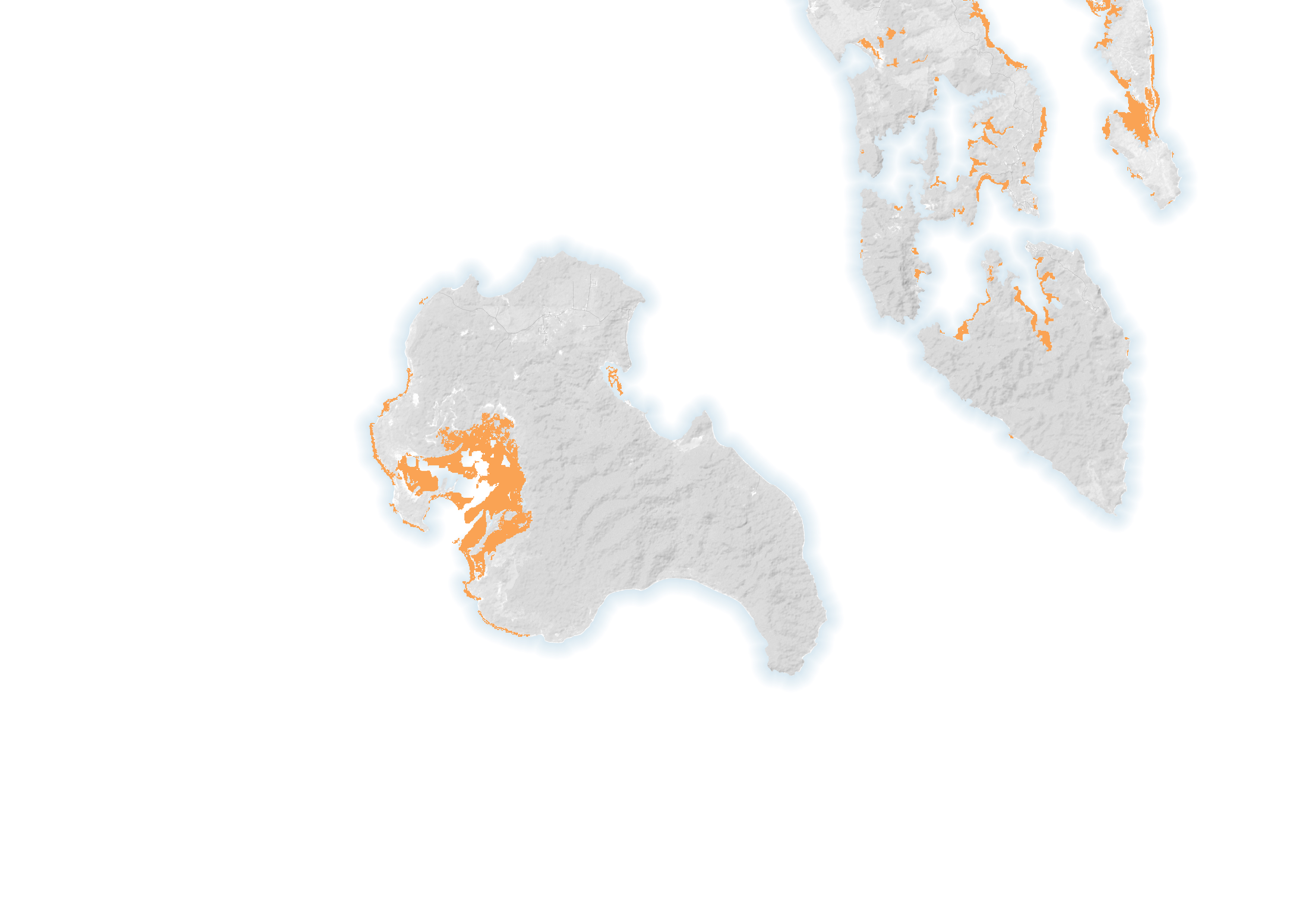
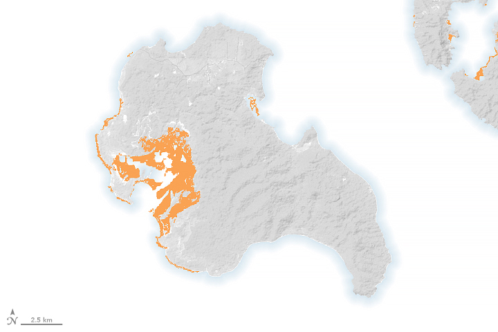
Mapping Missing Mangroves
The Landsat program’s 50 years of Earth observations have revolutionized the study of long-term global change, including the losses and gains of tidal wetlands.
This image originally appeared in the NASA Earth Observatory story Mapping Missing Mangroves.
NASA Earth Observatory image by Lauren Dauphin, using data from Nicholas J. Murray, et al. (2022), Landsat data from the U.S. Geological Survey and topographic data from the Shuttle Radar Topography Mission (SRTM). Story by Sara E. Pratt.
Published August 6, 2022
Data acquired 1999 - 2019