baniachong_oli_202176_th.jpg
0 x 0
JPEG
0 x 0
JPEG
720 x 480
JPEG
3289 x 2140
3 MB - JPEG
720 x 545
JPEG
1180 x 787
673 KB - JPEG
720 x 545
JPEG
720 x 480
JPEG
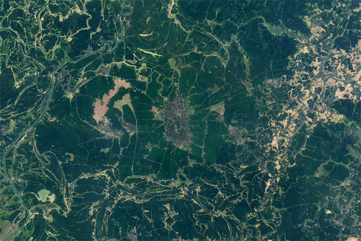
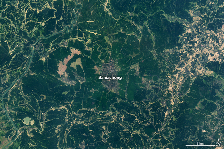
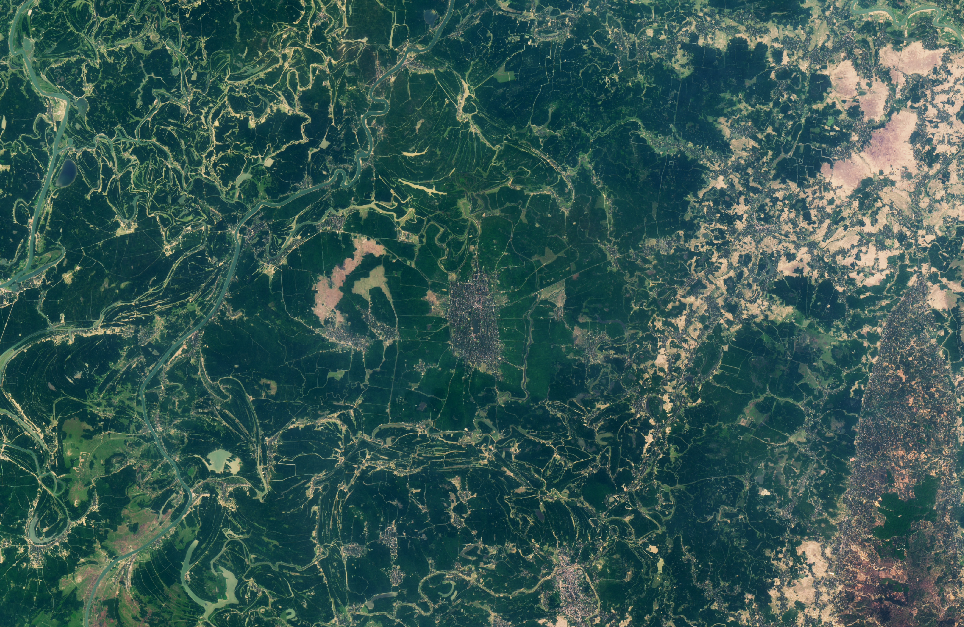
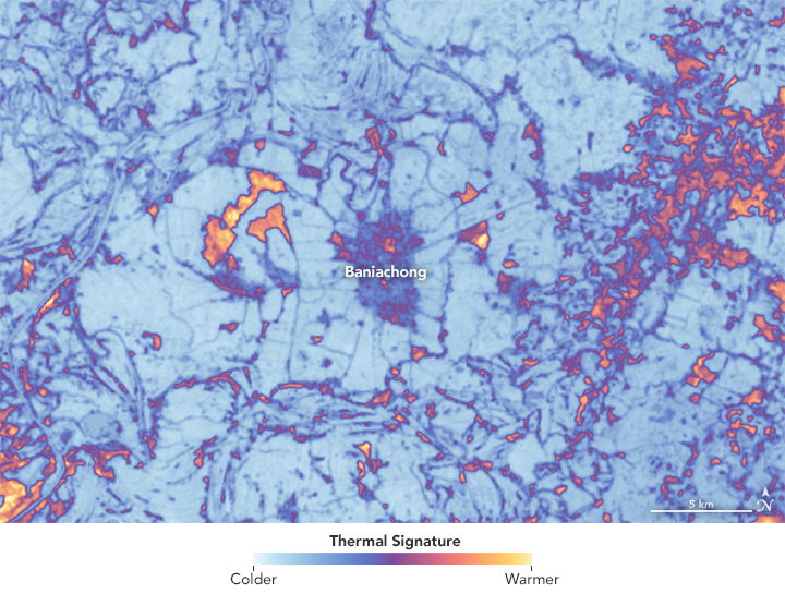
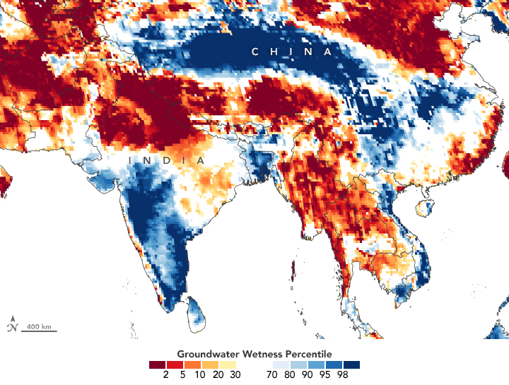
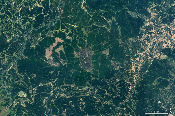
Fine-Tuning Irrigation in Asia
Scientists harness satellite data to help farmers use less water in India, Pakistan, and Bangladesh.
This image originally appeared in the NASA Earth Observatory story Fine-Tuning Irrigation in Asia.
NASA Earth Observatory images by Lauren Dauphin, using Landsat data from the U.S. Geological Survey and GRACE data from the National Drought Mitigation Center. Story by Laura Rocchio, Landsat Communication & Public Engagement Team, with Mike Carlowicz.
Published April 21, 2021
Data acquired March 17, 2021
- Sources:
- GRACE-FO
- Landsat 8 > OLI
- Collections:
- Food and Agriculture
- Science in Action