
1700 x 2200
1000 KB Bytes - JPEG

6800 x 8800
8 MB - JPEG
850 x 1100
295 KB - JPEG

3400 x 4400
3 MB - JPEG
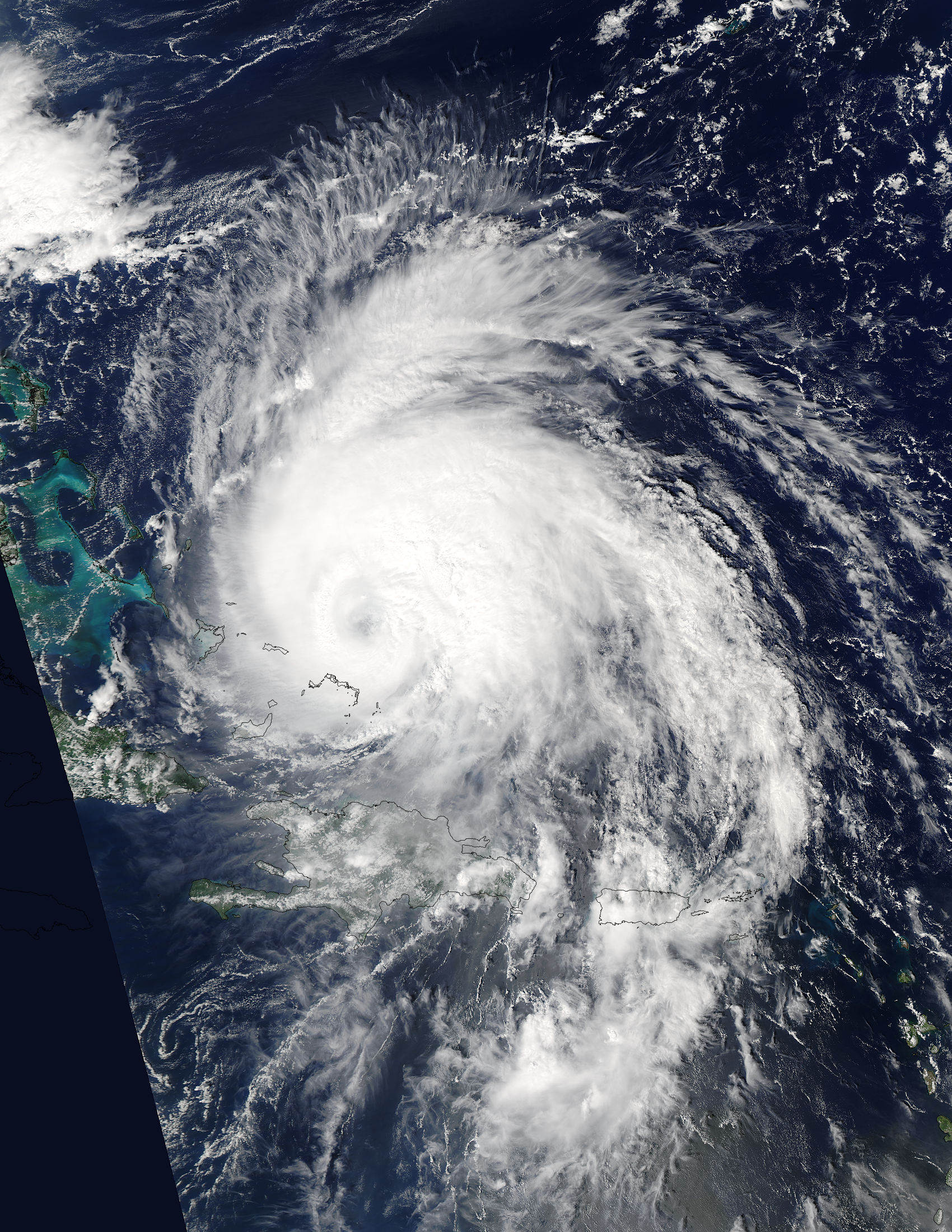
Hurricane Maria (15L) over Turks and Caicos Islands, and the Bahamas
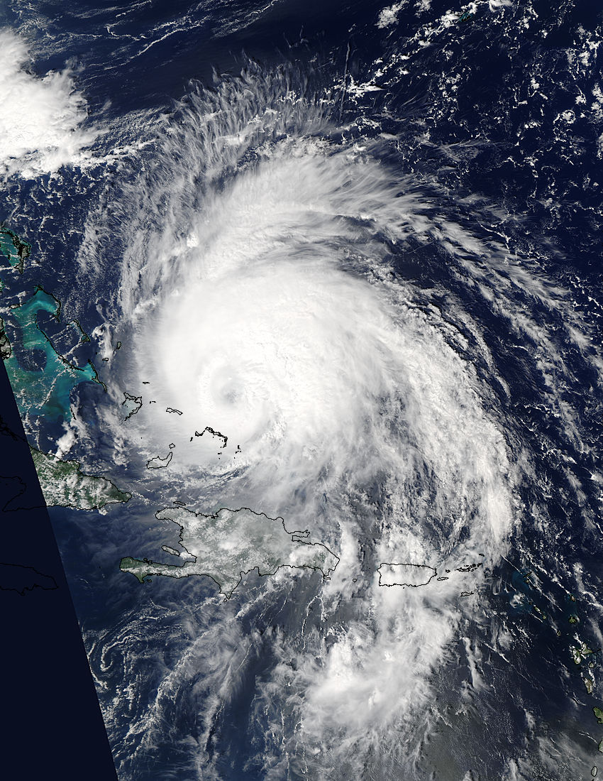
Hurricane Maria (15L) over Turks and Caicos Islands, and the Bahamas
region: At
sat: Aqua
projection: Plate Carree
projection center lon: -69.4000
projection center lat: +22.9000
image center lon: -69.4
image center lat: +22.9
standard parallel: +25.0000
UL lon: -77.8332
UL lat: +32.7904
UR lon: -60.9643
UR lat: +32.7904
LR lon: -60.9643
LR lat: +13.0053
LL lon: -77.8332
LL lat: +13.0053
UL easting (km): -849.8750
UL northing (km): +3646.1250
x scale factor: +0.9063077870366499
ellipsoid: WGS84
Contact: Jeff Schmaltz
L2 granules: A172651740 A172651745
Images by the LANCE/EOSDIS Rapid Response team.
Published September 22, 2017
Data acquired September 22, 2017
- Source:
- Aqua > MODIS
- Collection:
- Rapid Response Gallery