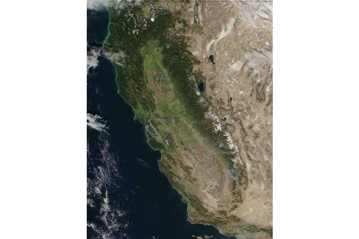
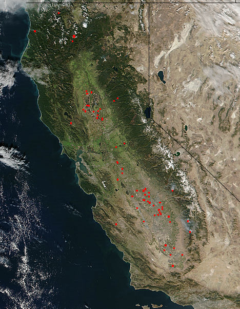
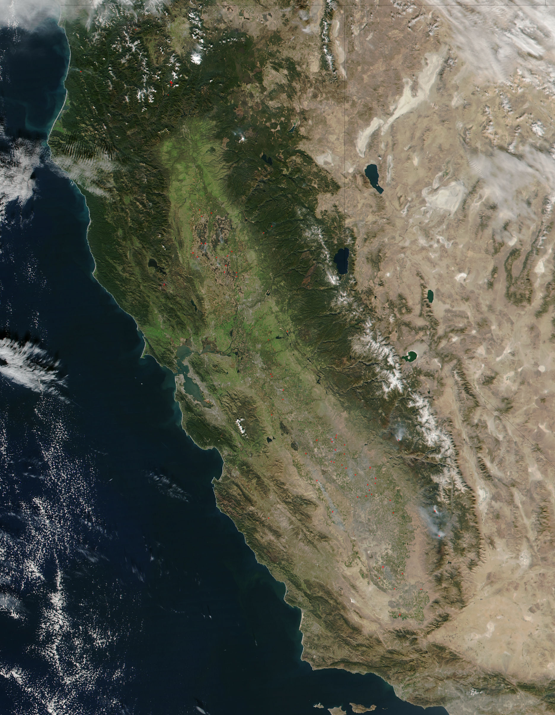
Data acquired November 17, 2016
936 x 1204
368 KB - JPEG
0 x 0
JPEG
468 x 602
103 KB - JPEG
1872 x 2408
884 KB - JPEG

936 x 1204
368 KB - JPEG
Fires in the Central Valley of California
Fires in the Central Valley of California
region: NA
United States
sat: SNPP
projection: Plate Carree
projection center lon: -121.0000
projection center lat: +38.0000
image center lon: -121
image center lat: +38
standard parallel: +40.0000
UL lon: -125.1163
UL lat: +42.0579
UR lon: -116.8749
UR lat: +42.0579
LR lon: -116.8749
LR lat: +33.9370
LL lon: -125.1163
LL lat: +33.9370
UL easting (km): -350.6250
UL northing (km): +4676.6250
x scale factor: +0.7660444431189780
ellipsoid: WGS84
Contact: Jeff Schmaltz
L2 granules: N163222148
Images by the LANCE/EOSDIS Rapid Response team.
Published November 17, 2016
Data acquired November 17, 2016
- Source:
- Suomi NPP > VIIRS
- Collection:
- Rapid Response Gallery