SouthPacificOcean.A2007002.2245_th.jpg
0 x 0
JPEG

0 x 0
JPEG
1100 x 850
253 KB - JPEG
4400 x 3400
2 MB - JPEG

2200 x 1700
862 KB - JPEG
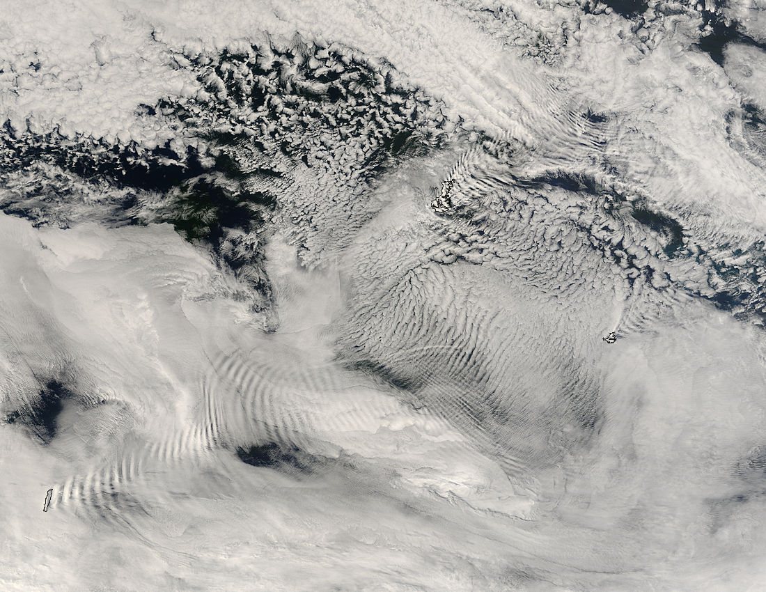
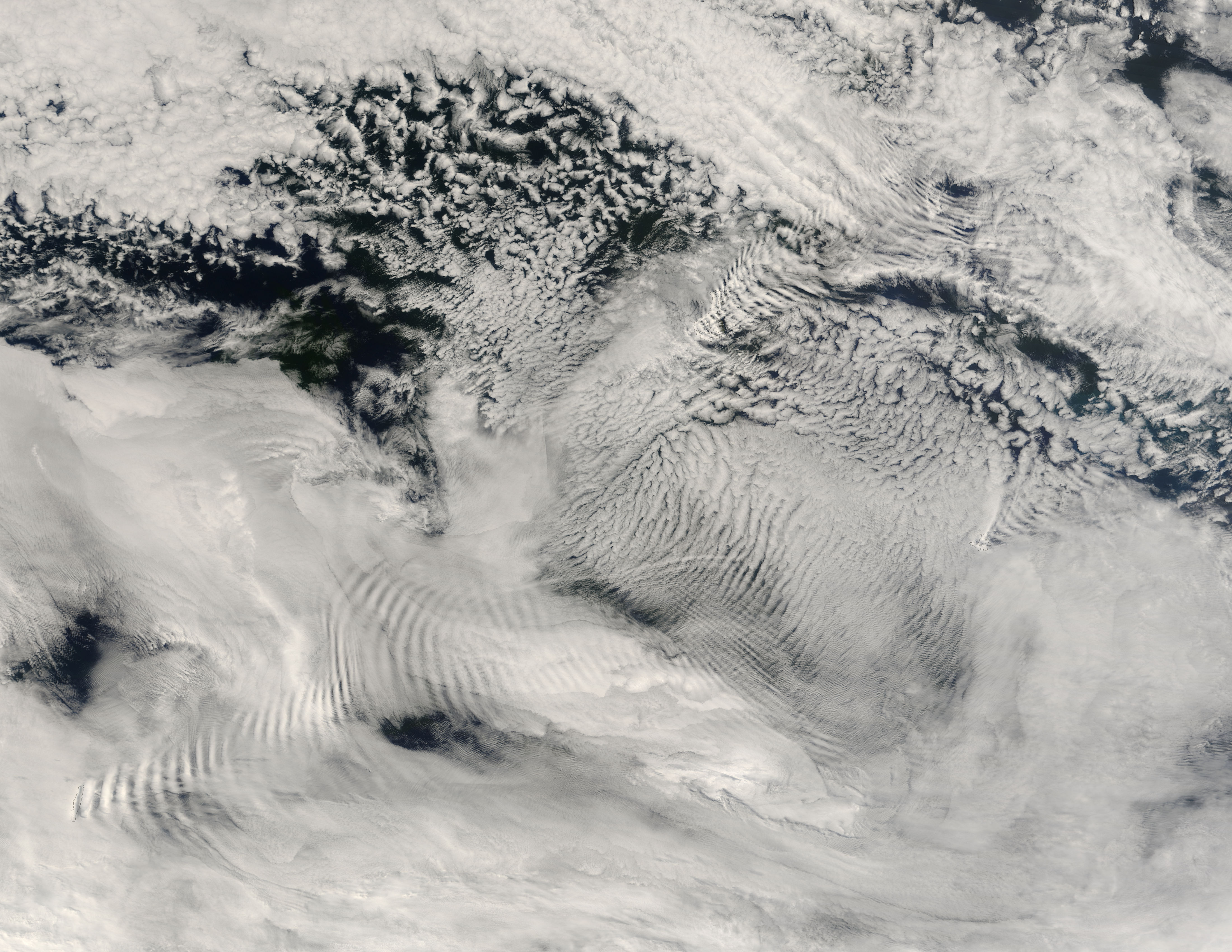
Ship-wave-shaped wave clouds induced by Macquarie Island, Auckland Islands, and Campbell Island, Sou
Ship-wave-shaped wave clouds induced by Macquarie Island, Auckland Islands, and Campbell Island, South Pacific Ocean
region: Pa
projection: Plate Carree
projection center lon: +165.0000
projection center lat: -52.0000
image center lon: +165
image center lat: -52
UL lon: +158.0065
UL lat: -48.1800
UR lon: +171.9967
UR lat: -48.1800
LR lon: +171.9967
LR lat: -55.8242
LL lon: +158.0065
LL lat: -55.8242
UL easting (km): -549.8750
UL northing (km): -5357.3750
x scale factor: +0.7071067811865476
ellipsoid: WGS84
Contact: Jeff Schmaltz
L2 granules: T070022240 T070022245
Images by the MODIS Rapid Response team.
Published January 2, 2007
Data acquired January 2, 2007
- Source:
- Terra > MODIS
- Collection:
- Rapid Response Gallery