40 KB - KML/KMZ
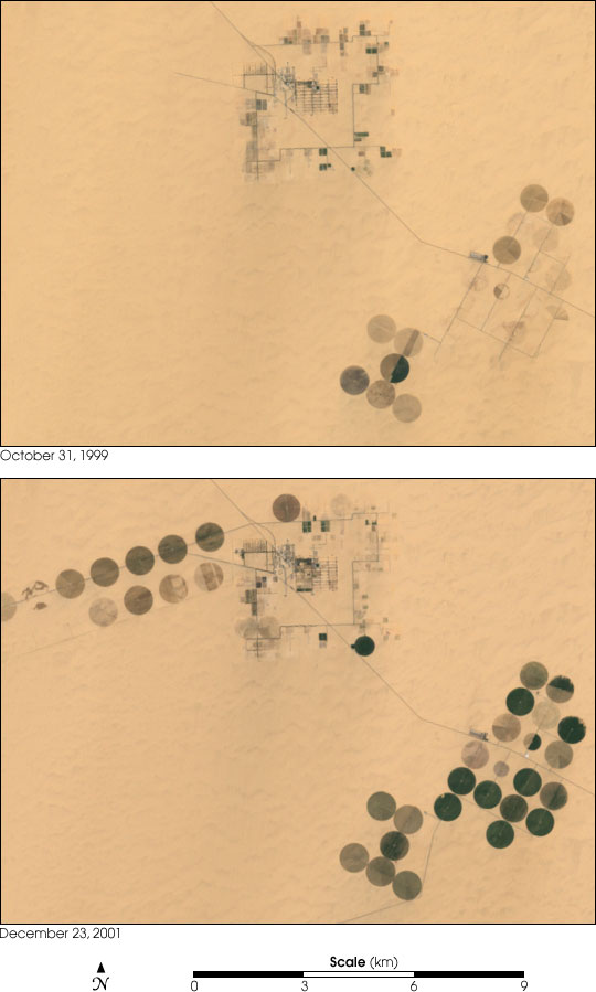
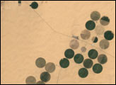
Irrigation in the Heart of the Sahara
Published March 2, 2002
Although it is now the largest desert on Earth, during the last ice age the Sahara was a savannah with a climate similar to that of present-day Kenya and Tanzania. The annual rainfall was much greater than it is now, creating many rivers and lakes that are now hidden under shifting sands or exposed as barren salt flats. Over several hundred thousand years, the rains also filled a series of vast underground aquifers. Modern African nations are now mining this fossil water to support irrigated farming projects.
Related images:
540 x 899
JPEG

2 MB - MOV

2400 x 1800
6 MB - GeoTIFF
2400 x 1800
6 MB - GeoTIFF

2400 x 1800
6 MB - GeoTIFF
Irrigation in the Heart of the Sahara
Published March 2, 2002
Although it is now the largest desert on Earth, during the last ice age the Sahara was a savannah with a climate similar to that of present-day Kenya and Tanzania. The annual rainfall was much greater than it is now, creating many rivers and lakes that are now hidden under shifting sands or exposed as barren salt flats. Over several hundred thousand years, the rains also filled a series of vast underground aquifers. Modern African nations are now mining this fossil water to support irrigated farming projects.
Related images:
540 x 899
JPEG
2 MB - MOV
2400 x 1800
6 MB - GeoTIFF
40 KB - KML/KMZ
2400 x 1800
6 MB - GeoTIFF
Irrigation in the Heart of the Sahara
Published March 2, 2002
Although it is now the largest desert on Earth, during the last ice age the Sahara was a savannah with a climate similar to that of present-day Kenya and Tanzania. The annual rainfall was much greater than it is now, creating many rivers and lakes that are now hidden under shifting sands or exposed as barren salt flats. Over several hundred thousand years, the rains also filled a series of vast underground aquifers. Modern African nations are now mining this fossil water to support irrigated farming projects.
Related images:
540 x 899
JPEG
2 MB - MOV
2400 x 1800
6 MB - GeoTIFF
40 KB - KML/KMZ
540 x 540
JPEG
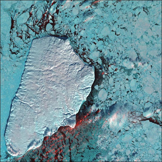
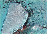
Akpatok Island
Published February 25, 2002
Akpatok Island lies in Ungava Bay in northern Quebec, Canada. Accessible only by air, Akpatok Island rises out of the water as sheer cliffs that soar 500 to 800 feet (150 to 243 m) above the sea surface. The island is an important sanctuary for cliff-nesting seabirds.
Related images:
4000 x 4000
4 MB - JPEG
4999 x 4999
48 MB - GeoTIFF
5000 x 5000
46 MB - GeoTIFF
147 KB - KML/KMZ
4999 x 4999
48 MB - GeoTIFF
Akpatok Island
Published February 25, 2002
Akpatok Island lies in Ungava Bay in northern Quebec, Canada. Accessible only by air, Akpatok Island rises out of the water as sheer cliffs that soar 500 to 800 feet (150 to 243 m) above the sea surface. The island is an important sanctuary for cliff-nesting seabirds.
Related images:
540 x 540
JPEG
4000 x 4000
4 MB - JPEG
5000 x 5000
46 MB - GeoTIFF
147 KB - KML/KMZ
5000 x 5000
46 MB - GeoTIFF
Akpatok Island
Published February 25, 2002
Akpatok Island lies in Ungava Bay in northern Quebec, Canada. Accessible only by air, Akpatok Island rises out of the water as sheer cliffs that soar 500 to 800 feet (150 to 243 m) above the sea surface. The island is an important sanctuary for cliff-nesting seabirds.
Related images:
540 x 540
JPEG
4000 x 4000
4 MB - JPEG
4999 x 4999
48 MB - GeoTIFF
147 KB - KML/KMZ
147 KB - KML/KMZ
Akpatok Island
Published February 25, 2002
Akpatok Island lies in Ungava Bay in northern Quebec, Canada. Accessible only by air, Akpatok Island rises out of the water as sheer cliffs that soar 500 to 800 feet (150 to 243 m) above the sea surface. The island is an important sanctuary for cliff-nesting seabirds.
Related images:
540 x 540
JPEG
4000 x 4000
4 MB - JPEG
4999 x 4999
48 MB - GeoTIFF
5000 x 5000
46 MB - GeoTIFF

540 x 405
JPEG
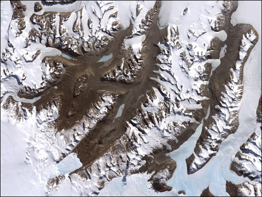
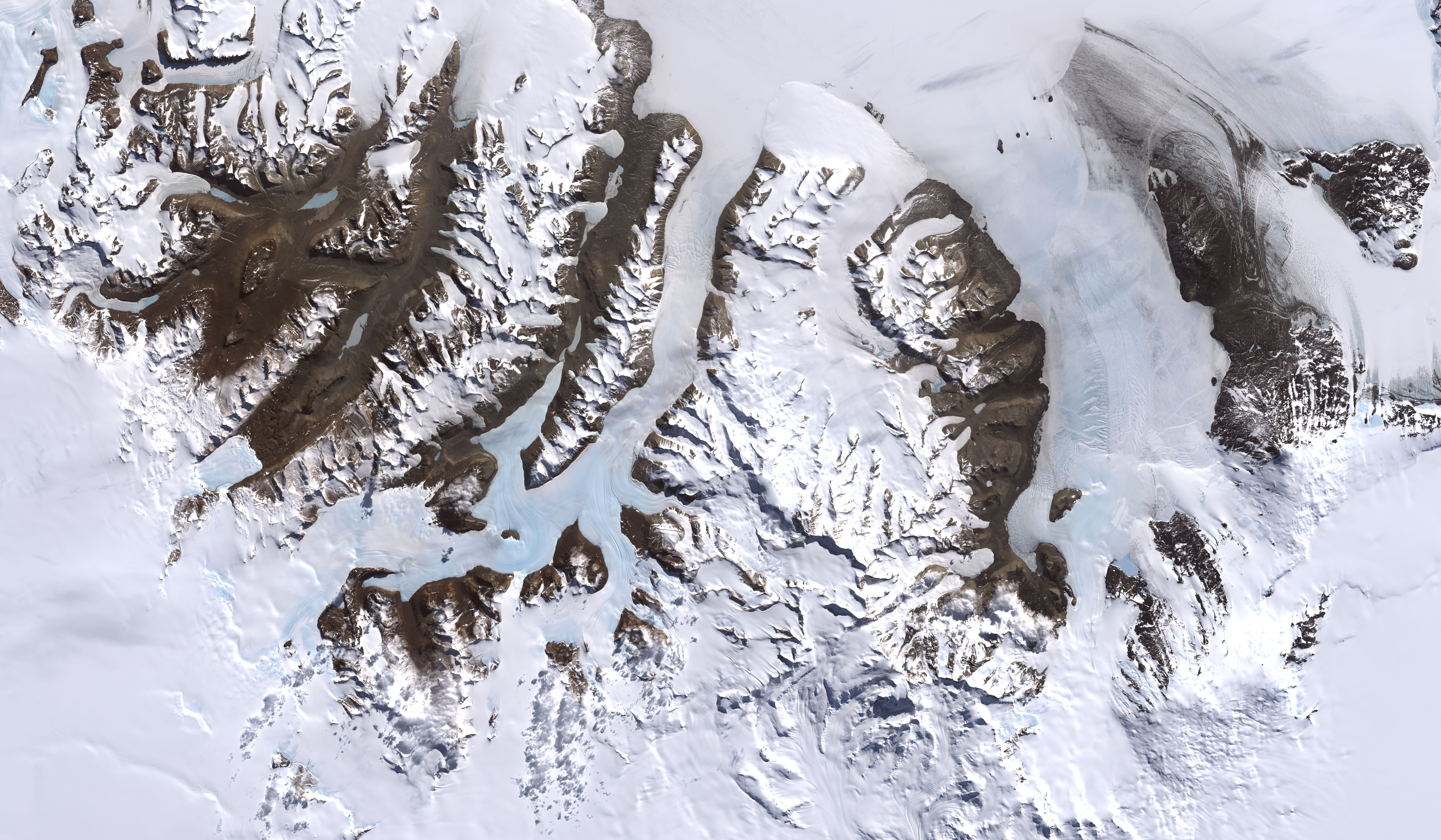
McMurdo Dry Valleys
Published January 26, 2002
One of the few areas of Antarctica not covered by thousands of meters of ice, the McMurdo Dry Valleys stand out in this satellite image. For a few weeks each summer temperatures are warm enough to melt glacial ice, creating streams that feed freshwater lakes that lie at the bottom of the valleys.
Related images:
6245 x 3640
3 MB - JPEG
4000 x 3000
32 MB - GeoTIFF
46 KB - KML/KMZ
46 KB - KML/KMZ
McMurdo Dry Valleys
Published January 26, 2002
One of the few areas of Antarctica not covered by thousands of meters of ice, the McMurdo Dry Valleys stand out in this satellite image. For a few weeks each summer temperatures are warm enough to melt glacial ice, creating streams that feed freshwater lakes that lie at the bottom of the valleys.
Related images:
540 x 405
JPEG
6245 x 3640
3 MB - JPEG
4000 x 3000
32 MB - GeoTIFF
4000 x 3000
32 MB - GeoTIFF
McMurdo Dry Valleys
Published January 26, 2002
One of the few areas of Antarctica not covered by thousands of meters of ice, the McMurdo Dry Valleys stand out in this satellite image. For a few weeks each summer temperatures are warm enough to melt glacial ice, creating streams that feed freshwater lakes that lie at the bottom of the valleys.
Related images:
540 x 405
JPEG
6245 x 3640
3 MB - JPEG
46 KB - KML/KMZ
540 x 405
JPEG
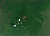
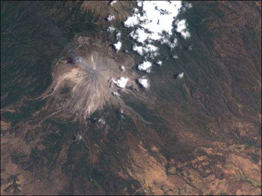
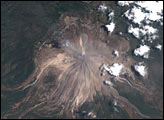
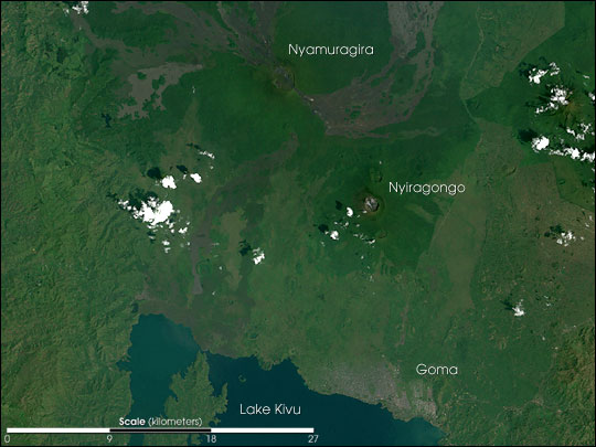
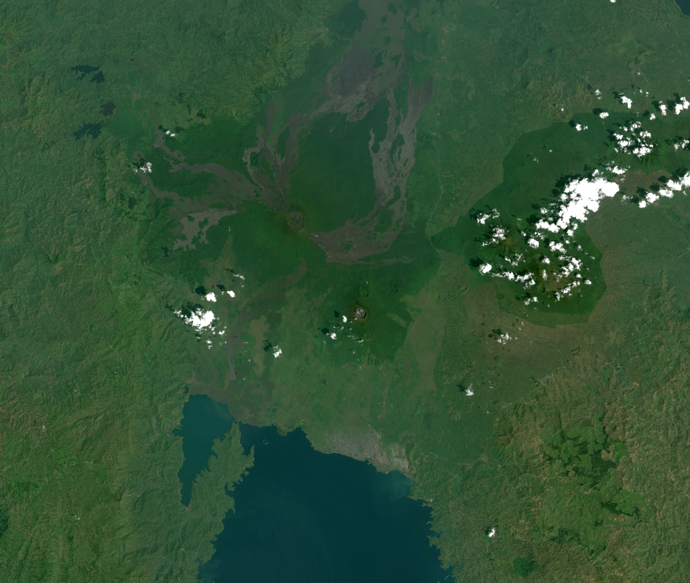
Nyiragongo Volcano before the Eruption
Published January 23, 2002
Related images:
2748 x 2322
2 MB - JPEG