Sensor: Landsat 5 > TM
720 x 530
PNG
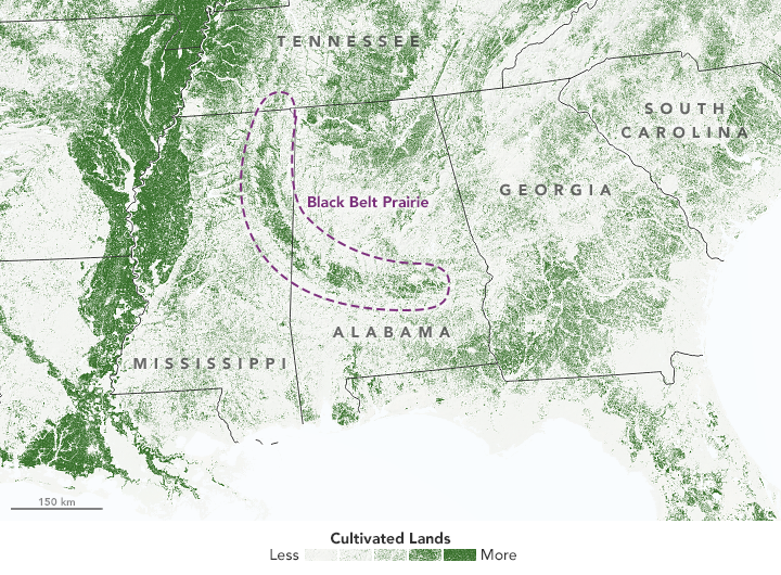
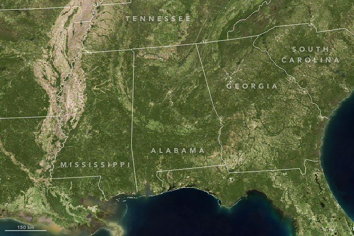
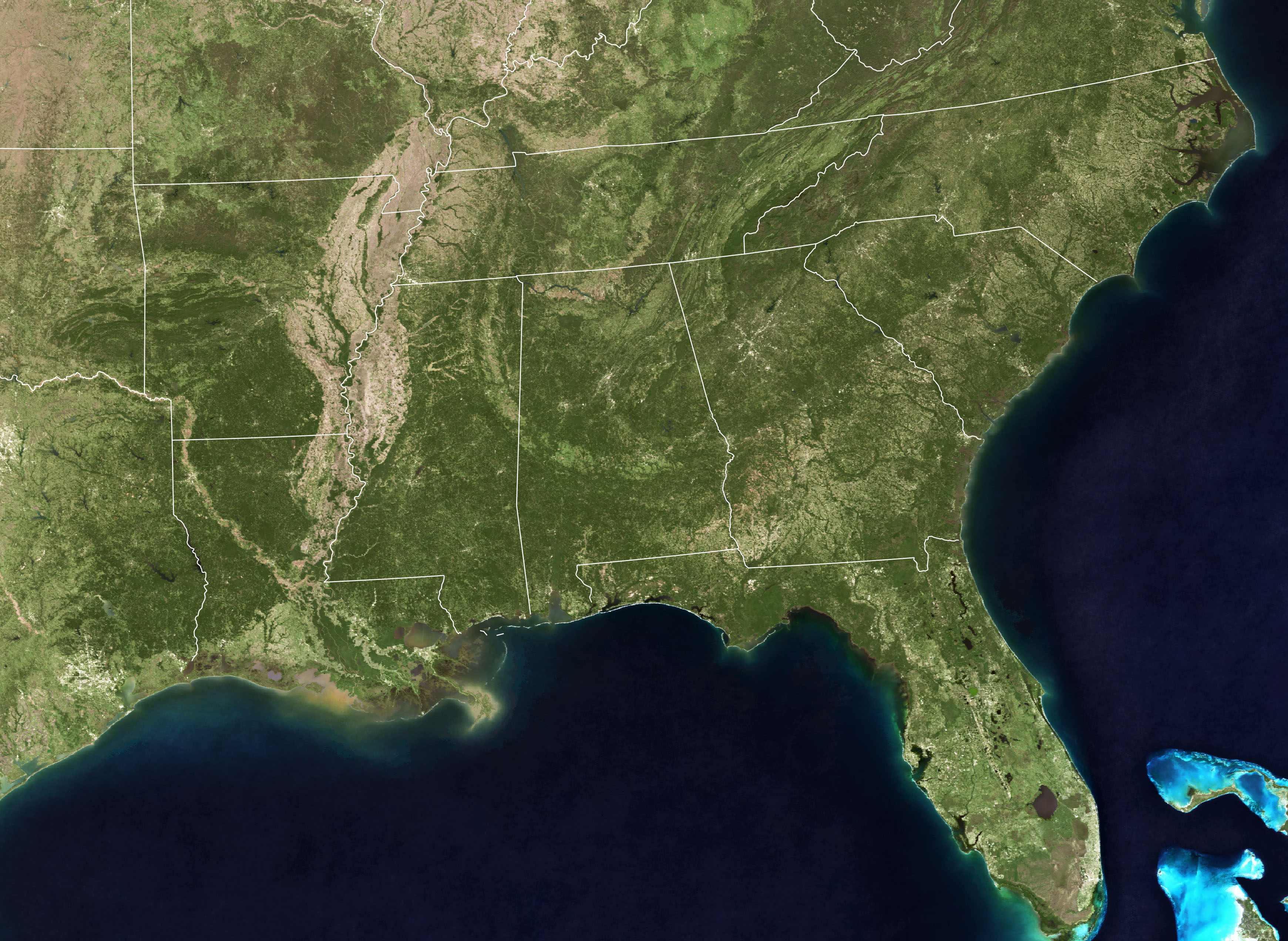
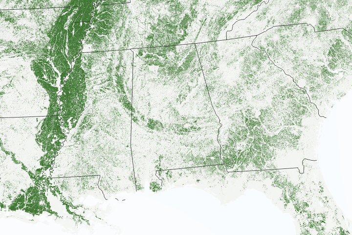
Black Belt Prairie
Published June 21, 2018
The crescent-shaped area of fertile, cultivated land stretches through parts of Mississippi and Alabama.
Related images:
720 x 480
JPEG
3481 x 2544
2 MB - JPEG

3481 x 2544
8 MB - PNG
720 x 480
JPEG
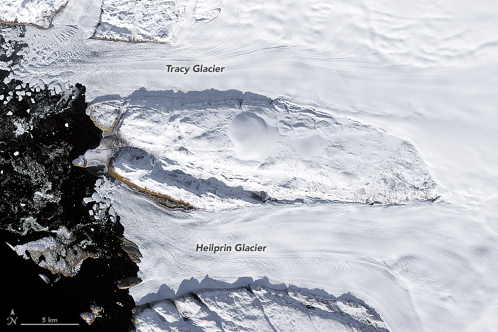
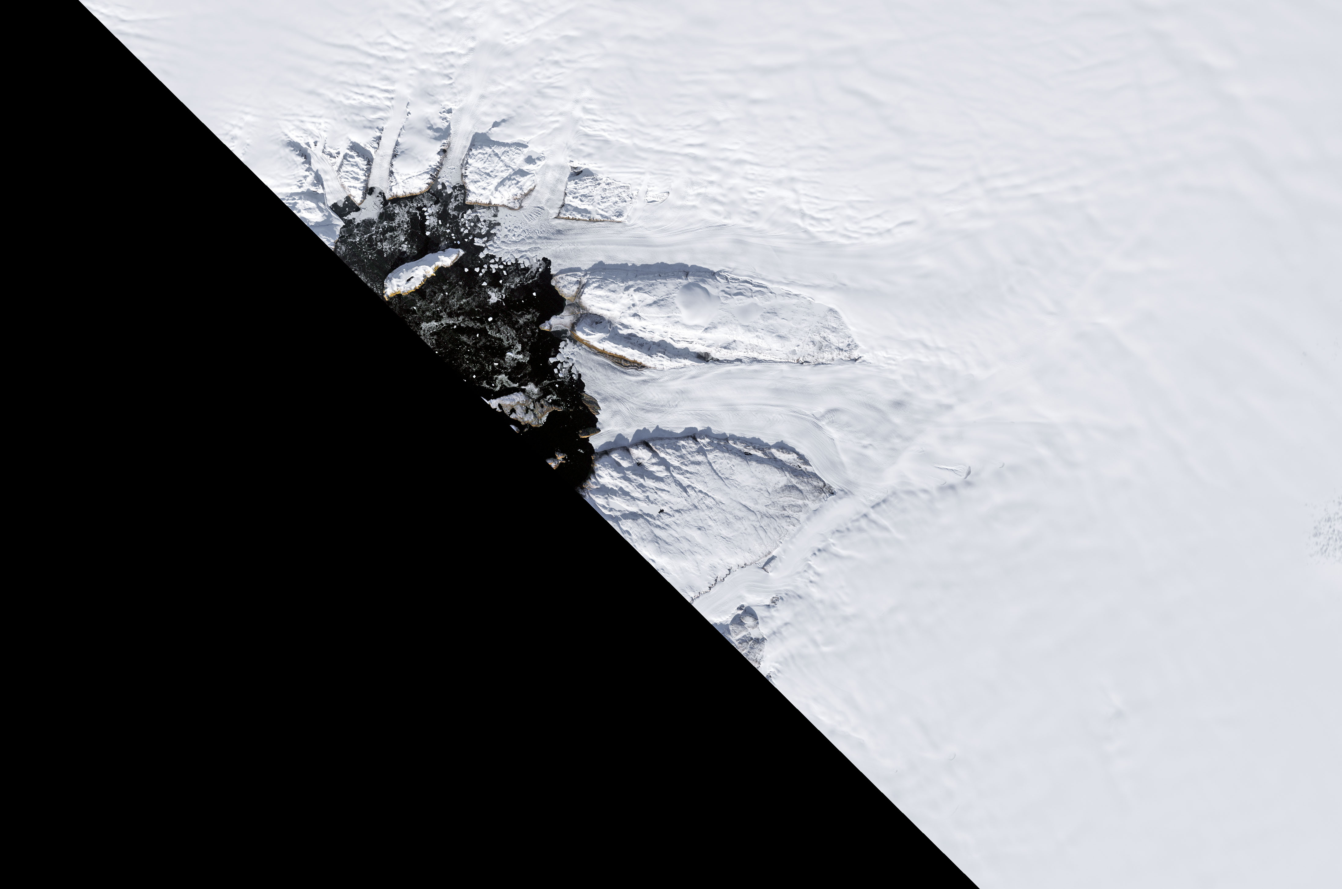
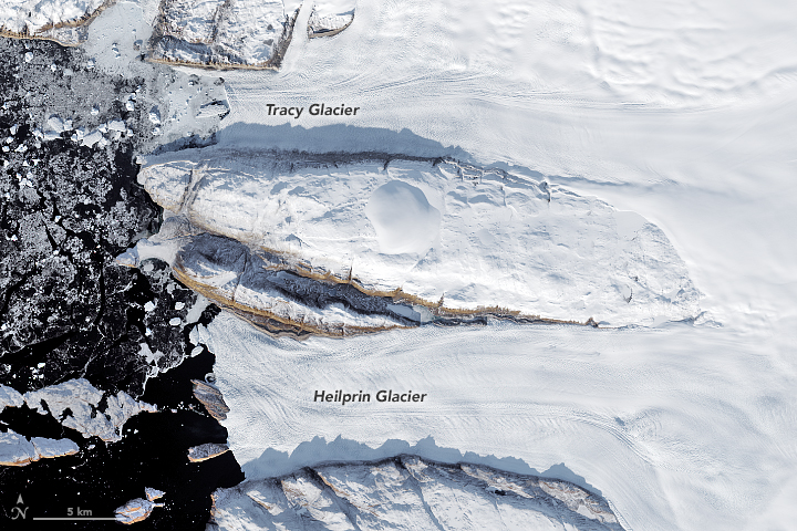
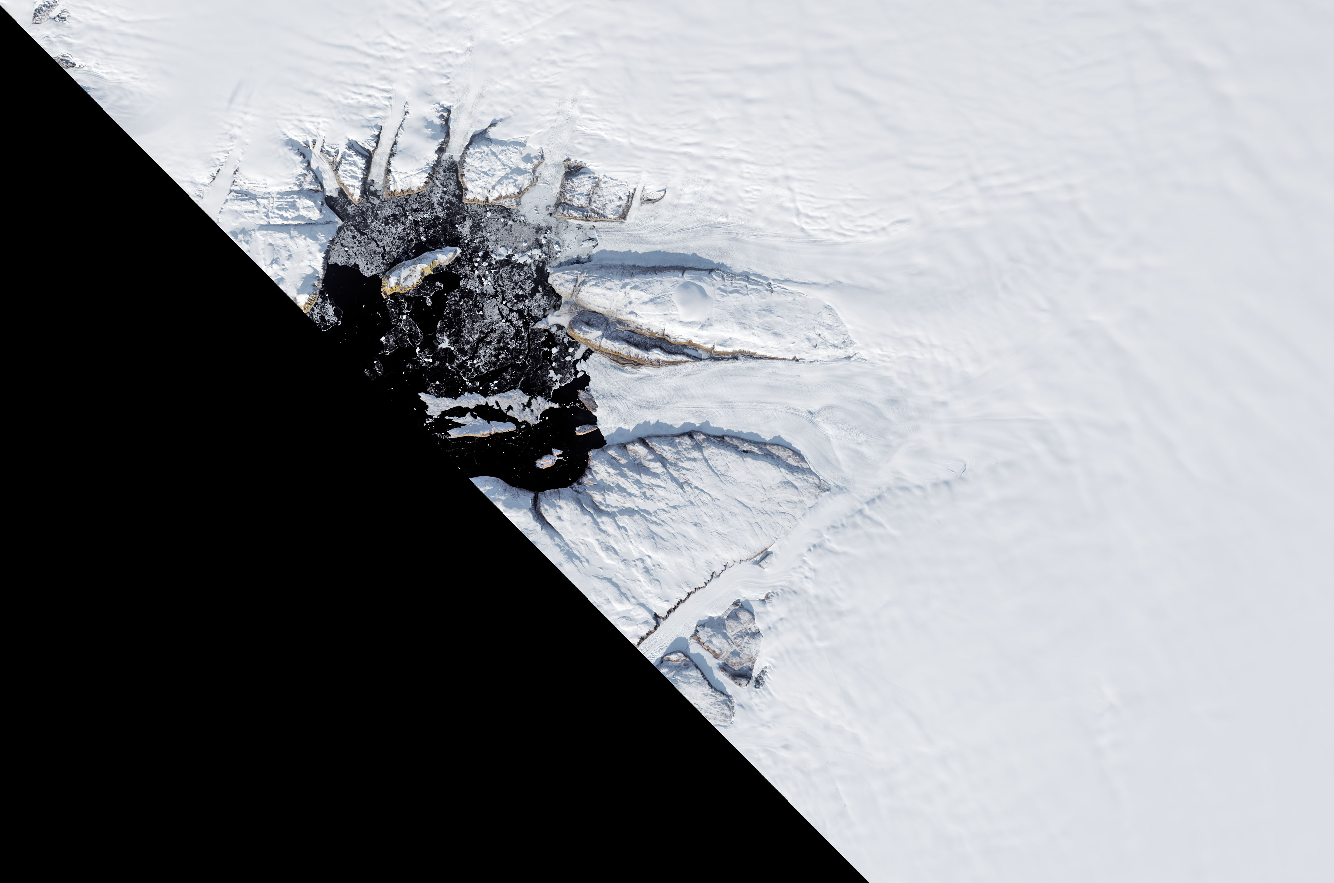
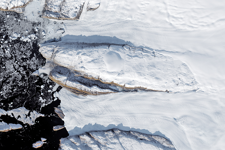
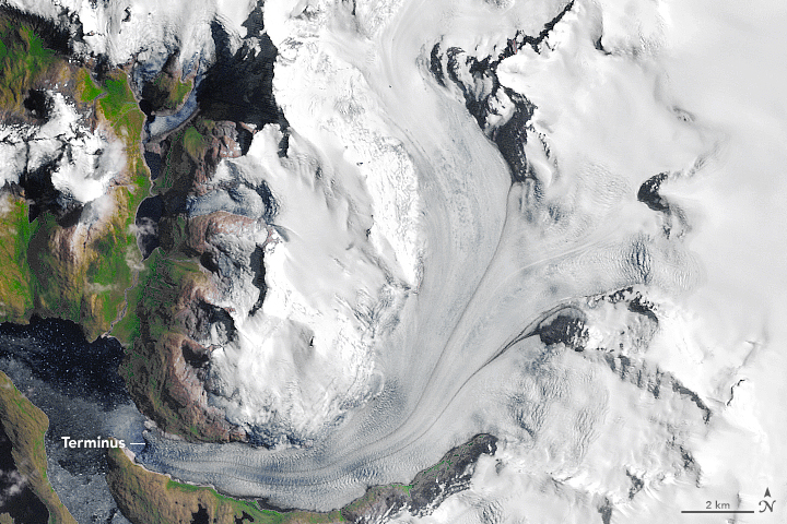
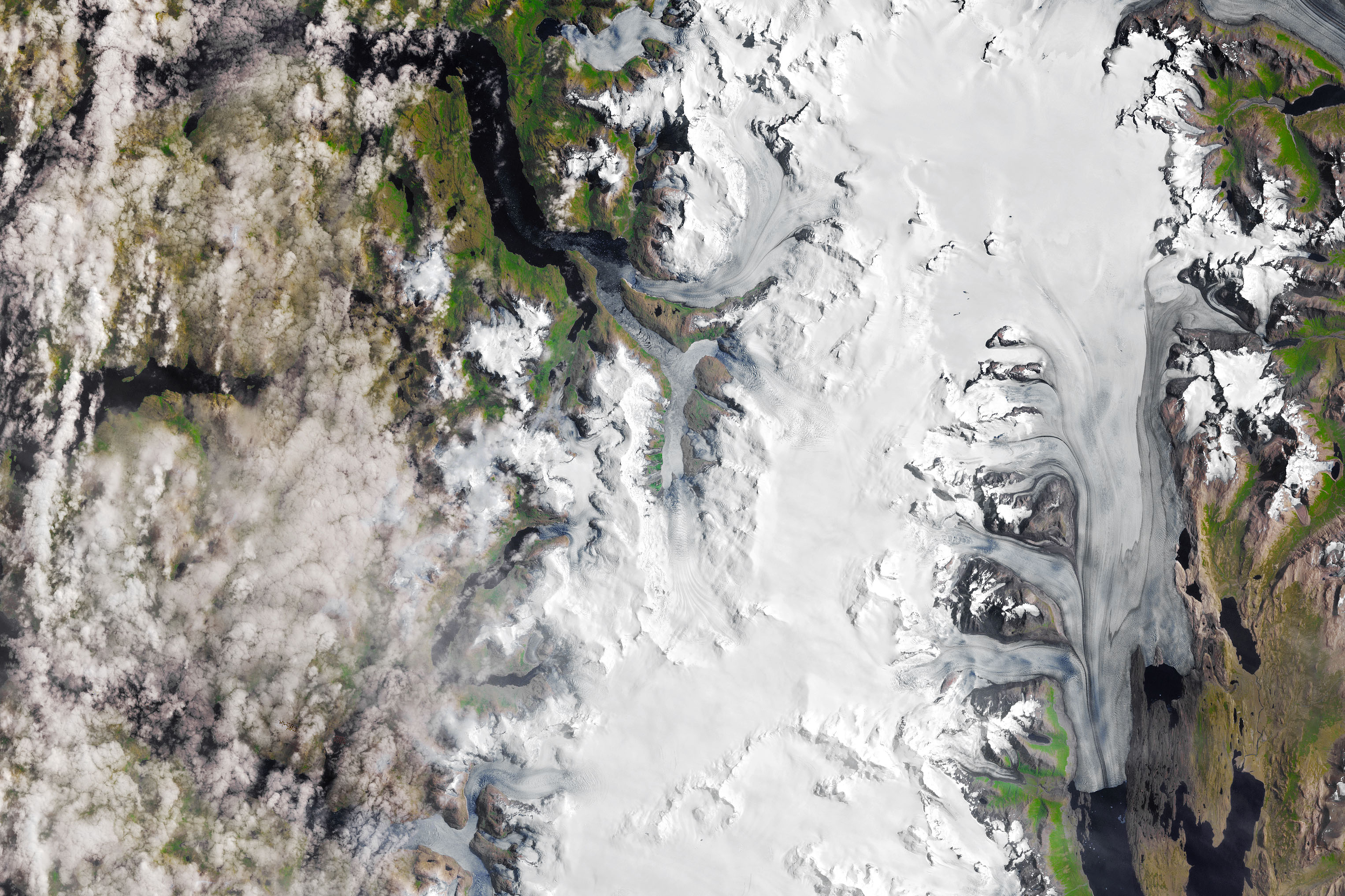
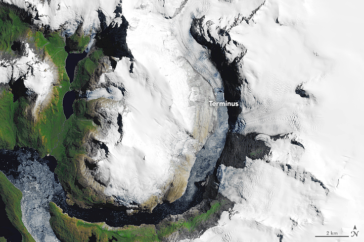
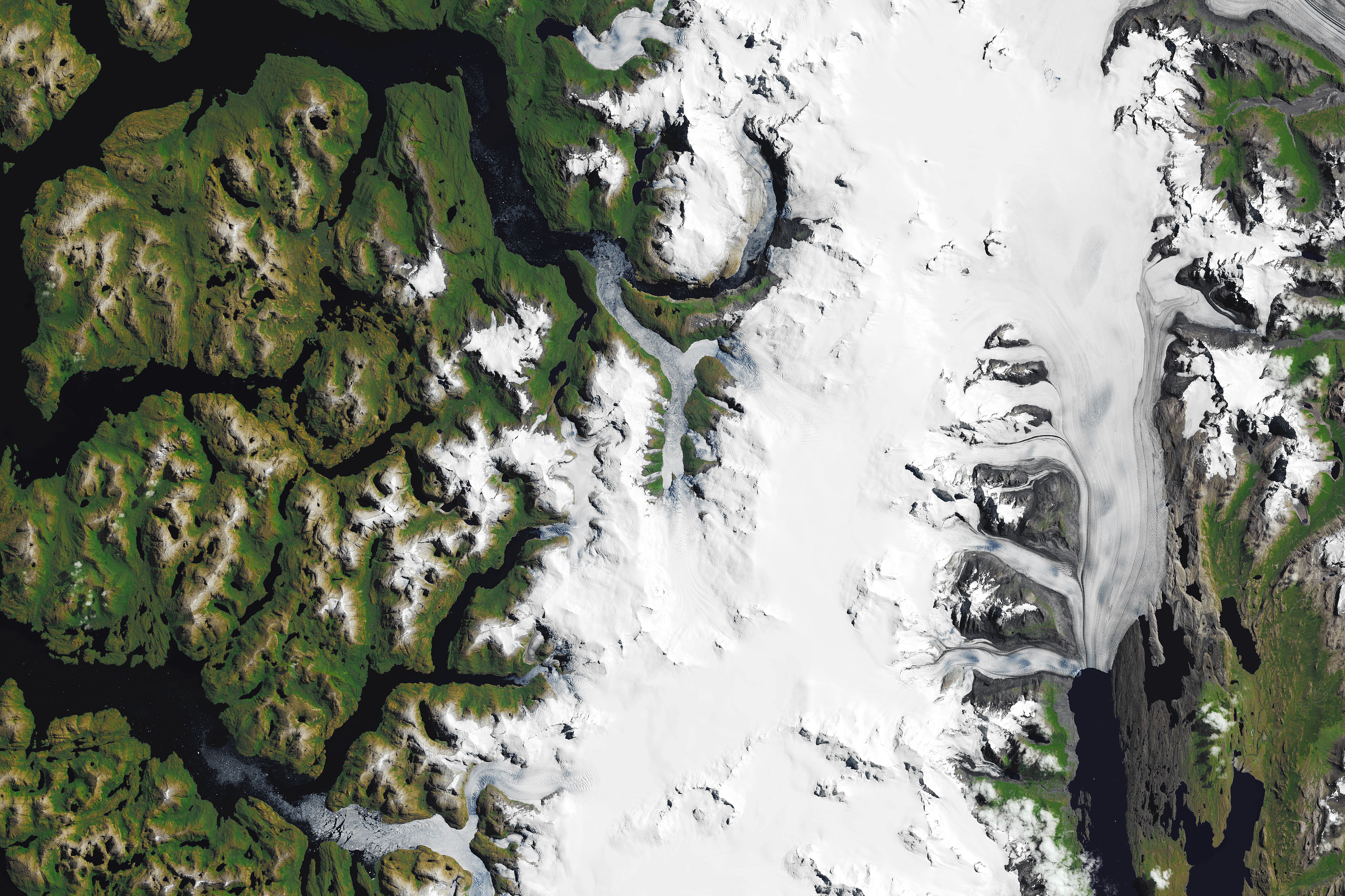
Decline of Two Glaciers in Northwest Greenland
Published April 8, 2018
The Tracy and Heilprin Glaciers may not be Greenland’s largest, but they are retreating fast.
Related images:
4390 x 2907
810 KB - JPEG
720 x 480
JPEG
4390 x 2907
956 KB - JPEG
720 x 480
JPEG
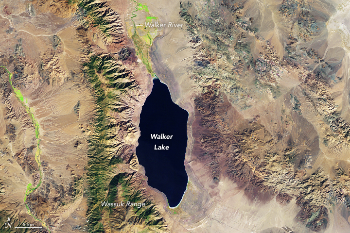
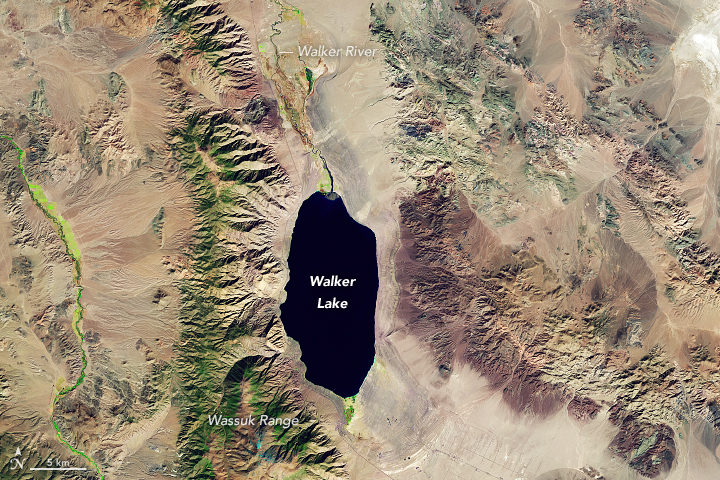
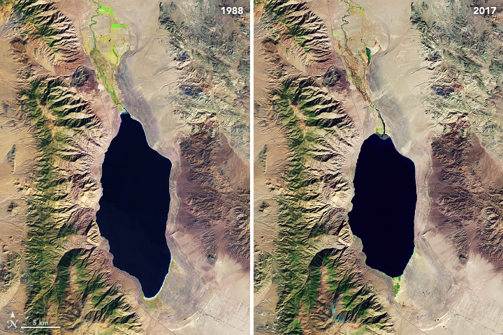
Disappearing Walker Lake
Published April 4, 2018
Like this lake in northwestern Nevada, many of the world’s prominent salt lakes are drying up.
Related images:
3812 x 3812
5 MB - JPEG
720 x 480
JPEG
3812 x 3812
5 MB - JPEG
720 x 480
JPEG
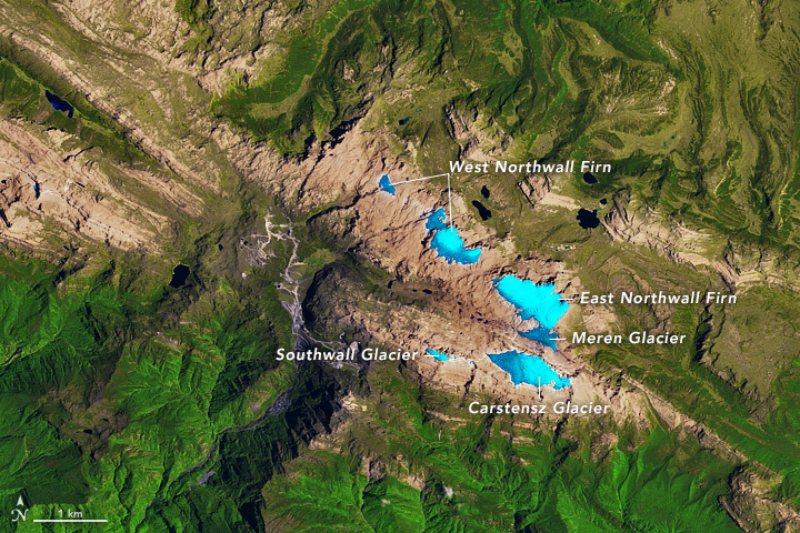
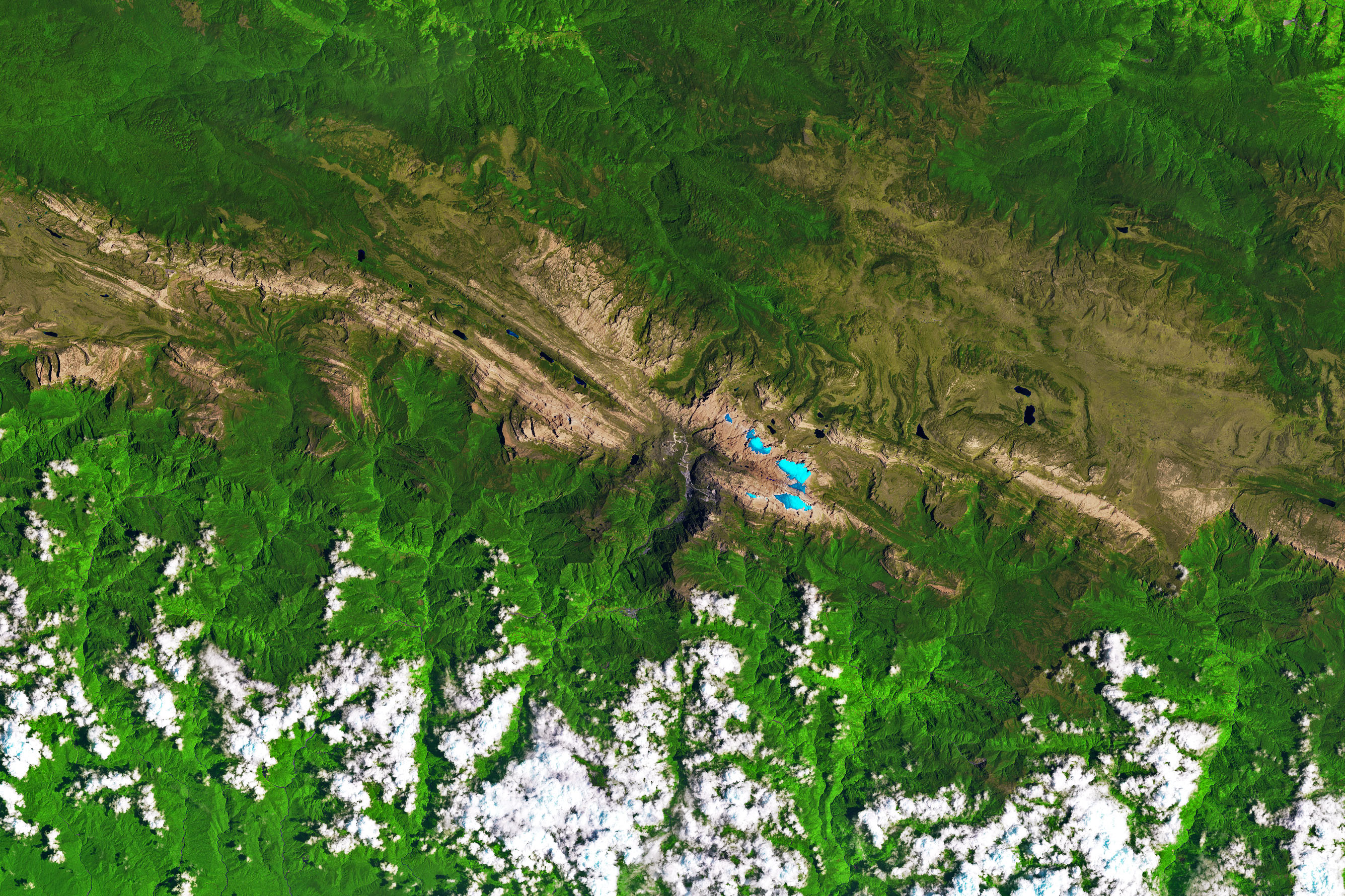
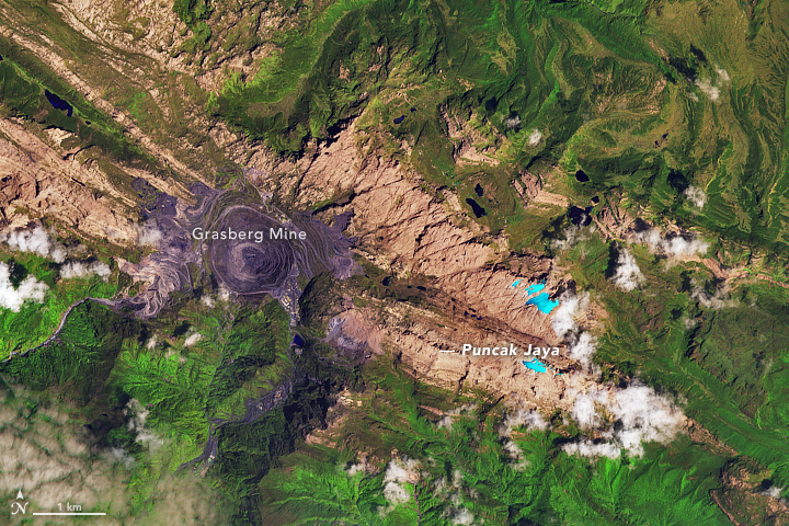
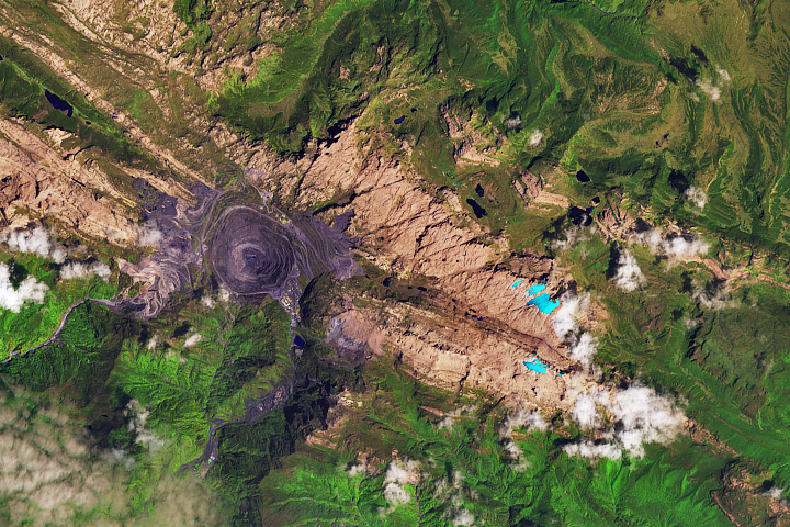
Glaciers in the Tropics, but Not for Long
Published February 14, 2018
Though the mountains are located just south of the equator, their elevation is high enough and the air temperatures are cold enough to still support a few small areas of ice.
Related images:
2672 x 1781
2 MB - JPEG
720 x 480
JPEG

2672 x 1781
2 MB - JPEG
720 x 480
JPEG
Glacial Retreat at a Non-glacial Pace
Published January 25, 2018
The HPS-12 glacier in Chile has lost about half of its length in three decades.
Related images:
3053 x 2035
1 MB Bytes - JPEG
720 x 480
JPEG
3053 x 2035
2 MB - JPEG

720 x 480
JPEG
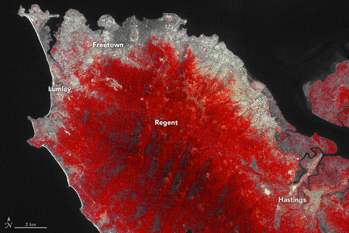
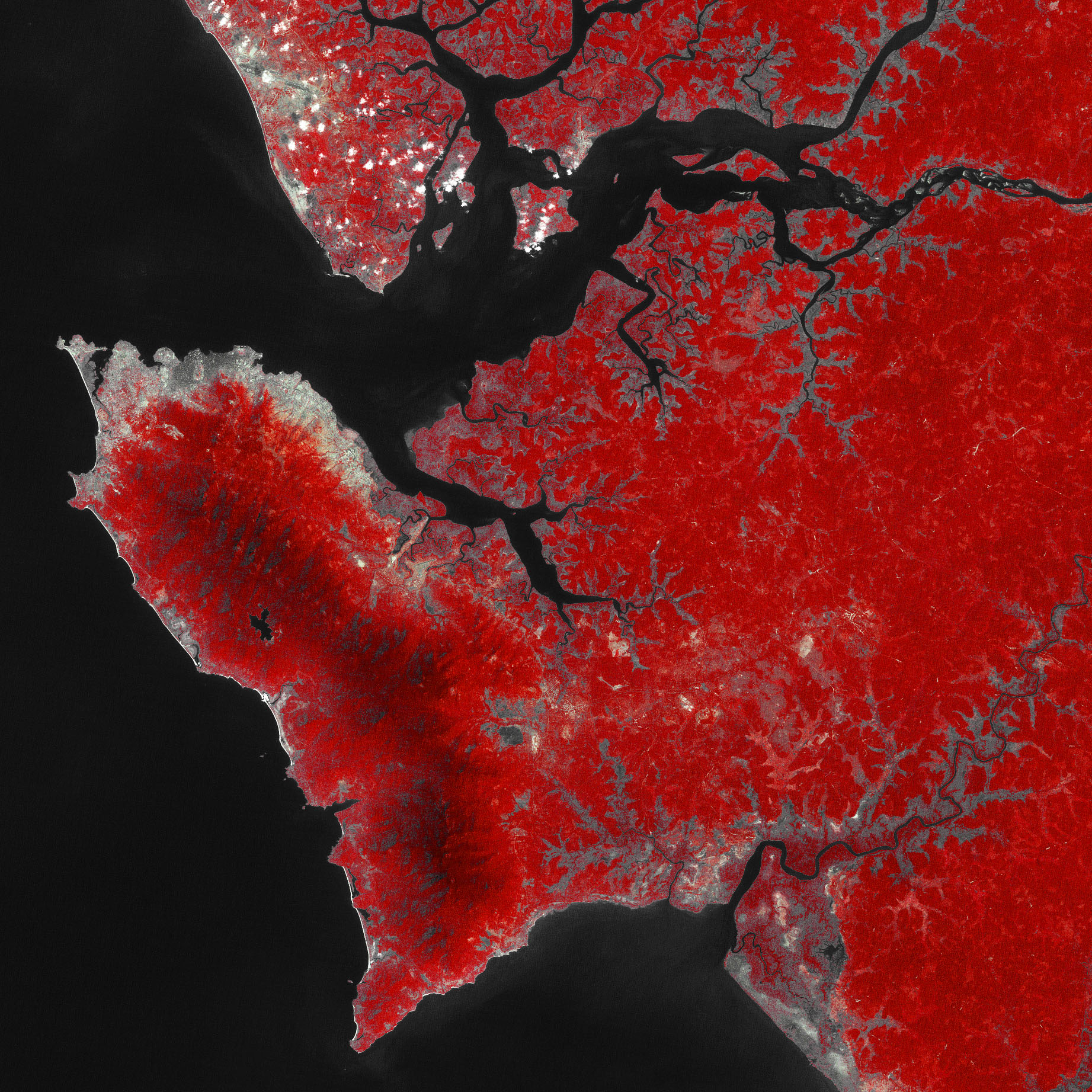
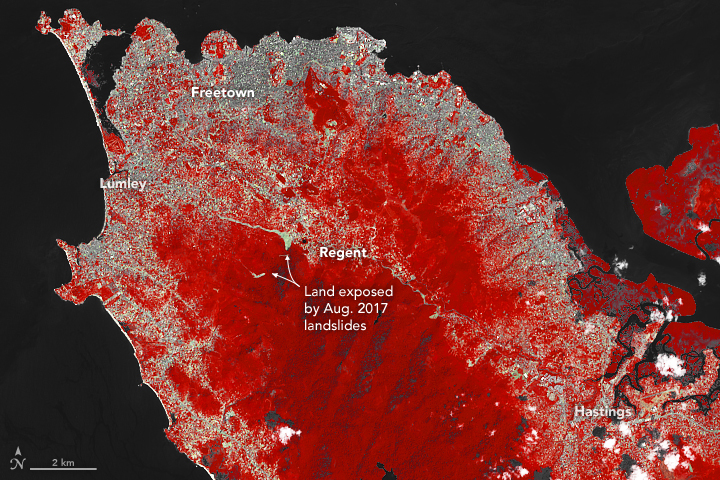
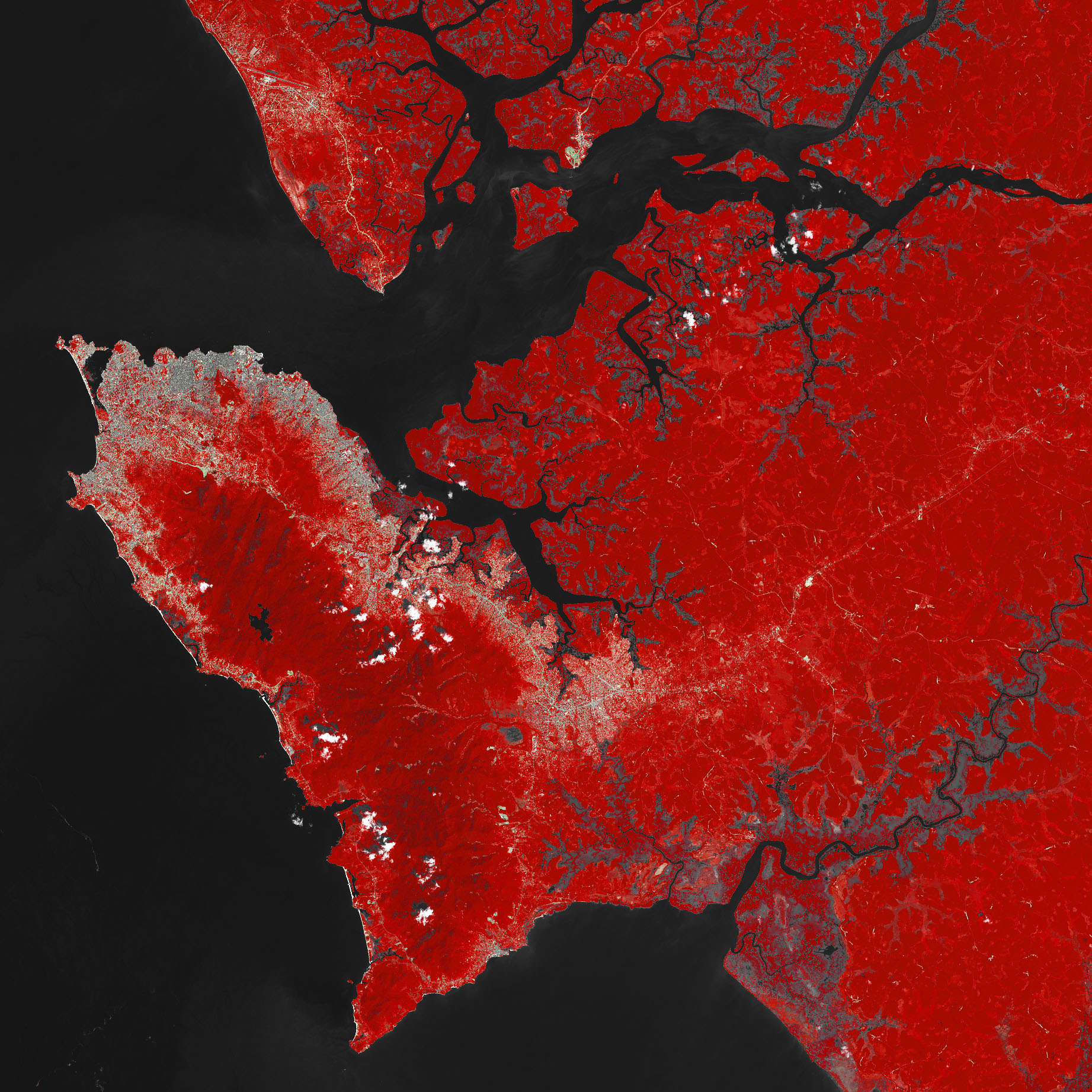
A Growing City and a Deadly Landslide
Published December 5, 2017
Downpours triggered Freetown’s deadly August mudslide, but decades of development in mountainous areas beyond the city set the stage for the disaster.
Related images:
1843 x 1843
1 MB Bytes - JPEG
720 x 480
JPEG
1843 x 1843
937 KB - JPEG
720 x 540
JPEG
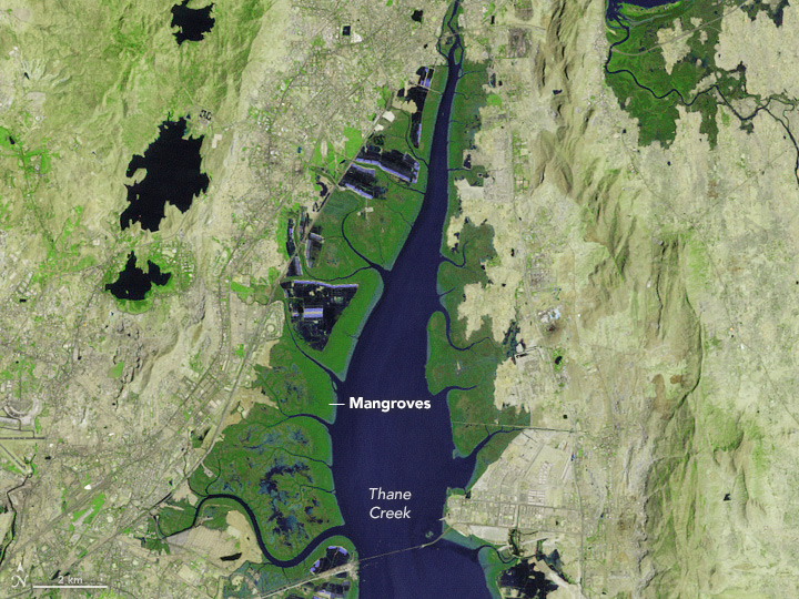
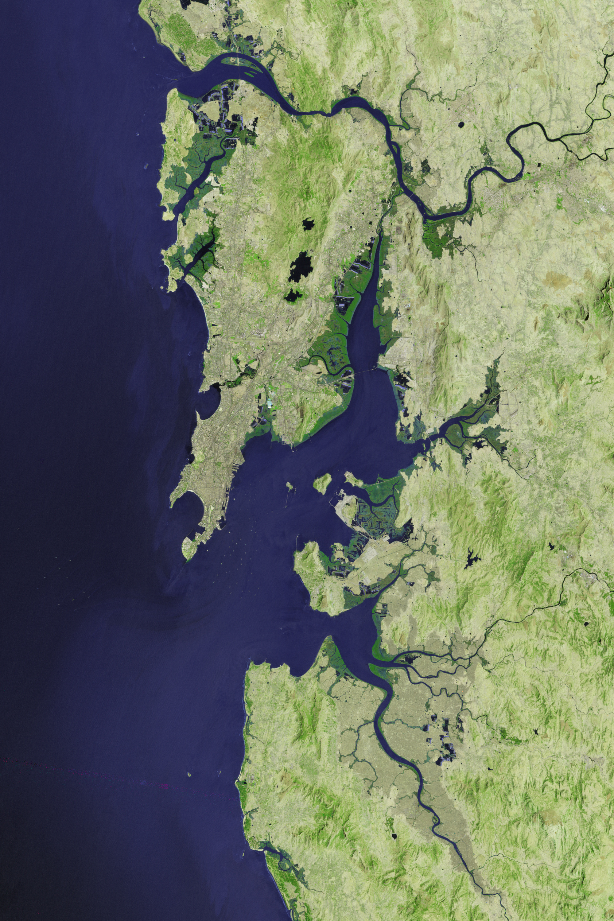
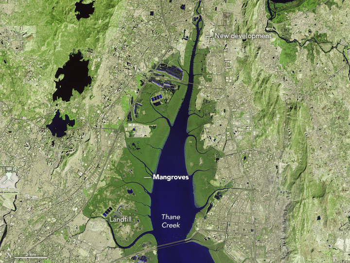
Monitoring Mumbai’s Mangroves
Published November 30, 2017
Satellites offer some needed perspective on the status of vulnerable mangrove forests along the Indian city’s many waterways.
Related images:
2000 x 3000
3 MB - JPEG
720 x 540
JPEG
2000 x 3000
3 MB - JPEG
720 x 540
JPEG
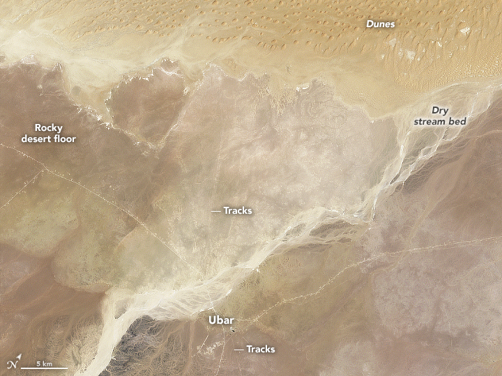
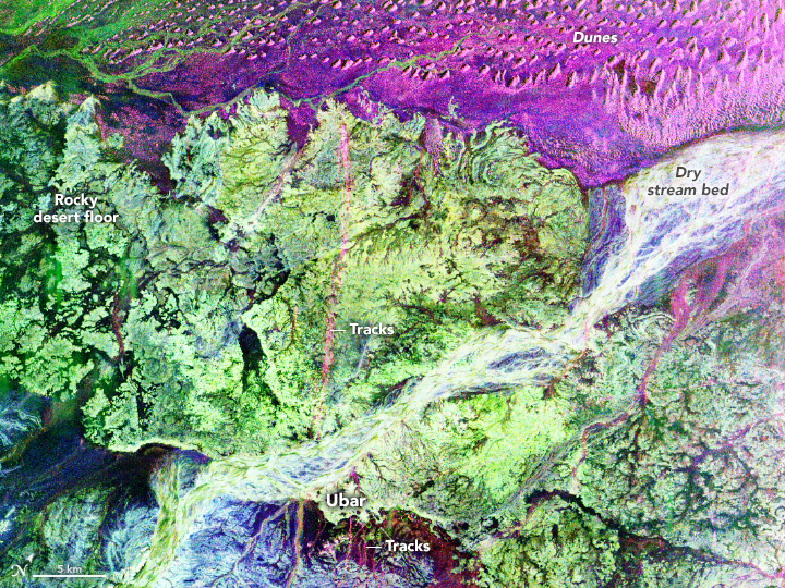
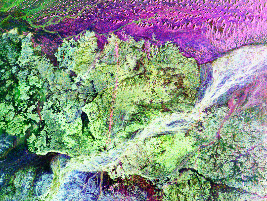
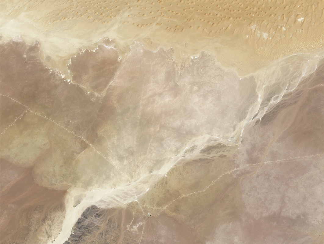
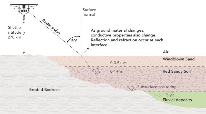
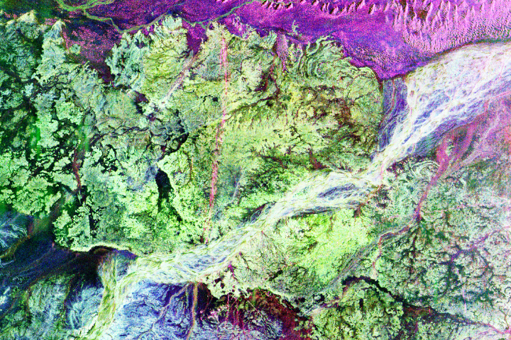
Secrets Beneath the Sand
Published August 29, 2017
Instruments such as imaging radar helped usher in a new era in archaeology.
Related images:
720 x 540
JPEG
1062 x 798
2 MB - JPEG
1062 x 798
902 KB - JPEG
720 x 400
56 KB - PNG
720 x 480
JPEG
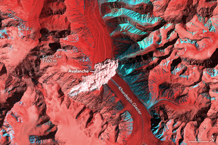
A Stroke of Luck
Published July 7, 2017
While investigating historical imagery of a surging glacier in the Karakoram, a scientist noticed a spectacular satellite image of an avalanche barreling into Khurdopin Glacier.
Related images:
4001 x 4001
5 MB - JPEG
4001 x 4001
41 MB - GeoTIFF

4001 x 4001
41 MB - GeoTIFF
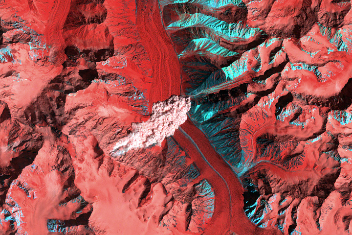
A Stroke of Luck
Published July 7, 2017
While investigating historical imagery of a surging glacier in the Karakoram, a scientist noticed a spectacular satellite image of an avalanche barreling into Khurdopin Glacier.
Related images:
720 x 480
JPEG
4001 x 4001
5 MB - JPEG
720 x 530
PNG
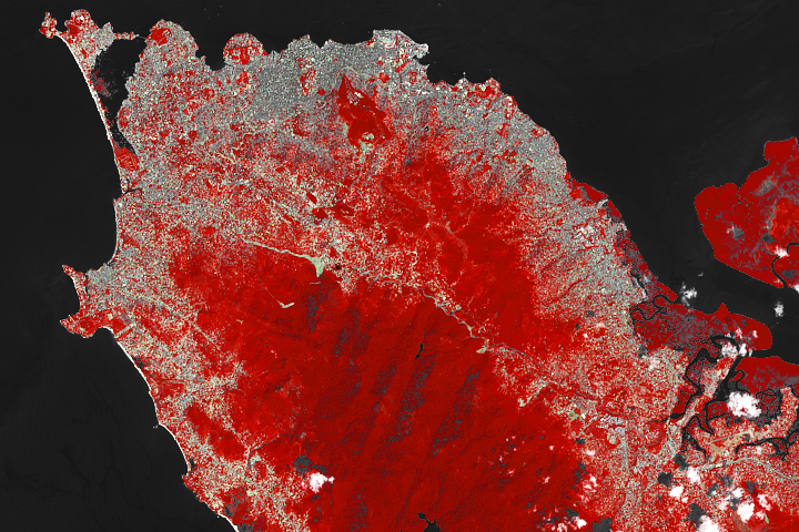
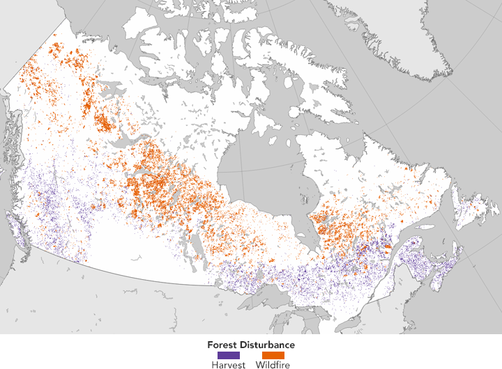
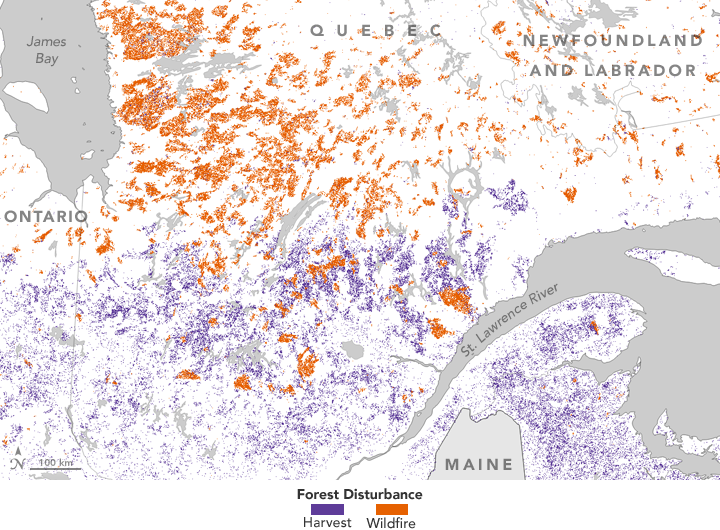
Tracking Forest Change in Canada
Published June 27, 2017
Researchers analyzed 25 years of Landsat data to establish where forests had burned or been cut.
Related images:
720 x 530
PNG
720 x 530
PNG
720 x 530
PNG
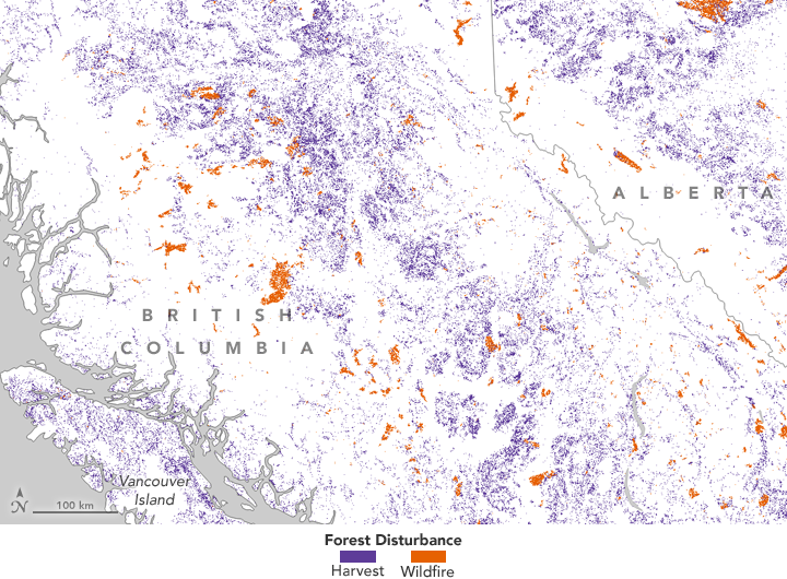
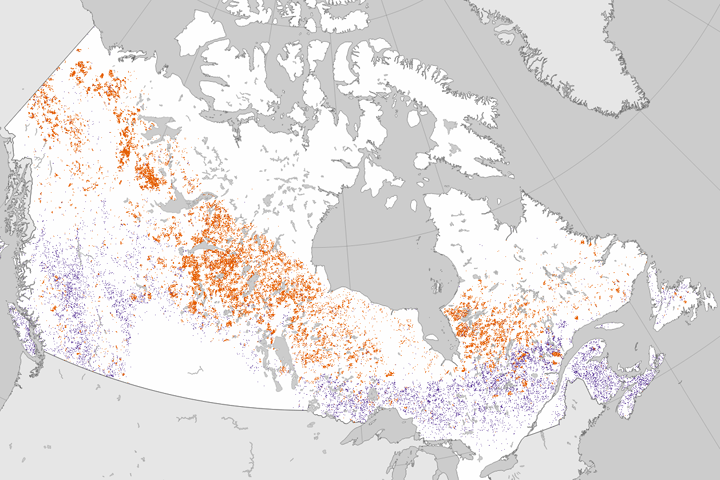
Tracking Forest Change in Canada
Published June 27, 2017
Researchers analyzed 25 years of Landsat data to establish where forests had burned or been cut.
Related images:
720 x 530
PNG
720 x 530
PNG