
2000 x 2000
11 MB - GeoTIFF
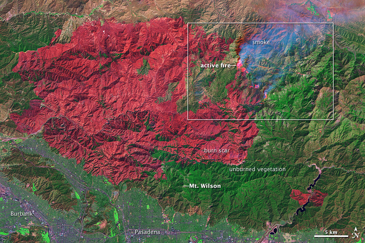
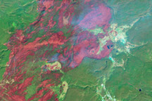
Fires in Los Angeles County
Published September 15, 2009
This false-color image illustrates the extent of the Station Fire in southern California.
Related images:
720 x 480
JPEG
2000 x 2000
5 MB - JPEG
720 x 480
JPEG
2000 x 2000
5 MB - JPEG
2000 x 2000
9 MB - GeoTIFF
122 KB - KML/KMZ
2000 x 2000
9 MB - GeoTIFF
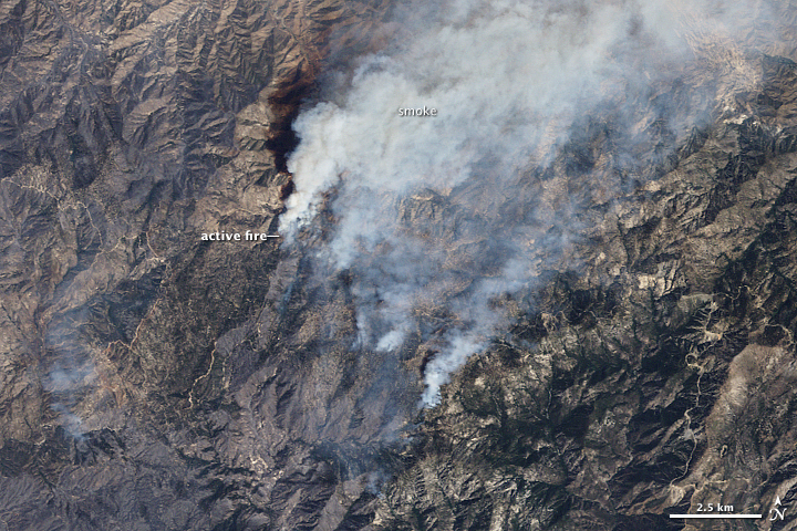
Fires in Los Angeles County
Published September 15, 2009
This false-color image illustrates the extent of the Station Fire in southern California.
Related images:
720 x 480
JPEG
2000 x 2000
5 MB - JPEG
2000 x 2000
11 MB - GeoTIFF
720 x 480
JPEG
2000 x 2000
5 MB - JPEG
122 KB - KML/KMZ

122 KB - KML/KMZ
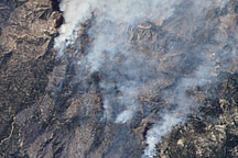
Fires in Los Angeles County
Published September 15, 2009
This false-color image illustrates the extent of the Station Fire in southern California.
Related images:
720 x 480
JPEG

2000 x 2000
5 MB - JPEG
2000 x 2000
11 MB - GeoTIFF
720 x 480
JPEG
2000 x 2000
5 MB - JPEG
2000 x 2000
9 MB - GeoTIFF
560 x 400
JPEG
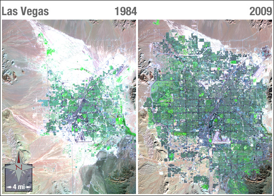
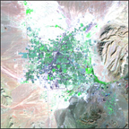
Las Vegas, NV 1984-2009
Published August 26, 2009
Landsat 5 images of Las Vegas in 1984 and 2009; the rapid pace of urbanization is clearly evident.
Related images:
2735 x 2735
14 MB - TIFF
560 x 560
JPEG
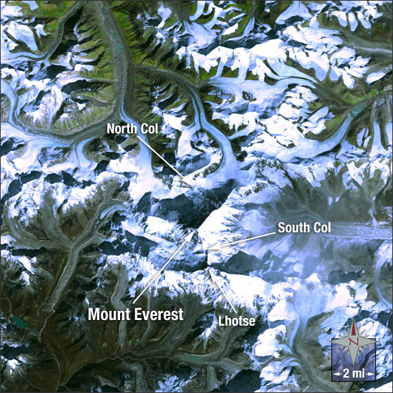
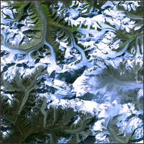
Mount Everest
Published August 10, 2009
This natural color Landsat 5 image was collected on June 11, 2005 using bands 3, 2 and 1.
Related images:
1807 x 1807
7 MB - TIFF

560 x 560
JPEG
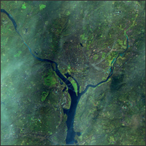
Inauguration Day 2009, Washington D.C.
Published August 5, 2009
Landsat 5 image of Washington D.C. taken on January 20, 2009 using bands 7,4, and 2.
Related images:
560 x 560
736 KB - TIFF
560 x 561
JPEG
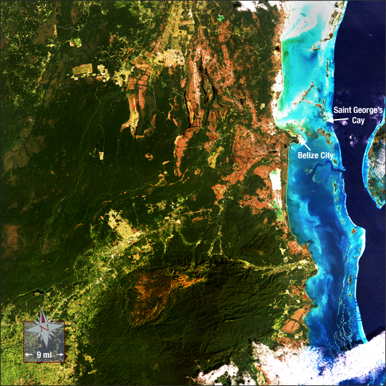
Belize
Published August 5, 2009
This image shows the north central coast of Belize. The Belize Barrier Reef, the second largest the world, can be seen where the dark blue water of the Caribbean turns to shallow light blue water. This image was acquired on Dec. 27, 1989; it was made using Landsat 5 bands 3,2,1.
Related images:
5951 x 6273
96 MB - TIFF

560 x 541
JPEG
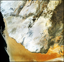
Namib-Naukluft National Park
Published August 4, 2009
This Landsat 5 image was taken on May 26, 1992 using Bands 3,2,1. Notice the dunes nearest the coast pointing in a northeasterly direction. This indicates coastal expansion.
Related images:
6067 x 5865
92 MB - TIFF

560 x 560
JPEG
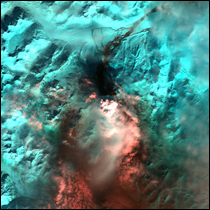
Mount Redoubt
Published August 4, 2009
Landsat 5 image of Mount Redoubt, Alaska during an eruption on March 26, 2009.
Related images:
4773 x 4773
32 MB - TIFF
560 x 560
JPEG
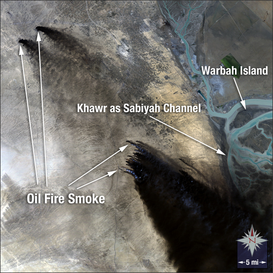
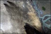
Kuwait Oil Fire
Published July 29, 2009
Landsat 5 image of the Kuwaiti oil fires on February 22, 1991.
Related images:
5623 x 5623
90 MB - TIFF
720 x 240
JPEG
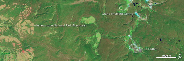
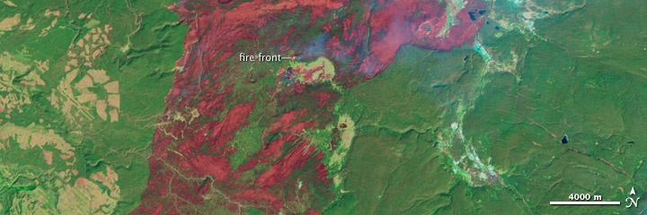
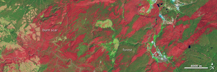
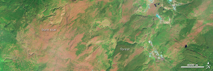
Yellowstone Recovers from 1988 Fires
Published July 1, 2009
In 1988, wildfires raced through Yellowstone National Park, consuming hundreds of thousands of acres. This series of Landsat images tracks the landscape’s slow recovery through 2008.
Related images:
3274 x 3274
5 MB - JPEG
3274 x 3274
26 MB - GeoTIFF
720 x 240
JPEG
3274 x 3274
5 MB - JPEG
3274 x 3274
28 MB - GeoTIFF
720 x 240
JPEG
3274 x 3274
5 MB - JPEG
3274 x 3274
26 MB - GeoTIFF
720 x 240
JPEG
3274 x 3274
5 MB - JPEG
3274 x 3274
24 MB - GeoTIFF
1 MB Bytes - KML/KMZ
720 x 240
JPEG
Yellowstone Recovers from 1988 Fires
Published July 1, 2009
In 1988, wildfires raced through Yellowstone National Park, consuming hundreds of thousands of acres. This series of Landsat images tracks the landscape’s slow recovery through 2008.
Related images:
720 x 240
JPEG
3274 x 3274
5 MB - JPEG
3274 x 3274
26 MB - GeoTIFF
3274 x 3274
5 MB - JPEG
3274 x 3274
28 MB - GeoTIFF
720 x 240
JPEG
3274 x 3274
5 MB - JPEG
3274 x 3274
26 MB - GeoTIFF
720 x 240
JPEG
3274 x 3274
5 MB - JPEG
3274 x 3274
24 MB - GeoTIFF
1 MB Bytes - KML/KMZ