NASA satellites and sensors constantly take the pulse of our planet, measuring how Earth changes by the day, season, year, and decade. Researchers and resource managers analyze those measurements and apply them on local and regional scales to better manage things like our food and water supplies, health, safety, land use, and ecosystems. NASA data is also used by other government agencies to help with responses to natural disasters and emergencies around the country and the world.
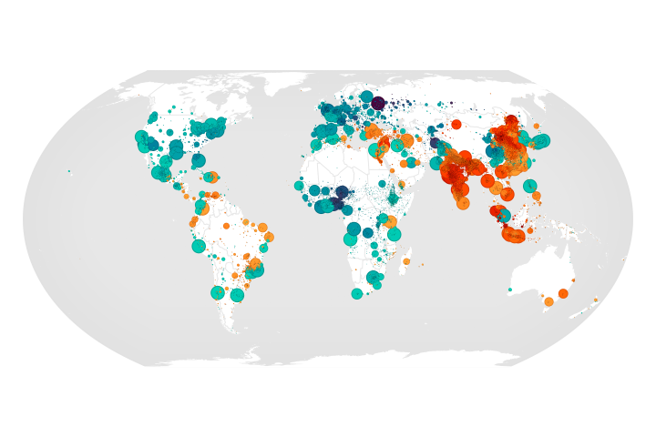
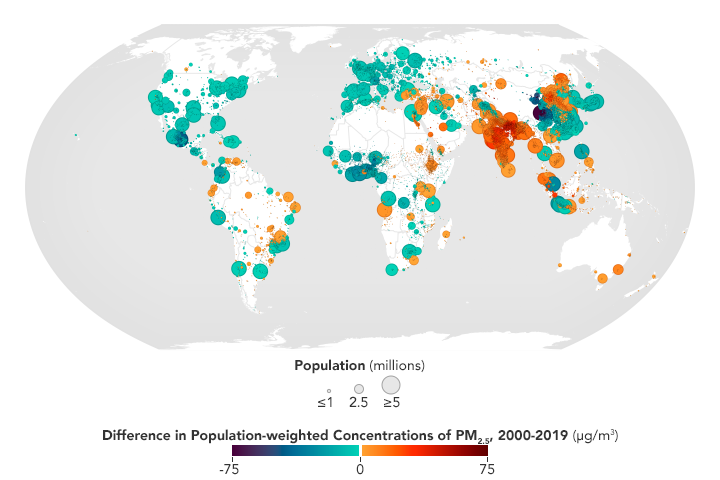
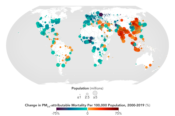
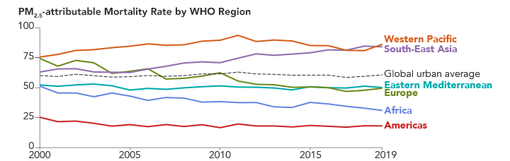
No Breathing Easy for City Dwellers: Particulates
Published March 15, 2022
A new satellite-derived dataset links concentrations of fine particulate matter in air pollution with health outcomes in cities around the world.
Related images:
720 x 480
PNG

7200 x 4800
6 MB - PNG
720 x 480
PNG
7200 x 4800
6 MB - PNG
720 x 228
PNG
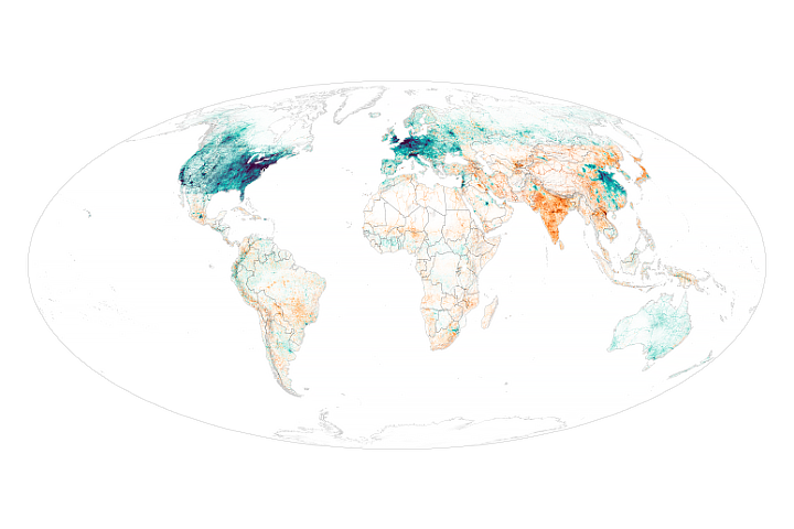
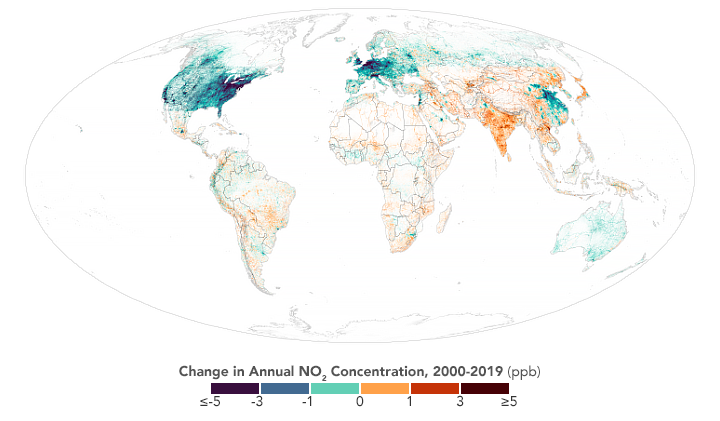
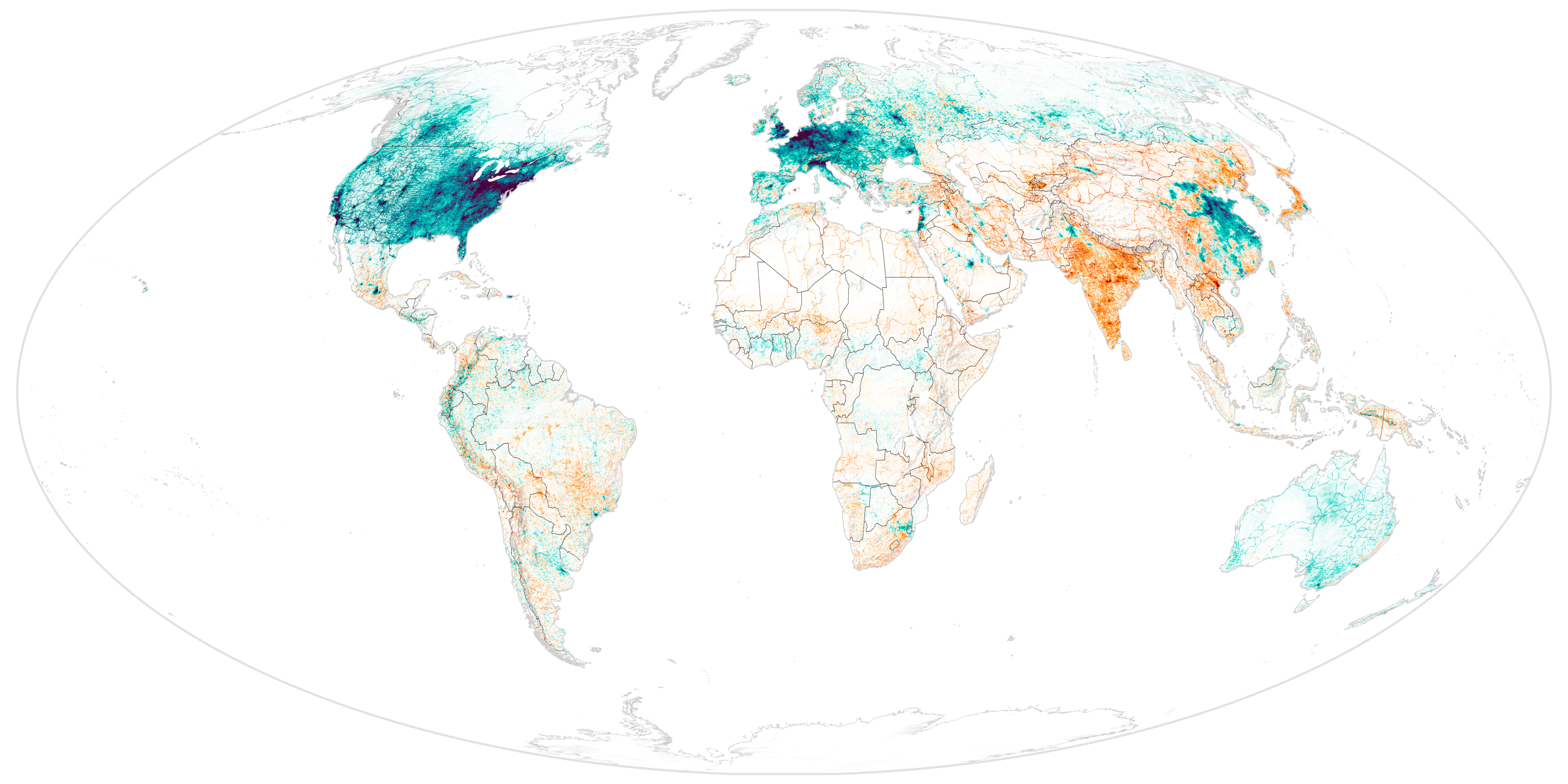
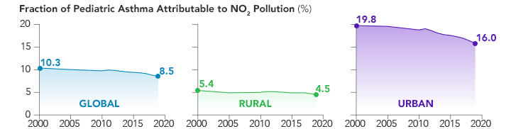
No Breathing Easy for City Dwellers: Nitrogen Dioxide
Published March 14, 2022
A new satellite-derived global dataset links concentrations of nitrogen dioxide with cases of pediatric asthma in urban areas around the world.
Related images:
720 x 421
PNG
7200 x 3600
2 MB - JPEG
720 x 182
PNG
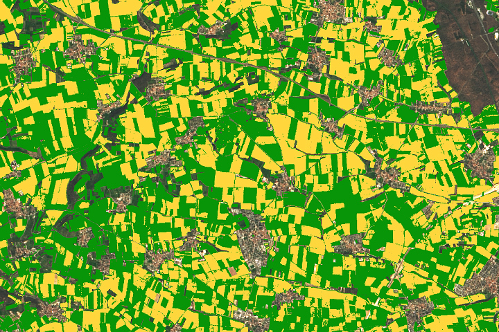
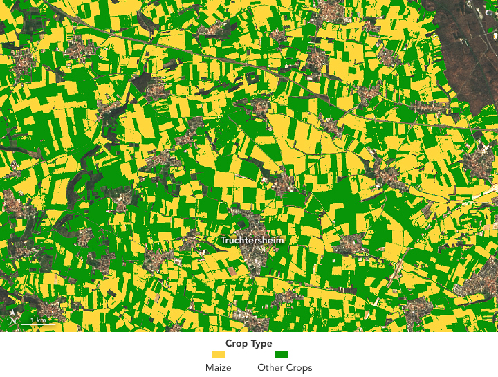
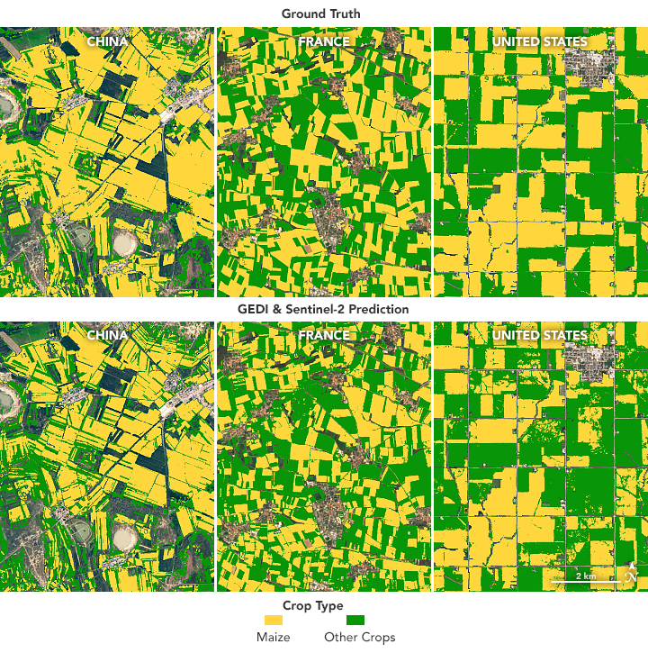
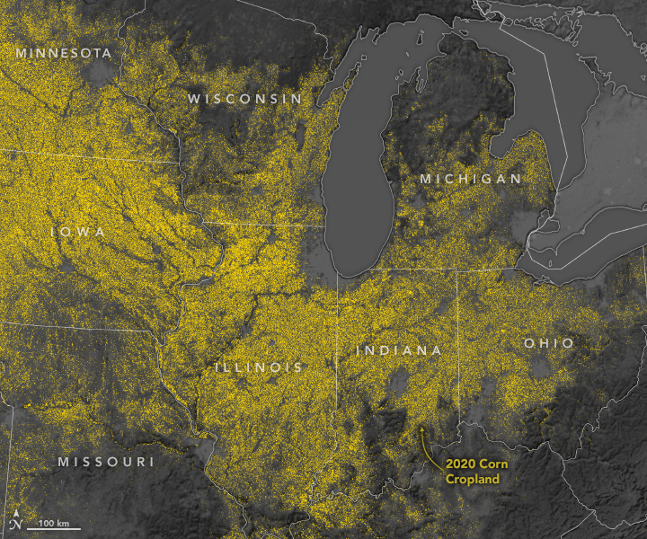
Lasering In on Corn Fields
Published March 7, 2022
An instrument designed to measure tree height can also distinguish corn from other crops.
Related images:

720 x 545
JPEG
2814 x 1765
4 MB - JPEG
720 x 545
JPEG
2814 x 1765
5 MB - JPEG
720 x 725
JPEG
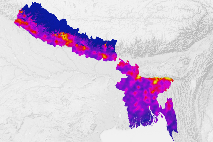
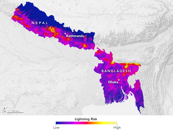
Assessing Lightning Risk in South Asia
Published February 11, 2022
With lightning killing hundreds of people in Bangladesh and Nepal each year, researchers think space-based observations could help reduce risks.
Related images:
720 x 545
JPEG

2481 x 1654
2 MB - JPEG
720 x 480
JPEG
5568 x 3712
5 MB - JPEG

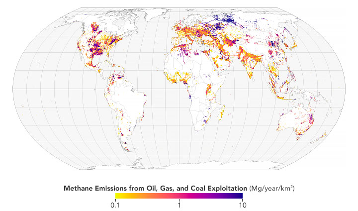
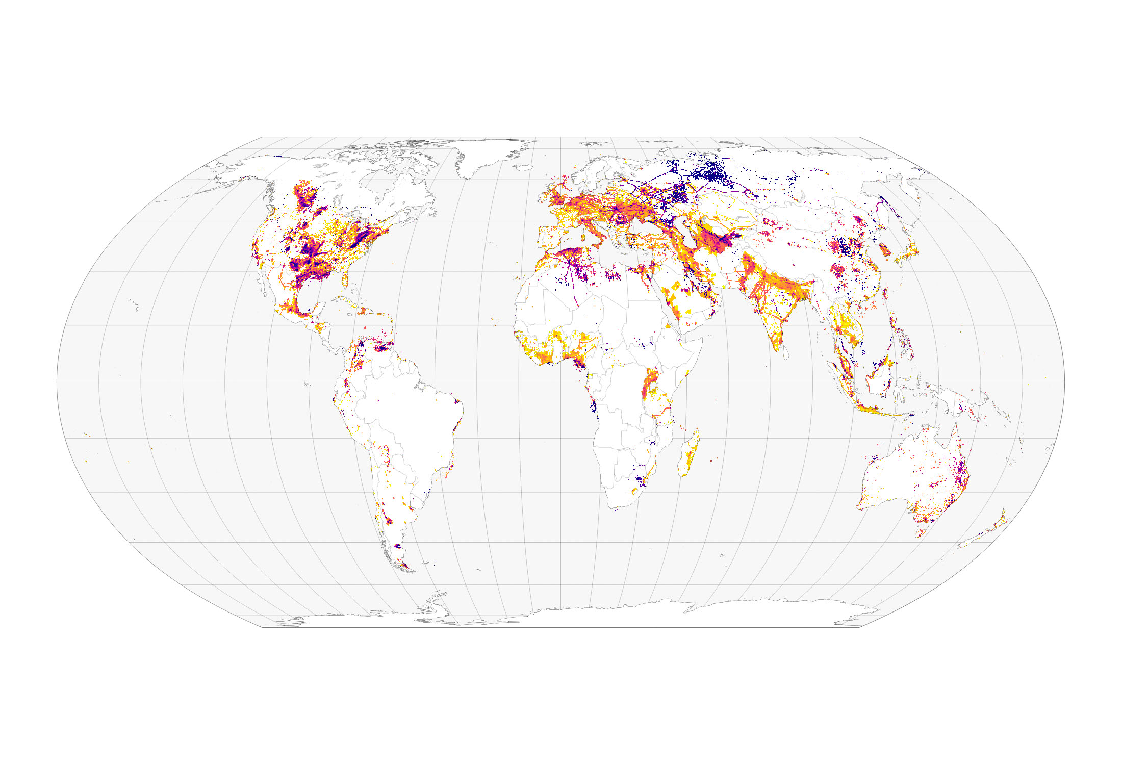
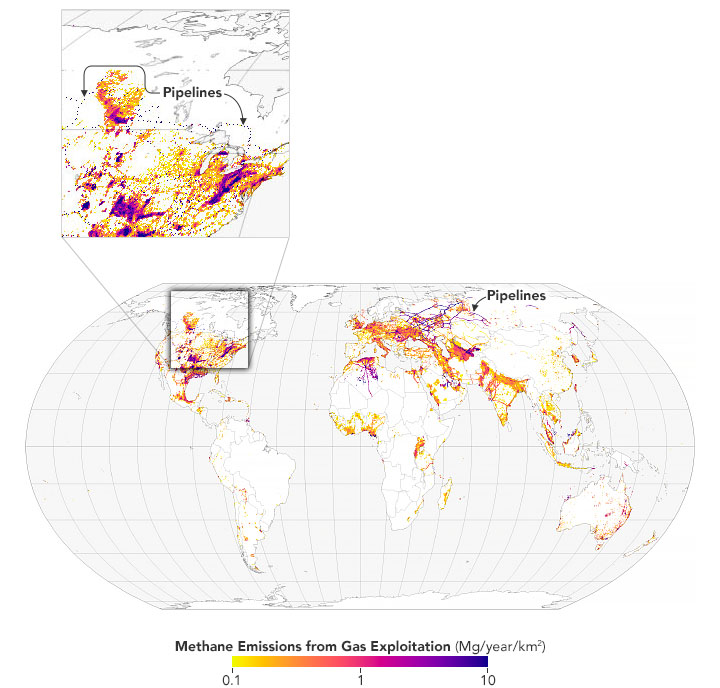
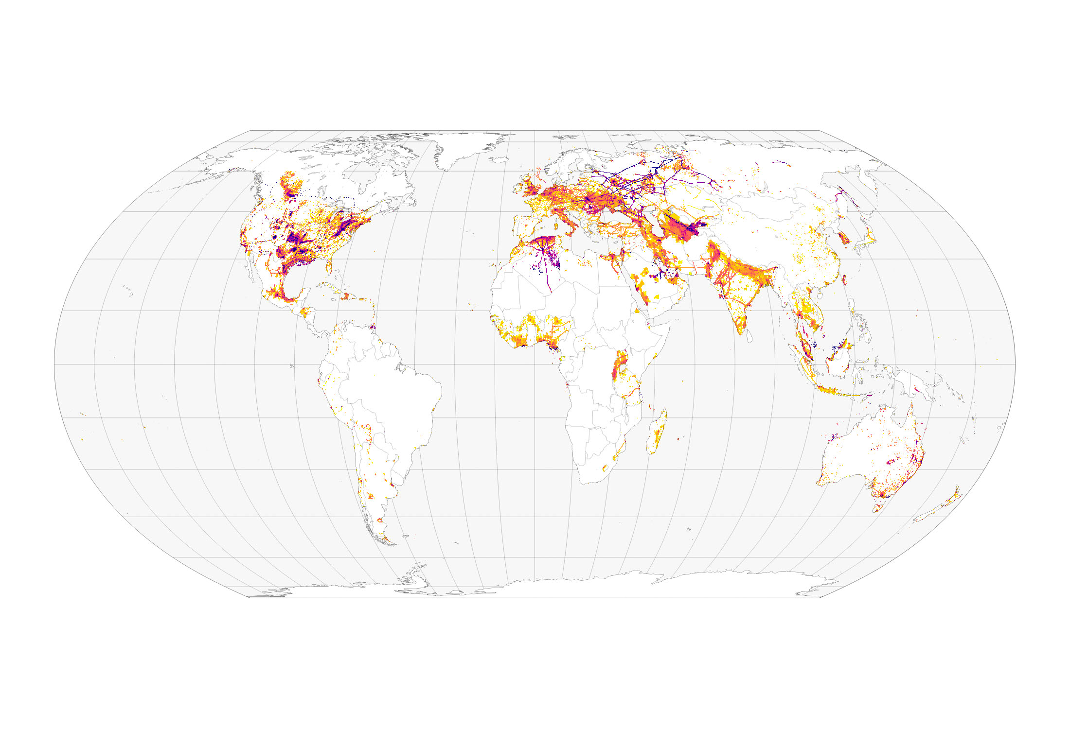
Mapping Methane Emissions from Fossil Fuel Exploitation
Published January 25, 2022
Scientists track the sources of 97 million metric tons of methane emissions.
Related images:
720 x 424
JPEG
2200 x 1500
444 KB - JPEG
720 x 688
JPEG
2200 x 1500
399 KB - JPEG
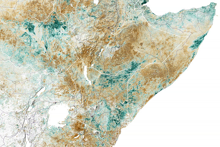
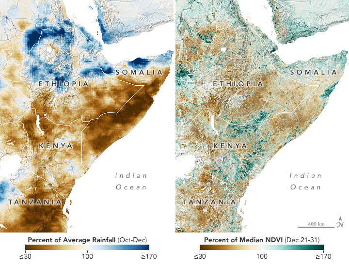
Failed Rainy Seasons Create Food Emergency in Eastern Africa
Published January 7, 2022
More than 20 million people in Somalia, Kenya, and Ethiopia now face some of the worst food security risks in 35 years.
Related images:
720 x 545
JPEG
8728 x 5819
11 MB - JPEG
720 x 745
JPEG
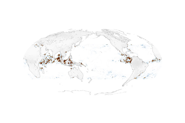
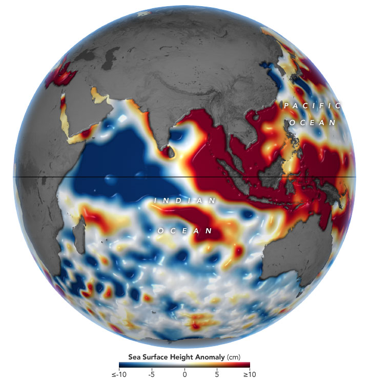
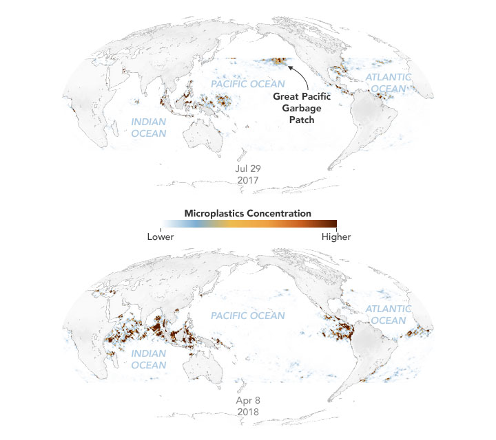
Mapping Marine Microplastics
Published December 3, 2021
Researchers used satellite data to detect and track masses of plastic floating in the ocean.
Related images:

MPEG
720 x 640
JPEG
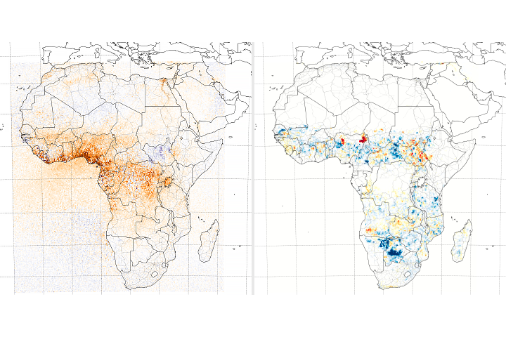
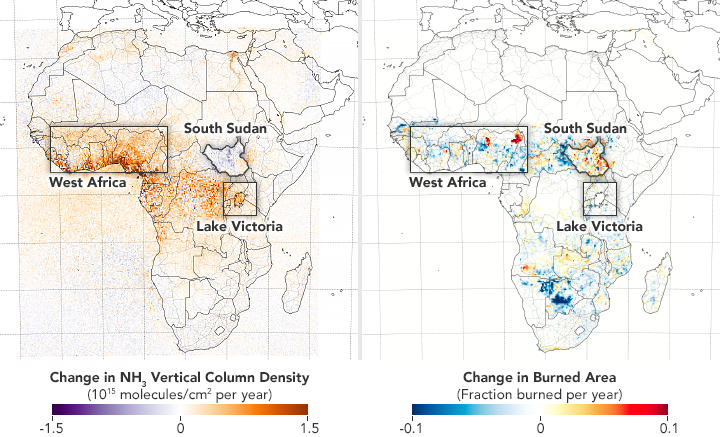
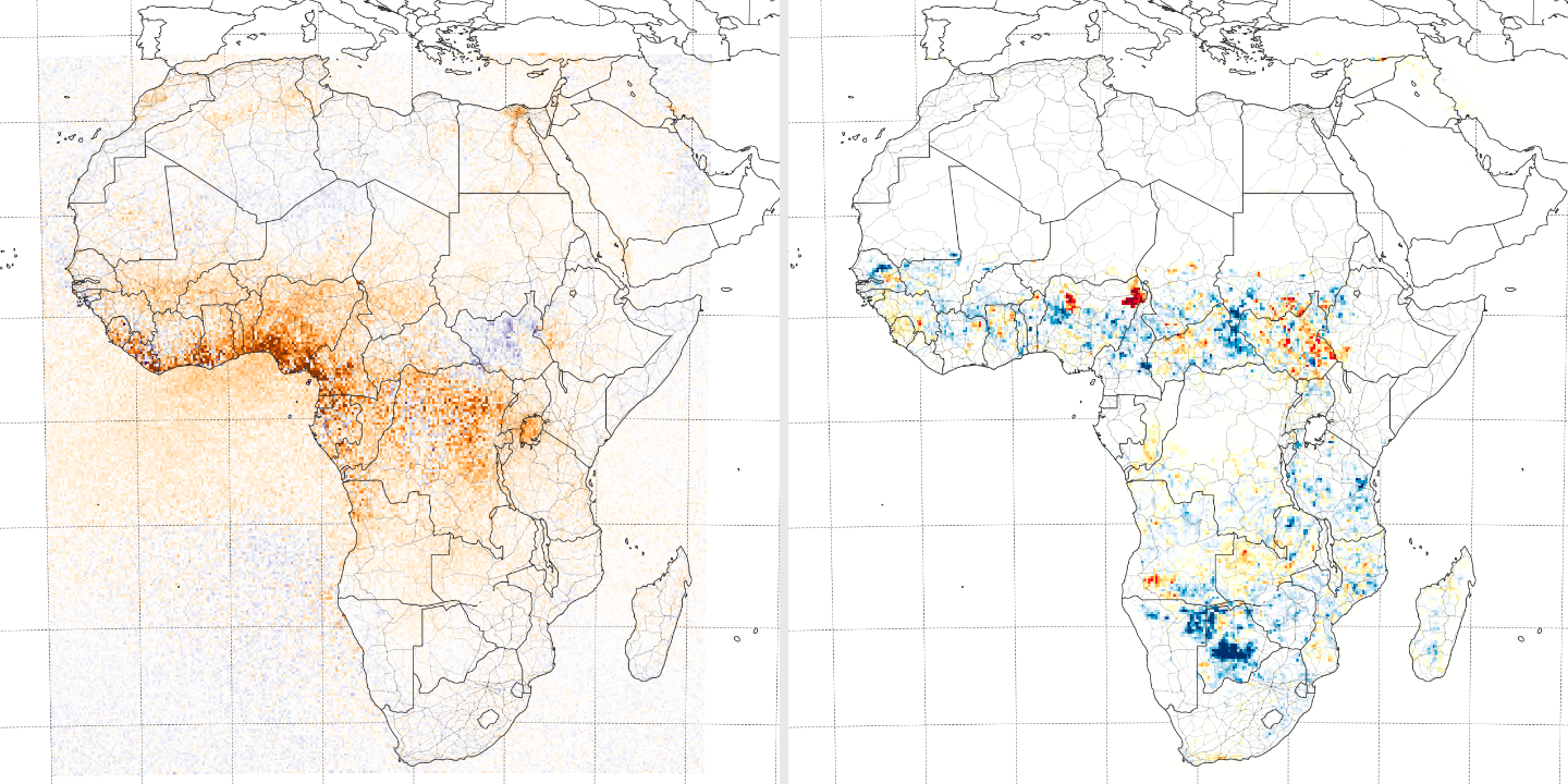
Study Traces Ammonia Pollution in Africa
Published November 17, 2021
Scientists used satellites to parse where and how agriculture is changing atmospheric concentrations of the chemical.
Related images:
720 x 437
PNG
1440 x 720
1 MB Bytes - PNG
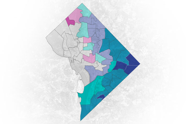
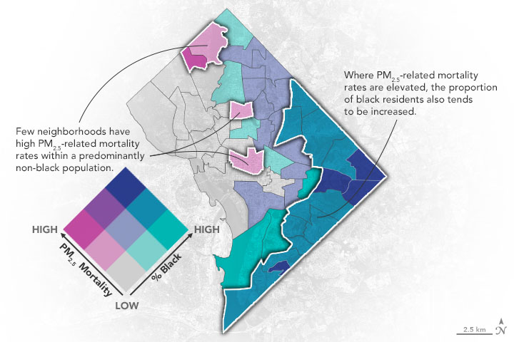
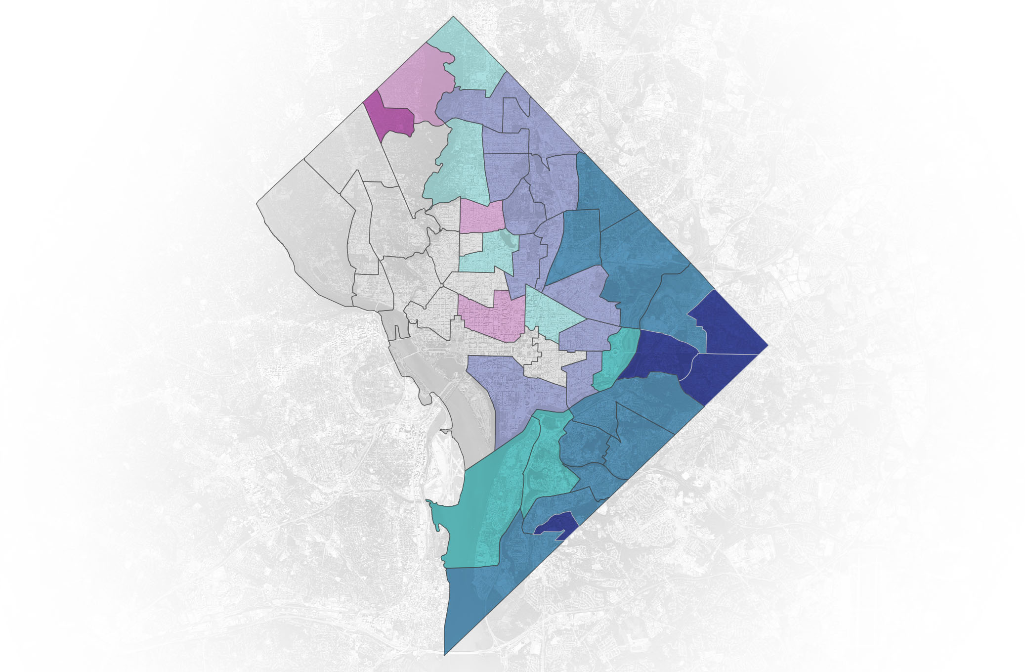
An Extra Air Pollution Burden
Published November 9, 2021
New research shows that neighborhoods in Washington, D.C., with more people of color are exposed to more air pollution and have higher rates of disease.
Related images:
720 x 480
JPEG
2074 x 1359
280 KB - JPEG
720 x 480
JPEG
4928 x 3280
11 MB - JPEG
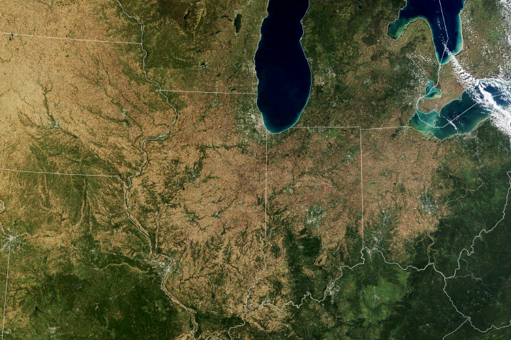
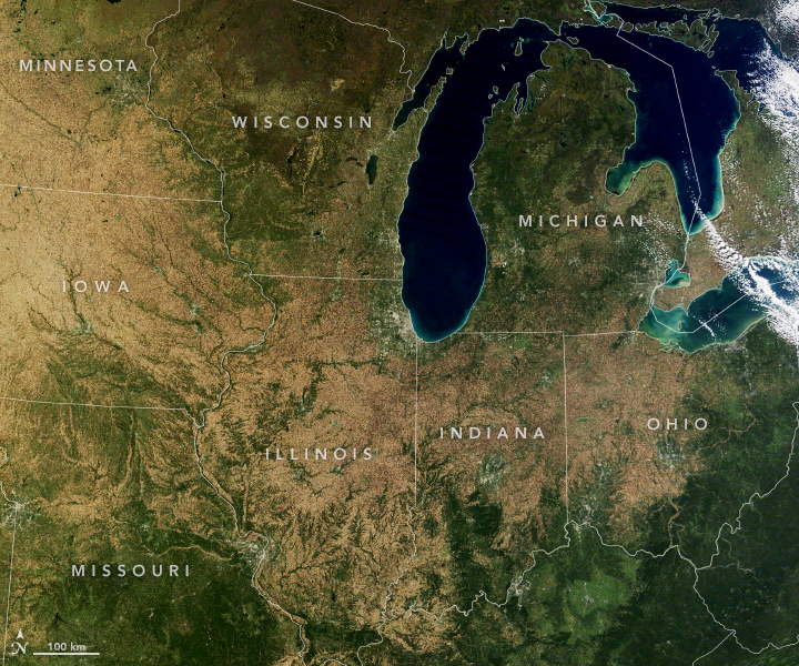
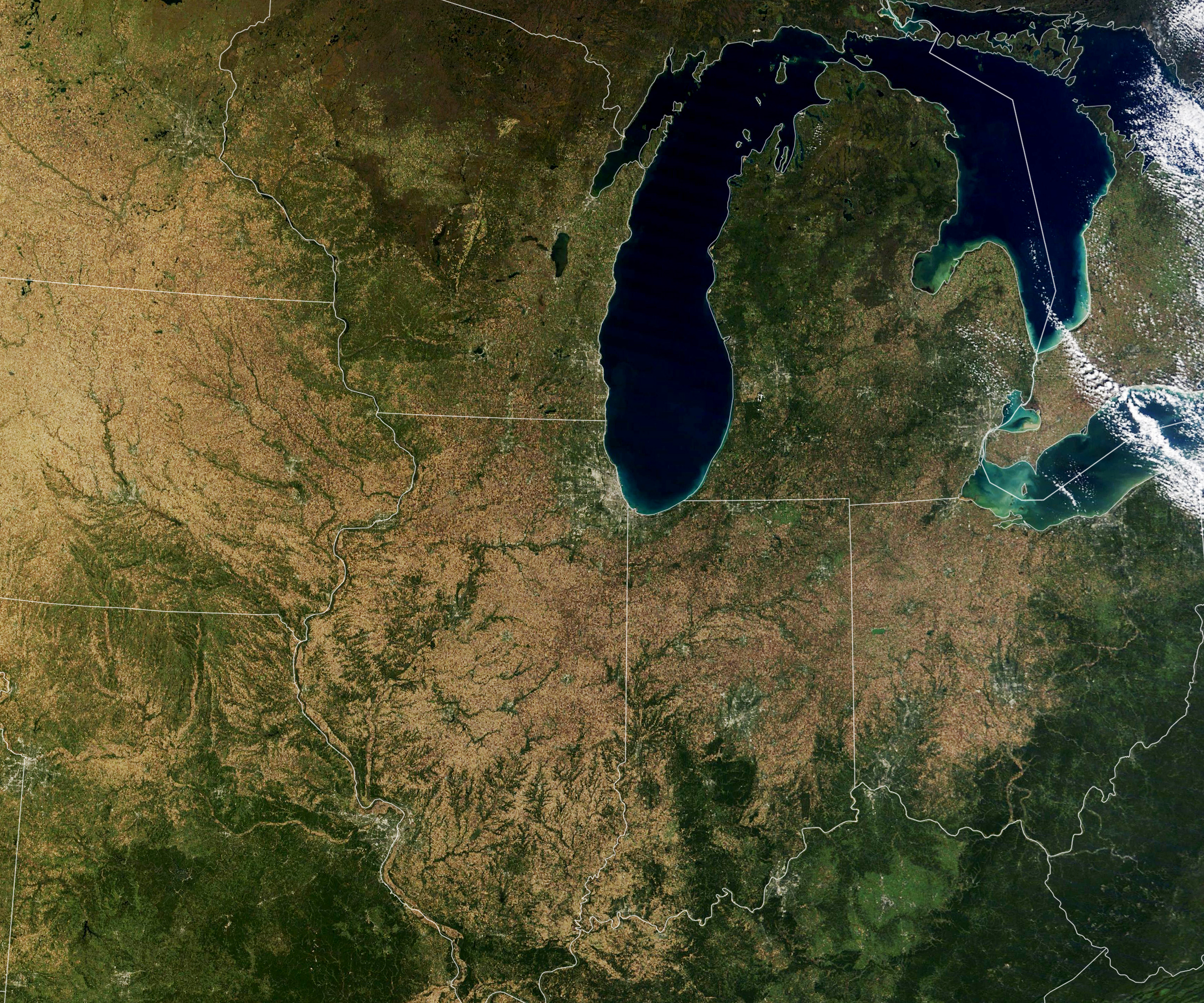
Falling For Corn
Published November 4, 2021
More than one third of the world’s maize (corn) crop is grown in the United States, and the largest share comes from a swath of land across the Midwest.
Related images:
720 x 600
JPEG
2432 x 2027
4 MB - JPEG
720 x 600
JPEG
2432 x 2027
7 MB - JPEG
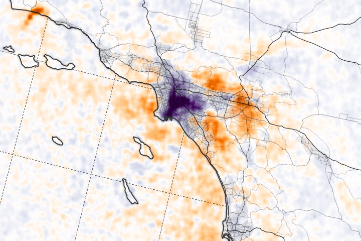
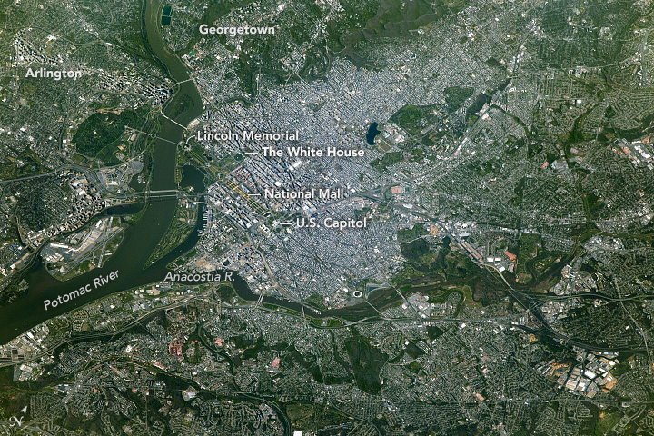
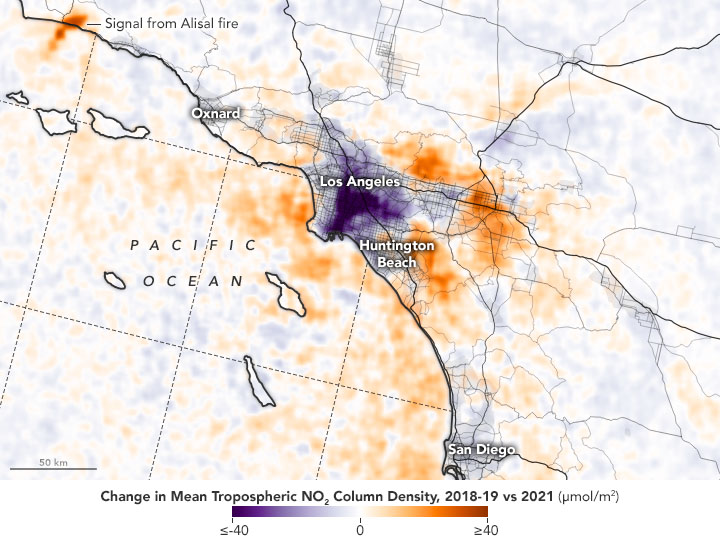
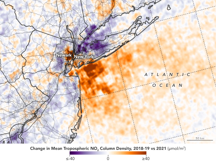
Scientific Questions Arrive in Ports
Published October 27, 2021
Satellite observations of nitrogen dioxide near key U.S. ports suggest that increased shipping activity and backlogs may be affecting air quality.
Related images:
720 x 545
JPEG
9425 x 5685
9 MB - JPEG
720 x 545
JPEG
720 x 480
JPEG
9365 x 9399
17 MB - JPEG
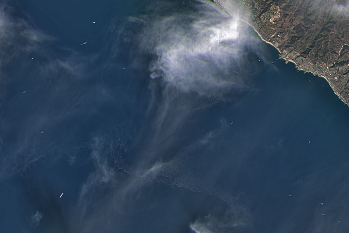
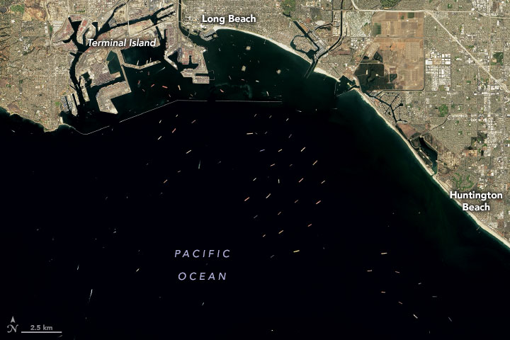
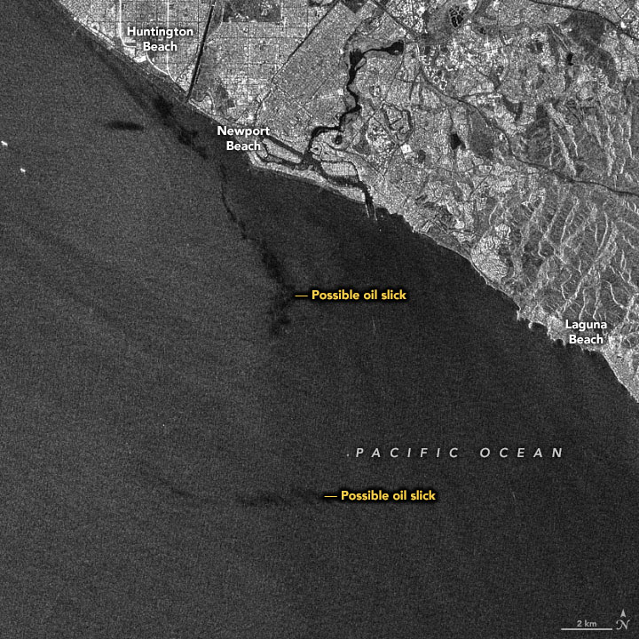
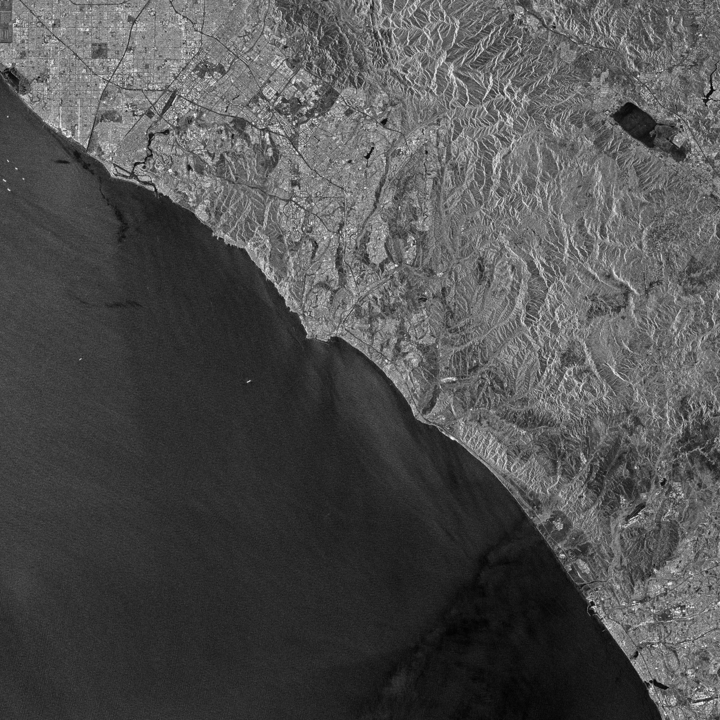
Satellites View California Oil Spill
Published October 8, 2021
Satellite imagers can make oil spills easier to detect in open water.
Related images:

720 x 720
JPEG

2451 x 2451
1 MB Bytes - JPEG
720 x 720
JPEG
2451 x 2451
2 MB - JPEG