
Pacific Typhoons
Published August 9, 2006
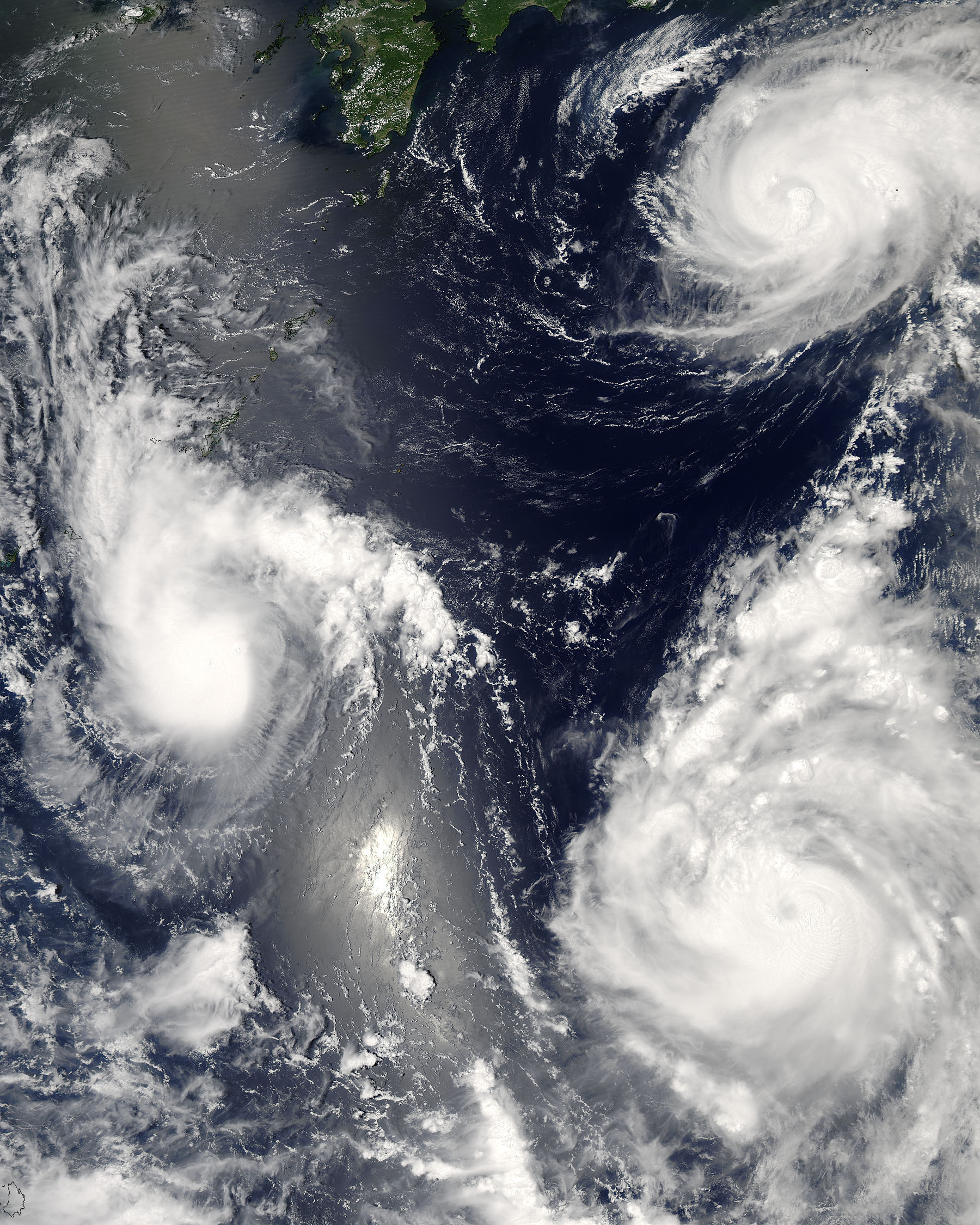
Three different typhoons were spinning over the western Pacific Ocean on August 7, 2006, when the Moderate Resolution Imaging Spectroradiometer (MODIS) on NASA’s Aqua satellite acquired this image. The strongest of the three, Typhoon Saomai, formed in the western...
Related images:

337 x 421
129 KB - JPEG
1800 x 2250
971 KB - JPEG

3600 x 4500
3 MB - JPEG

7200 x 9000
8 MB - JPEG
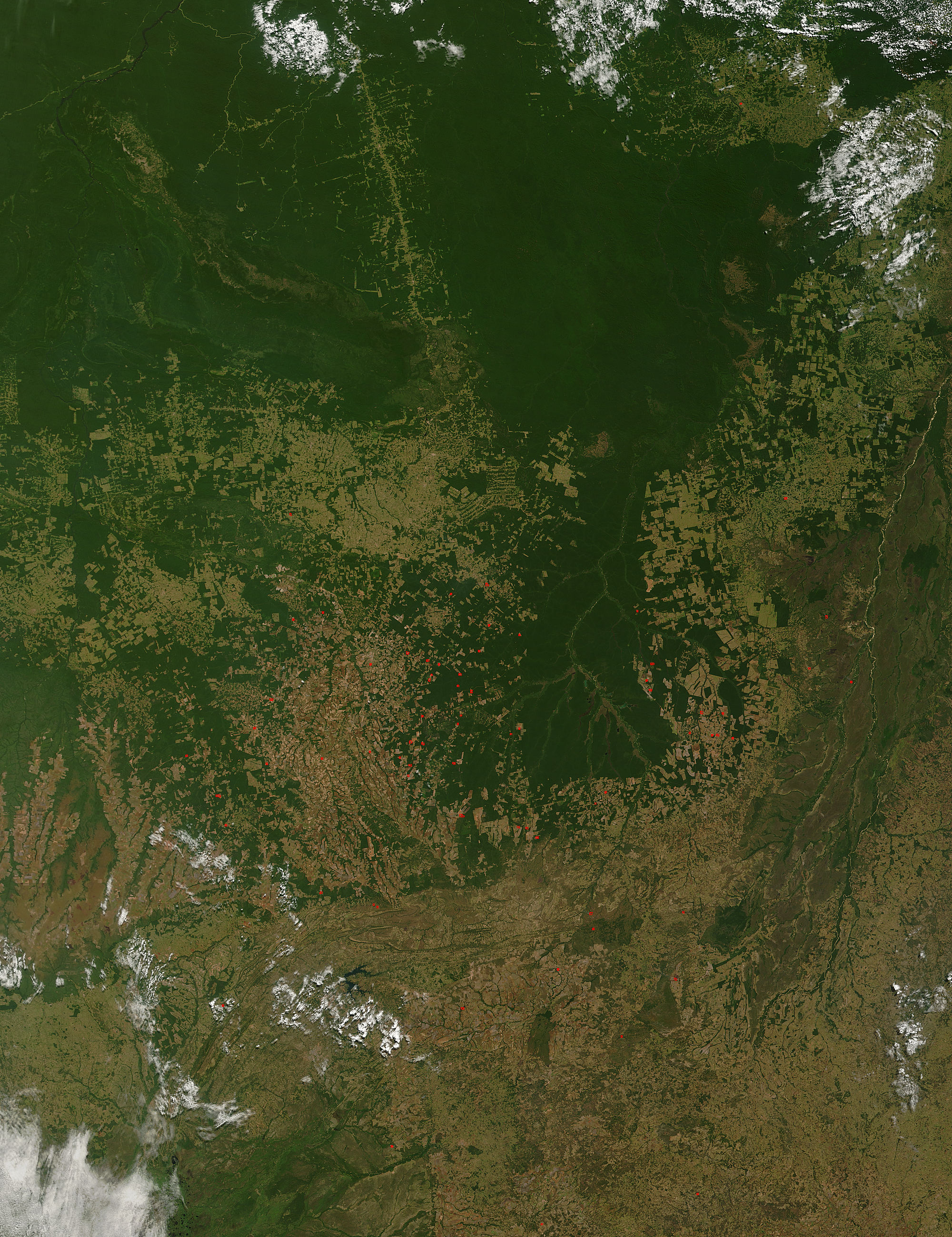
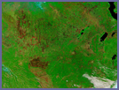
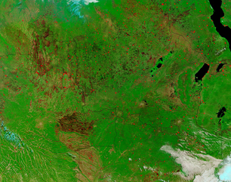
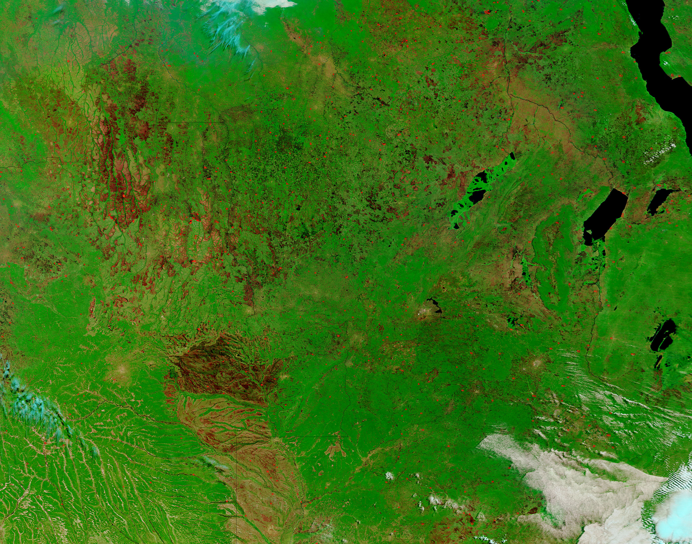
Deforestation in Mato Grasso, Brazil
Published August 8, 2006
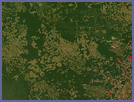
In the Brazilian state of Mato Grosso, verdant green Amazon Rainforest is broken up by broad tracks of pale green and tan deforested land. In 2005, the government of Brazil said that 48 percent of Amazon...
Related images:
337 x 420
191 KB - JPEG
1000 x 1300
439 KB - JPEG
2000 x 2600
2 MB - JPEG
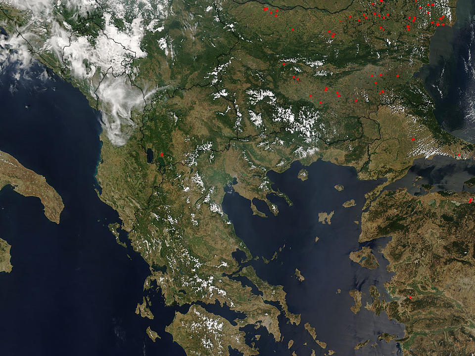
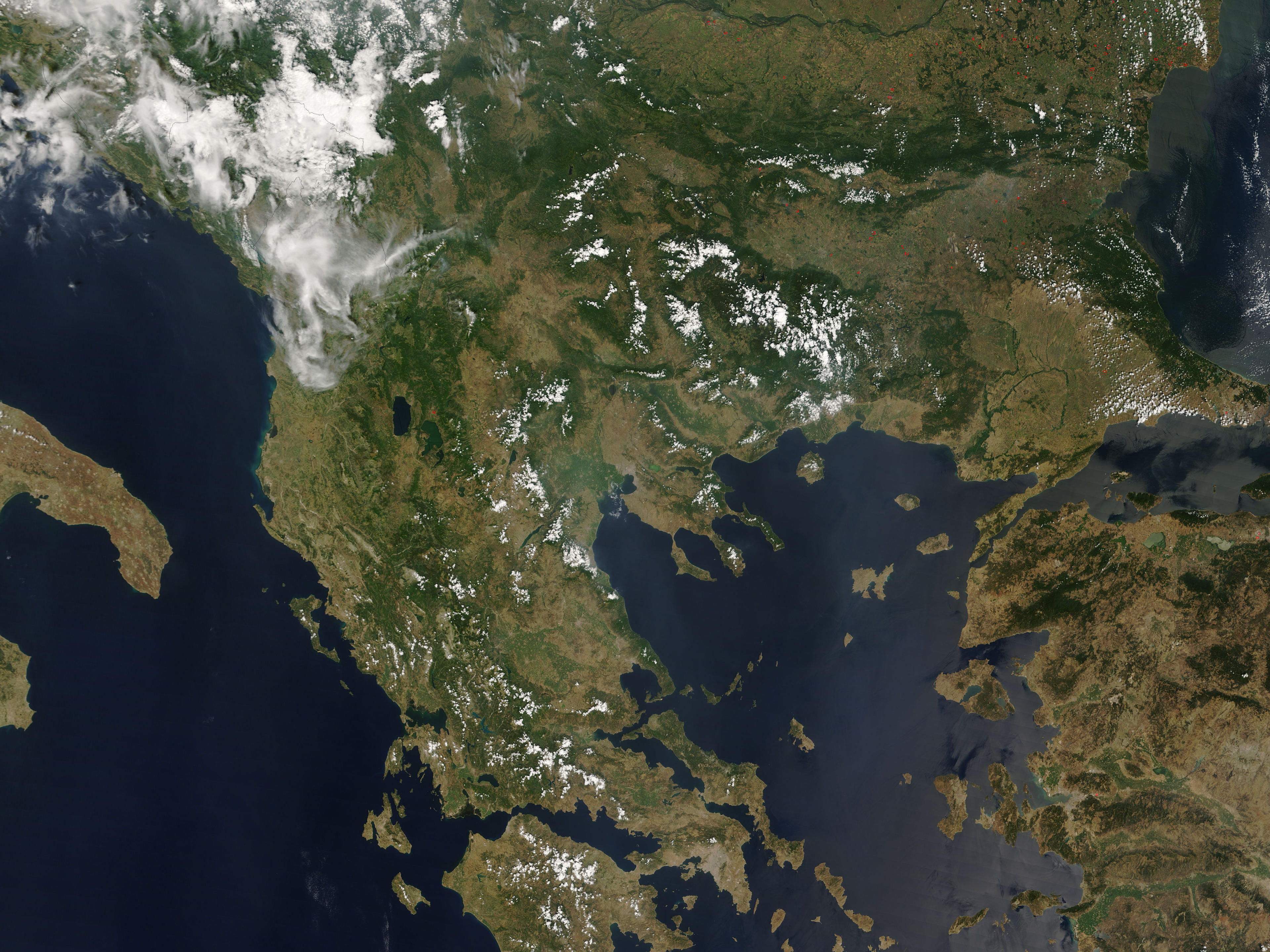
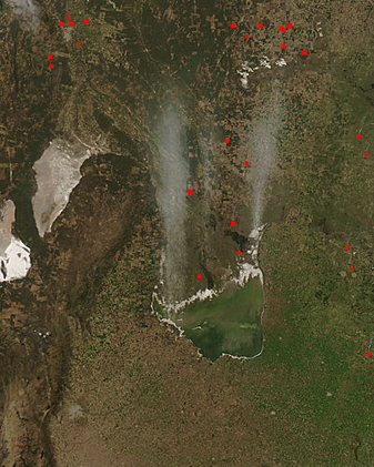
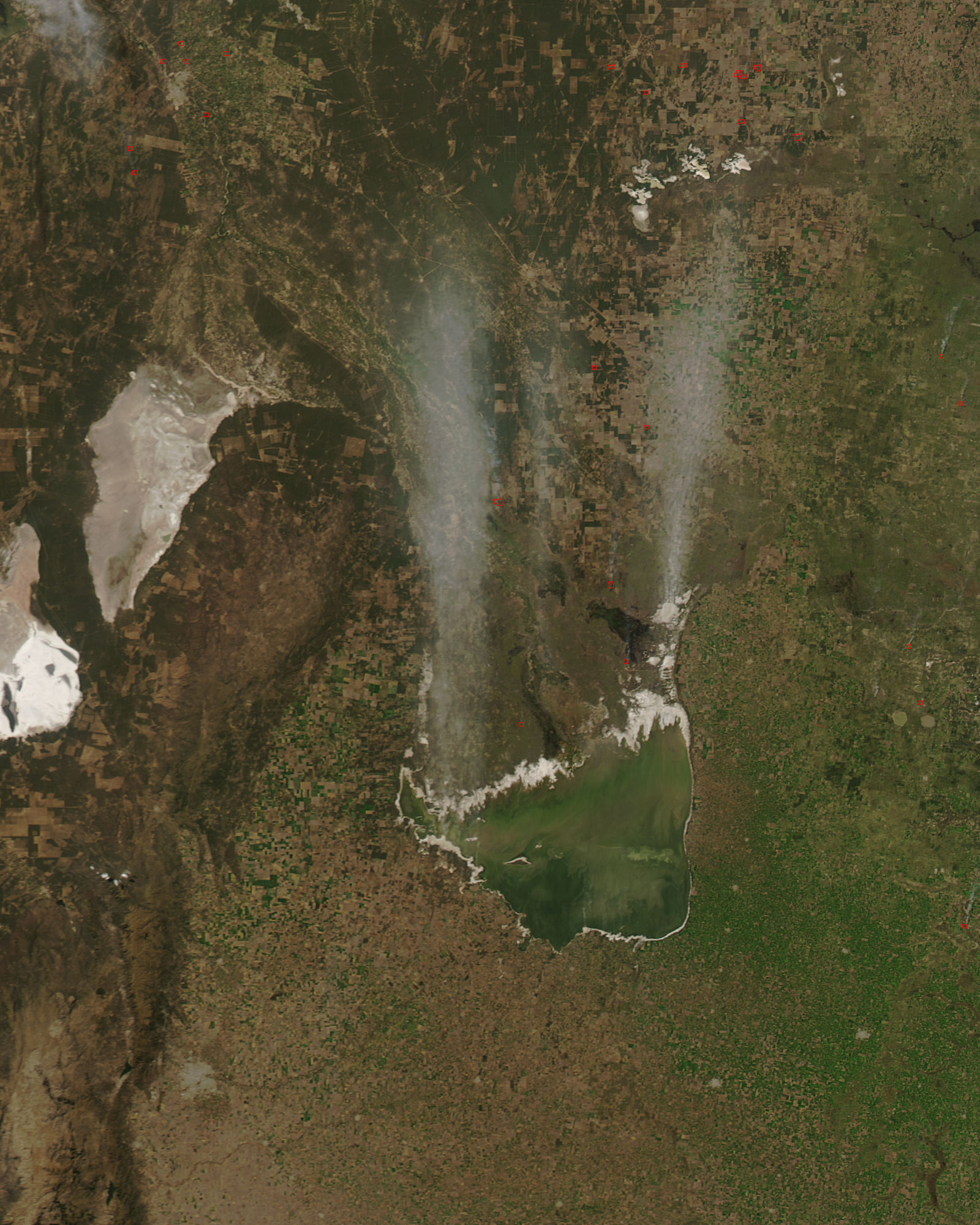
Greece
Published August 7, 2006
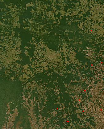
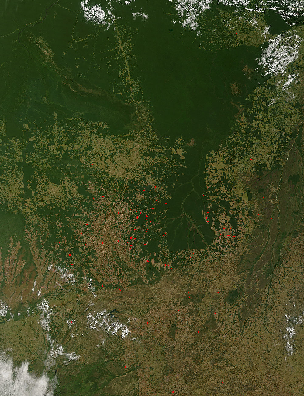
This MODIS Terra image, acquired August 2, 2006, shows most of Greece, with its jagged coastline, and many islands and peninsulas. Also shown are the countries surrounding Greece to the north - from left to right they are Albania, Macedonia, Bulgaria, and Turkey. The red dots on...
Related images:

337 x 253
100 KB Bytes - JPEG
960 x 720
191 KB - JPEG

1920 x 1440
677 KB - JPEG
3840 x 2880
2 MB - JPEG
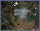
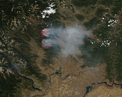
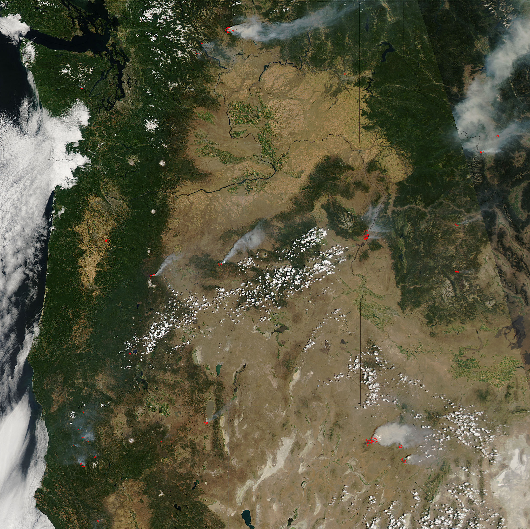
Fires in Northern Washington
Published August 6, 2006
In the Okanogan-Wenatchee National Forest in northern Washington, a complex of two large fires that started in July continued to burn on August 2, 2006. The Tripod Complex Fire was burning in beetle-killed lodgepole pine forests and had grown to more than 40,000 acres...
Related images:

337 x 268
98 KB - JPEG
390 x 310
102 KB Bytes - JPEG

780 x 620
235 KB - JPEG

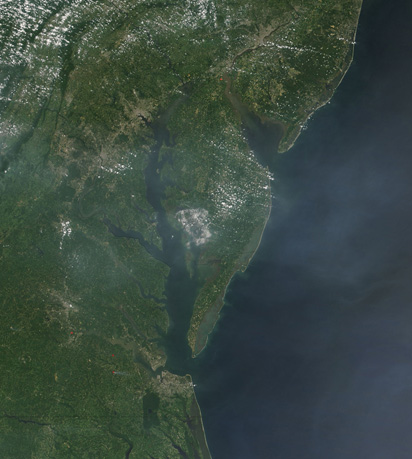
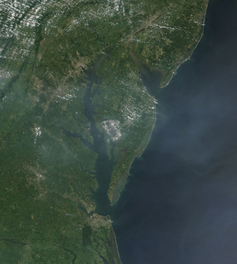
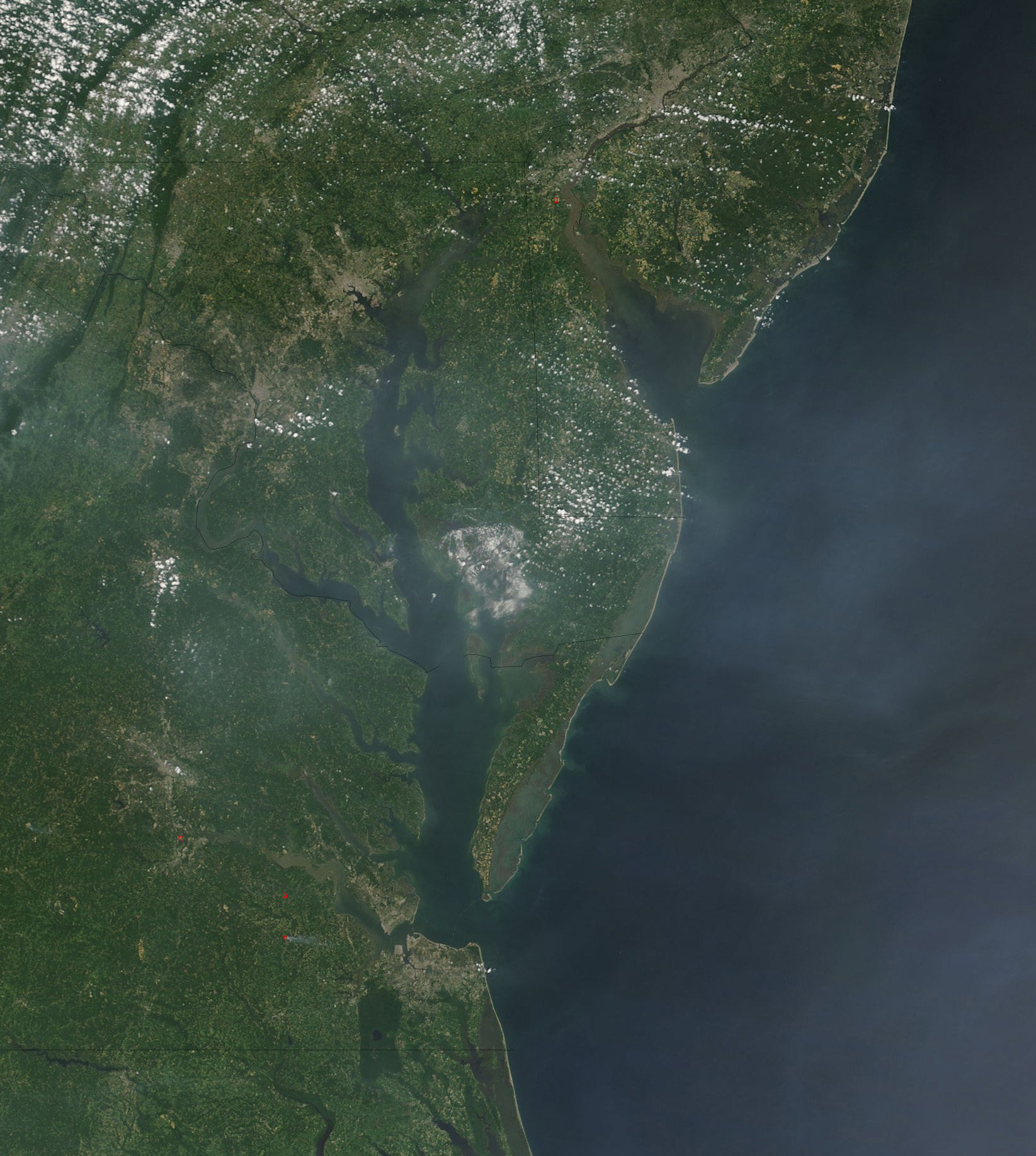
Haze over the Eastern United States
Published August 5, 2006
The MODIS on NASA’s Terra satellite captured this image on the morning of August 2, 2006, as temperatures were beginning to climb, on the east coast of the US. At the time, a high heat advisory was in effect for the region. In addition to trapping particulate pollution...
Related images:
412 x 459
99 KB - JPEG
337 x 375
99 KB - JPEG

823 x 918
292 KB - JPEG
1645 x 1836
753 KB - JPEG
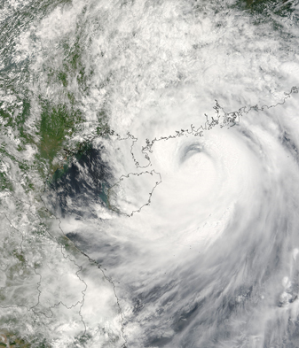
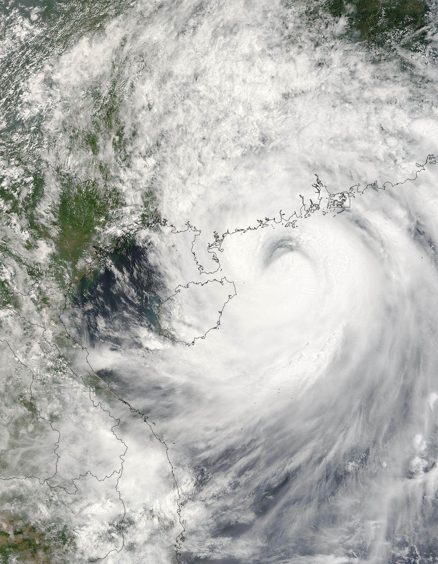
Typhoon Prapiroon over China
Published August 4, 2006
Typhoon Prapiroon formed in the eastern Pacific on July 31 2006, off the coast of Luzon, the northernmost of the Philippine Islands. The tropical depression strengthened to storm status in the next day after crossing Luzon, and reached typhoon status by early August 2...
Related images:
337 x 393
108 KB - JPEG
1400 x 1800
559 KB - JPEG

2800 x 3600
2 MB - JPEG
5600 x 7200
4 MB - JPEG
Burn Scars in Central Africa
Published August 3, 2006
South of the Sahara Desert, agricultural burning dominates the savanna landscape in Africa in the dry season. Vast areas of the continent burn every year as people set fire to range and crop lands to clear or renew them...
Related images:
337 x 265
144 KB - JPEG

1400 x 1100
770 KB - JPEG
2800 x 2200
3 MB - JPEG
5600 x 4400
6 MB - JPEG
Dust storm near Laguna Mar Chiquita, Argentina
Published August 2, 2006
Mar Chiquita is a huge permanent lagoon of salt water, located in the Argentine provinces of Cordoba and Santiago del Estero. It is about 100 km long and 40 km wide, and up to 4 m deep. The lake level shows great variations by year, with its surface area and salinity changing
Related images:

400 x 500
67 KB - JPEG
337 x 421
158 KB - JPEG

800 x 1000
248 KB - JPEG
1600 x 2000
639 KB - JPEG
Fires in the Western United States
Published August 1, 2006
The western United States was wilting under widespread hot temperatures in late July 2006. In blazing heat, firefighters were working to contain numerous wildfires in several Western states, including Washington, Oregon...
Related images:

337 x 336
130 KB - JPEG

1020 x 1018
599 KB - JPEG
2040 x 2036
2 MB - JPEG
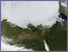
The Beaufort Sea
Published July 31, 2006
This MODIS Terra image, captured July 25, 2006, shows the Beaufort Sea, a large body of water which is actually part of the Arctic Ocean. Located north of the Northwest Territories, the Yukon, and Alaska and west of Canada's Arctic islands, its northwestern boundary is defined by a line connecting Point Barrow, Alaska...
Related images:

337 x 253
21 KB - JPEG
1400 x 1050
377 KB - JPEG

2800 x 2100
1 MB Bytes - JPEG
5600 x 4200
4 MB - JPEG
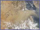
Dust Storm over the Red Sea
Published July 30, 2006
This MODIS Terra image, acquired July 25, 2006, shows a dust storm blowing off the coast of Sudan (left), out over the Red Sea. The Red Sea separates the African countries like Egypt, Sudan, and Ethiopia from...
Related images:

337 x 279
23 KB - JPEG
1100 x 912
269 KB - JPEG

2200 x 1824
636 KB - JPEG

4400 x 3648
2 MB - JPEG
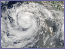
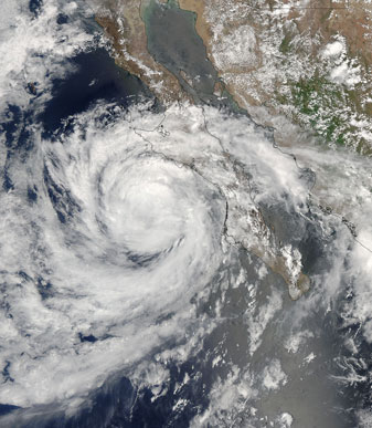
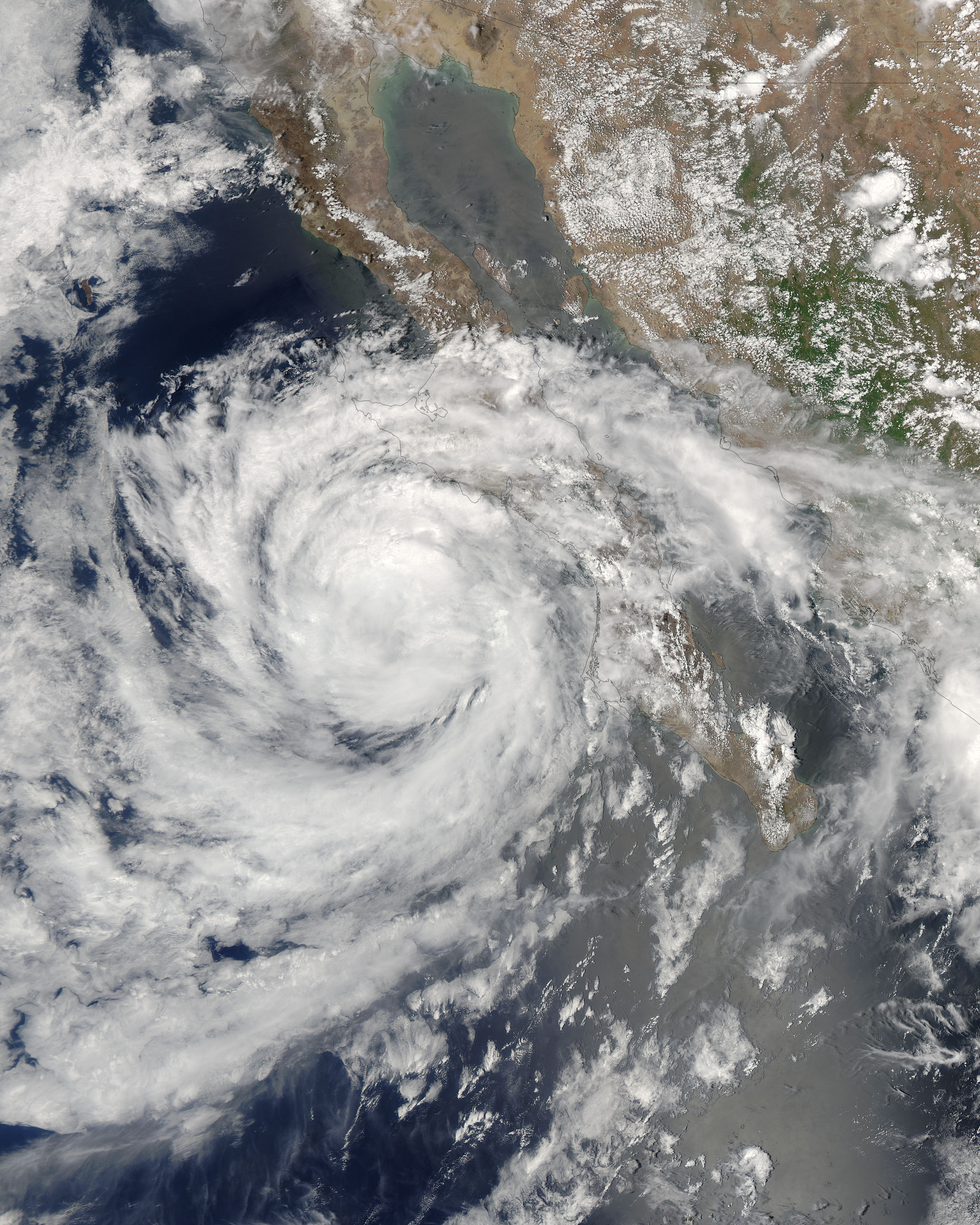
Tropical Storm Emilia off Baja California
Published July 29, 2006
Tropical Storm Emilia skirted the coast of Baja California as it moved northwest into the Pacific Ocean on July 26, 2006. When the MODIS on NASA’s Aqua satellite captured this image at 1:35 p.m. Pacific Daylight Time, the storm had sustained winds of...
Related images:
337 x 387
43 KB - JPEG

1200 x 1500
490 KB - JPEG
2400 x 3000
2 MB - JPEG
4800 x 6000
4 MB - JPEG