
That’s a key question for many farmers, and new research may make it easier to develop growing season plans.

The fast-growing blaze charred more than 100,000 acres in the span of a week.

Forests play a key role in filtering the waters of a reservoir in central Massachusetts that’s home to submerged towns and nesting eagles.
Published Aug 11, 2025
A long-exposure photo taken from low Earth orbit captured the brilliant illumination coming from airglow, lightning, and stars.
Published Aug 10, 2025
Arctic waters near Norway’s Bear Island teemed with tiny plant-like organisms that painted the seas turquoise-blue and green.
Published Aug 9, 2025
The Aude fire rapidly burned around 16,000 hectares in August 2025, becoming the country’s largest fire since 1949.
Published Aug 7, 2025
A short-lived storm dropped some of the largest accumulations in decades on Australia’s Northern Tablelands.
Published Aug 6, 2025Image of the Day Severe Storms Snow and Ice Temperature Extremes

Fires burning in boreal forests created hazy skies across North America in summer 2025.
Published Aug 5, 2025
Skies turned orange across the city of Ica as winds, locally known as Paracas winds, lofted dust from the coastal desert region.
Published Aug 4, 2025
The outlet of Berg Lake, dammed by the Steller Glacier in Alaska, has been reconfigured after decades of ice retreat.
Published Aug 4, 2025
These maps show the average amount of water vapor in a column of atmosphere by month. Water vapor is the key precursor for rain and snow and one of the most important greenhouse gases in the atmosphere.

Snow and ice influence climate by reflecting sunlight back into space. When it melts, snow is a source of water for drinking and vegetation; too much snowmelt can lead to floods. These maps show average snow cover by month.

The lake in northwestern Utah displays striking red and green waters that contrast with the region’s surrounding desert, salt flats, and mountainous terrain.
Published Aug 3, 2025
Net radiation is the balance between incoming and outgoing energy at the top of the atmosphere. It is the total energy available to influence climate after light and heat are reflected, absorbed, or emitted by clouds and land.

Iceberg A-23A continued to lose sizable pieces of ice during the 2025 austral winter, but it remained the planet’s largest freely floating berg.
Published Aug 2, 2025
These maps depict monthly total rainfall around the world. Rainfall is the primary source of fresh water for humans, plants, and animals. Rain also moves heat between the atmosphere, oceans, and land.

Chlorophyll is used by algae and other phytoplankton--the grass of the sea--to convert sunlight and carbon dioxide into sugars. These maps show chlorophyll concentrations in the ocean, revealing where phytoplankton are thriving.

The NISAR satellite will detect the movement of land and ice surfaces with centimeter precision, aiding in a range of applications from disaster response and infrastructure monitoring to agricultural management.
Published Jul 31, 2025
12 months of high-resolution global true color satellite imagery.
Published Oct 13, 2005
The blaze in central Utah experienced rapid growth during dry, windy days in late July 2025, creating hazy skies throughout the region.
Published Jul 30, 2025
Your challenge is to tell us the location of the satellite image and why it is interesting.
Published Jul 22, 2025

Satellite images of Earth at night have been a curiosity for the public and a tool of fundamental research for at least 25 years. They have provided a broad, beautiful picture, showing how humans have shaped the planet and lit up the darkness.
Published Apr 12, 2017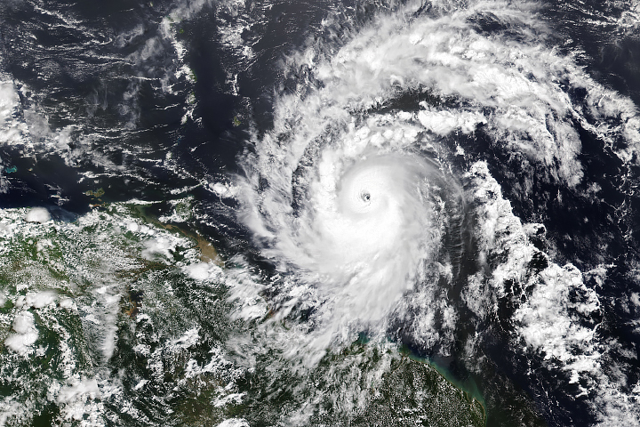
Hurricane season in the basin runs from June 1 to November 30.
Published Jul 1, 2024
NASA satellites document how our world—forests, oceans, human landscapes, even the Sun—changes over months, seasons, and years.
Published Apr 29, 2009
What do you do when presented with a new satellite image? Here's what the Earth Observatory team does to understand the view.
Published Nov 18, 2013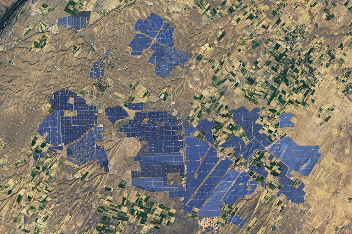
People have developed systems to harvest and store energy from sources such as wind, sunlight, and tidal action. Many of these installations are visible from orbit.
Published May 10, 2024
Airborne aerosols can cause or prevent cloud formation and harm human health. These maps depict aerosol concentrations in the air based on how the tiny particles reflect or absorb visible and infrared light.
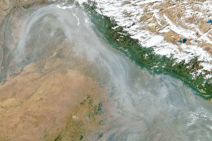
From ground-level ozone to particulate matter to nitrogen dioxide, an array of gasses and particles can affect the air people breathe, with implications for human health.
Published Apr 8, 2024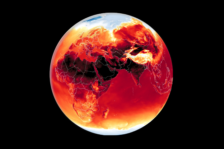
Warmer-than-average temperatures are showing up locally and globally, with consequences for people, landscapes, and ecosystems.
Published Mar 26, 2024Have you ever wondered what it would be like to live in a different part of the world? What would the weather be like? What kinds of animals would you see? Which plants live there? By investigating these questions, you are learning about biomes.
Published Aug 28, 2020
Whether sparked by lightning, intentional land-clearing, or human-caused accidents, wildland fires are burning longer and more often in some areas as the world warms.
Published Feb 27, 2024
Warmer-than-average temperatures are showing up locally and globally, with consequences for people, landscapes, and ecosystems.
Published Aug 15, 2023alert message


